Piano Fiscalino / Fischleinboden - Torre di Toblin / Toblinger Knoten
Starting point: Piano Fiscalino / Fischleinboden (1454 m)
| Latitude/Longitude: | 46,66680°N 12,35360°E |
| |
Walking time: 4 h 30 min
Difficulty: extremely difficult marked way
Via ferrata: C
Elevation gain: 1163 m
Elevation difference along the route: 1170 m
Map: Tabacco 10 1:25.000
Recommended equipment (summer): helmet, self belay set
Recommended equipment (winter): helmet, self belay set, ice axe, crampons
Views: 4.285
 | 3 people like this post |
Access to starting point:
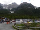
From Ljubljana through the Karawanks Tunnel to Spittal. Next we drive towards Lienz, where at the roundabout we continue in the direction of the village Sillian and Italy. On the Italian side of the border, we quickly come to San Candido, where we continue left in the direction of the tourist town Sesto / Sexten. Just a little after the town Sesto we come to San Giuseppe / Moss, where signs for Val Fiscalina / Fischleintal point us to the right. Further, we drive on an ascending road which we follow to a large paid parking lot.
The free parking lot is approximately 2 km lower, by the bottom station of the cable car "Alta Pusteria".
Route description:
From the parking lot, we continue a few dozen meters along the main road and a little before the hotel Dolomitenhof we turn right onto a narrow road that is closed to traffic. Initially still asphalted, the road soon becomes a gravel road. From the road, we then turn left onto a wide footpath that leads further through a scenic valley. Along the gentle path, we soon reach the hut Talschlusshütte / Rifugio Fondo Valle.
At the hut, we continue right following the signs »Rif. Tre Cime« and »Rif. Comici«. After a few minutes of walking along the wide path we come again to a marked junction. At the junction, which offers a magnificent view of the north face of the peak Einserkofel / Cima Una (2698 m), we continue right onto path 102 where signs direct us to the hut Rifugio Locatelli / Drei Zinnen Hütte, while left leads the path to the hut Rifugio Comici / Zsigmondy Hütte.
Further on, the path begins to ascend somewhat more steeply along the right side of the valley Alteinsteinertal / Valle Sasso Vecchio and mostly runs through dwarf pines. The path then approaches the stream several times and a view towards Monte Paterno begins to open up. When we approach the waterfall of the stream Altensteiner Bach, the path turns slightly right and begins to ascend below the slopes of the peaks Punta Slawina Lunga / Langlahn spitze (2770 m) and Sasso Vecchio / Altsteinspitze (2909 m). The path leads us out of the dwarf pines and ascends towards the northwest. Later, when the path brings us to gentler grassy slopes, it turns left and takes us past the lakes Laghi dei Piani to the Locatelli hut.
From the hut, we continue north past the chapel by which we will notice a signpost directing us to the via ferrata Torre di Toblin. The path then runs along the right side of the mountain Sasso di Sesto towards the north and is marked with red triangles. Later the path turns left and follows a short ascent to the saddle between the peaks Sasso di Sesto and Torre di Toblin. At the saddle, we continue slightly right and cross the slopes below the west face of the peak Torre di Toblin. The path then brings us to the north side, where we enter the climbing section of the path.
At the start, the path steeply ascends right upward along the steel cable. Further on, the path runs along a steep gully and ascends vertically on a ladder several times. Since the path is usually quite crowded, there is also a high risk of falling rocks. Later, the path turns slightly left and crosses the vertical slope on brackets. Further on, a few more vertical ascents on the ladder follow, after which we soon reach the very panoramic summit.
We descend along a somewhat easier but still very demanding path, which initially follows the south ridge for a short time before descending to the east side. Further on, we descend steeply along the steel cable, and along the path we will also notice some tunnels from the First World War. The steep path then brings us to the scree on the eastern side of the mountain, from where we continue right towards the south and descend to the Locatelli hut.
Because the path is usually very crowded, do not ascend in the reverse direction from that described above. For this reason, the path by which we descend is not marked in the lower section.

Photos:
 1
1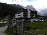 2
2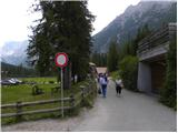 3
3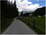 4
4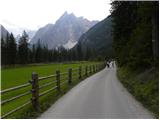 5
5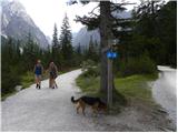 6
6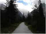 7
7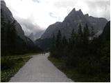 8
8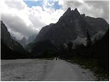 9
9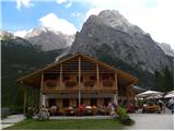 10
10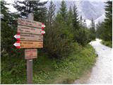 11
11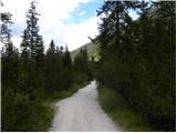 12
12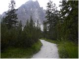 13
13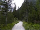 14
14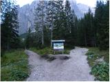 15
15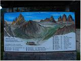 16
16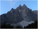 17
17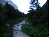 18
18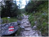 19
19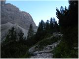 20
20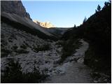 21
21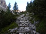 22
22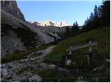 23
23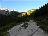 24
24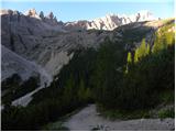 25
25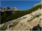 26
26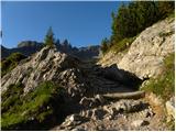 27
27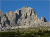 28
28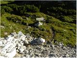 29
29 30
30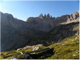 31
31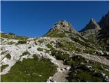 32
32 33
33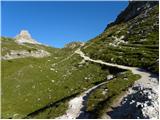 34
34 35
35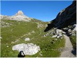 36
36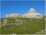 37
37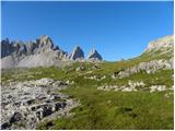 38
38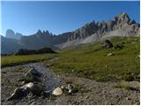 39
39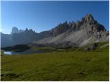 40
40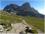 41
41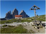 42
42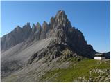 43
43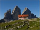 44
44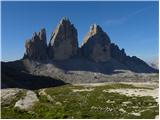 45
45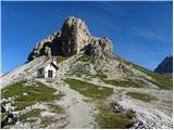 46
46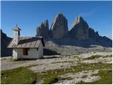 47
47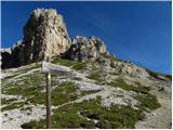 48
48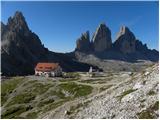 49
49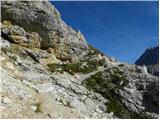 50
50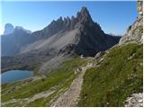 51
51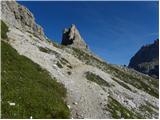 52
52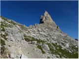 53
53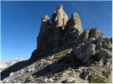 54
54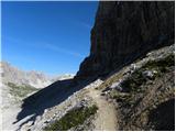 55
55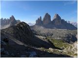 56
56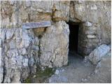 57
57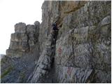 58
58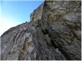 59
59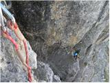 60
60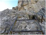 61
61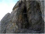 62
62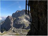 63
63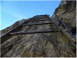 64
64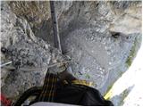 65
65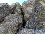 66
66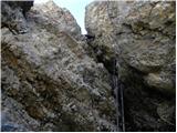 67
67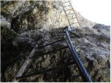 68
68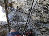 69
69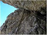 70
70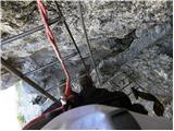 71
71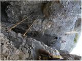 72
72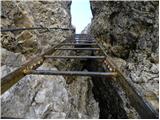 73
73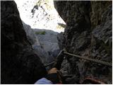 74
74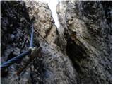 75
75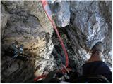 76
76 77
77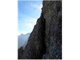 78
78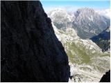 79
79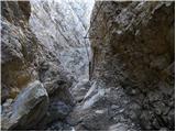 80
80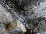 81
81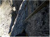 82
82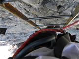 83
83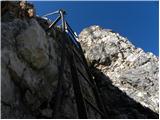 84
84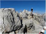 85
85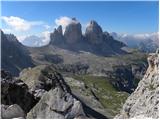 86
86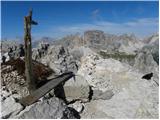 87
87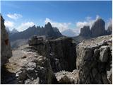 88
88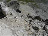 89
89 90
90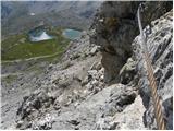 91
91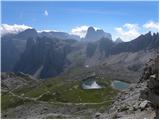 92
92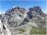 93
93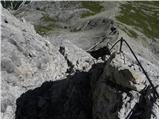 94
94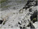 95
95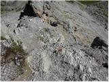 96
96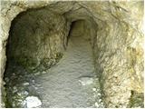 97
97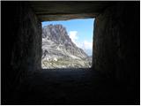 98
98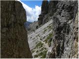 99
99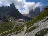 100
100
Discussion about the trip Piano Fiscalino / Fischleinboden - Torre di Toblin / Toblinger Knoten
|
| JORDAN15. 08. 2013 |
On 4.8.13 we were for the second time this year in the Dolomites. We chose Torre di Toblin as the goal, which we conquered in the afternoon, which turned out to be an excellent move as we were alone on the ferrata, and the ascent is in the shade. Everything went very quickly, so we spent 1:15h for the ascent from Locatelli hut and descent. On the descent we hurried a bit because a thunderstorm was approaching. The ferrata, although short, is demanding and excellently protected, but not for those afraid of heights.
|
|
|
|
| mirank7. 01. 2017 |
In pictures 5, 8, 9 and 13 it is indeed Cima Una, what confused me was the altitude data. 3094 m is the height of Zwolfer-cima dodici or Croda di Toni (not visible in any picture, because it is foggy behind), Cima Una is 2698 m high.
|
|
|
|
| Rok7. 01. 2017 |
Thanks for the notice. I have corrected the altitude data.
|
|
|
|
| mirank3. 10. 2020 |
Good and detailed description, but I would suggest a variant for those who have other plans. In picture 36 the saddle north (right) of Toblin is clearly visible; we climb directly to it at a suitable spot (trodden here and there). At the saddle itself we encounter a slightly less visible transverse path towards Lastron dei scarpieri. Here we turn left towards Toblin along or beside the locally still preserved trenches from WWI. This short gentle ascent ends with a slightly steeper scramble, where we keep slightly right and up and there step onto the marked path somewhere in the area of pic 55. This way you save at least half an hour or even more. Paternkofel calls the same day
|
|
|
To post a comment you must log in:
If you do not yet have a username, you must first
register.