Pišece (Pri mlinu) - Veliki vrh (Orlica)
Starting point: Pišece (Pri mlinu) (255 m)
| Latitude/Longitude: | 46,00460°N 15,64770°E |
| |
Walking time: 2 h 40 min
Difficulty: easy marked way
Elevation gain: 446 m
Elevation difference along the route: 655 m
Map:
Recommended equipment (summer):
Recommended equipment (winter): ice axe, crampons
Views: 119
 | 1 person like this post |
Access to starting point:
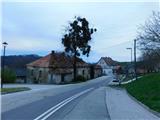
a) We drive to Krško, where we first follow the signs for Brežice, then the signs for Zdole, and after Zdole the signs for Bizeljsko. We continue through Sromlje, following the road to Pišece, where we park at the parking lot near the church of St. Michael, or at the nearby cemetery.
b) From Brežice we follow the signs for Bizeljsko, then on the flat section where the road runs through the forest, we turn left onto the side road in the direction of Globoko. In the settlement of Globoko we turn right towards Pišece, and continue following the signs for Pišece. When we arrive in Pišece we park at the parking lot next to the cemetery or near the church of St. Michael.
c) From the direction of Bistrica ob Sotli we drive towards Brežice, at the end of the settlement Bizeljsko we turn right in the direction of Pišece. When we arrive in Pišece we park at the parking lot next to the cemetery or near the church of St. Michael.
Route description:
From the place where we parked, we first walk to the church of St. Michael and pass around it on the lower left side, following the markings and at the beginning also the signs for Gozdno pot and Pot suverenosti; at a small intersection there are also mountaineering signs for Velika bukva and Pečice.
A short transverse ascent follows on a narrow asphalt road, where if we step to the left side a few steps off the path, a wonderful view of Pišece opens up; a little further at the chapel we turn sharply right.
The path ahead leads past a small museum; the asphalt road soon enters the forest and a small valley, which we leave and continue left following the signs for Pečice. A few minutes of steep ascent through the forest follow, then we reach a forested ridge where the path levels somewhat, and we continue following Knafelc markings. Higher up we reach a somewhat better-trodden path with a starting point at the pond or Pišece Castle; we keep slightly to the right direction, continue walking on the marked path, and take care not to cross right onto Gozdno pot Pišece. A moderate ascent through the forest follows, where we climb along the indistinct ridge of Velika Vagla; when the path reaches the highest point, the summit of Velika Vagla is to the right, only three steps from the path.
A short descent follows and we quickly reach the turning loop of the forest road, which we merely cross (left unmarked road (shortcut) towards Velika bukva or Bivak LD Pišece), then we begin ascending towards Veliki vrh, which we reach after a few minutes of ascent; the summit is not distinct and not specially marked, but some views open from it towards the east to southeast.
Some easy descent follows along the northeast ridge of Veliki vrh; a few minutes further we reach a small saddle, where we go left downhill in the direction of Velika bukva and Pečice (slightly right Veliki Špiček, two minutes).
A transverse descent follows on the northwest slopes of Veliki vrh; when we join the previously mentioned road (shortcut), only a few steps separate us from the hunting bivouac.
Near the bivouac, paths from the starting point at Ribnik and from the starting point at Grad Pišece join us from the left; we walk along the road for only a few dozen steps, then red mountaineering direction signs for Kerinov spomenik and Pečice direct us right onto the mountaineering path (straight Pot suverenosti), which begins to ascend through the forest. After 15 minutes of ascent we arrive near the summit of Intermedija, where we go right and reach the highest point of the summit in a few steps, from which some views open through the treetops.
From the summit we continue on the marked path, which begins to descend towards the southwest; lower down we return to the road and follow it to the right. A few minutes further we go slightly right from the road and continue the path to the right of the road, later cross it and continue on the marked path to the left of the road. We return to the road at a marked junction of several roads and the marked path, where we go right (left Kerinov spomenik 1-2 minutes), then immediately left in the direction of Veliki vrh (continue straight on the road to Grad Podsreda, to the castle also possible via Veliki vrh).
The path ahead steeply ascends for a few minutes on the slopes of Šuljcev breg; the markings along the path disappear, but along the path we can notice some signs of Pot suverenosti (on this section some maps show a path over Šuljcev breg, but there is no trodden path over the pasture there, nor markings).
The transitional path leading further towards Veliki vrh runs along the forested southern slopes of Šuljcev breg and for some time merely crosses the slopes to the left; below the pasture saddle between the two summits we again notice the sign for Pot suverenosti, which does not indicate the continuation direction. Here we go right on the cart track that ascends along the pasture; at the junction where we join the path leading from the nearby farm, we go left, then transversely ascending to the left on a gentle forest path.
When we reach the marked junction west of Veliki vrh, we go right and ascend to the highest summit of the Orlica massif in a few dozen steps, where there is a monument to the Slovenian tolar.
Starting point - Velika Špegla 0:30, Velika Špegla - Velika Vagla 0:35, Velika Vagla - Veliki vrh 0:10, Veliki vrh - Veliki Špiček 0:10, Veliki Špiček - Bivak Lovske družine Pišece 0:10, Bivak Lovske družine Pišece - Intermedija 0:15, Intermedija - Kerinov spomenik 0:25, Kerinov spomenik - Veliki vrh 0:25.
The description and photos refer to the condition in March 2026.

Photos:
 1
1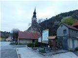 2
2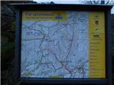 3
3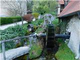 4
4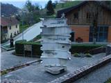 5
5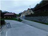 6
6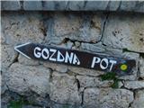 7
7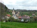 8
8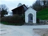 9
9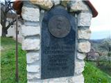 10
10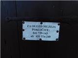 11
11 12
12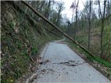 13
13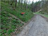 14
14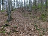 15
15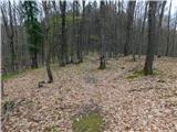 16
16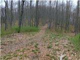 17
17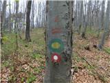 18
18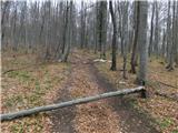 19
19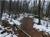 20
20 21
21 22
22 23
23 24
24 25
25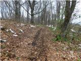 26
26 27
27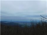 28
28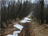 29
29 30
30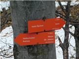 31
31 32
32 33
33 34
34 35
35 36
36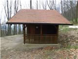 37
37 38
38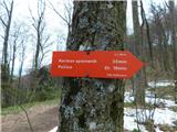 39
39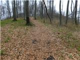 40
40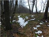 41
41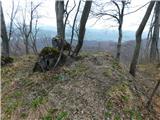 42
42 43
43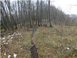 44
44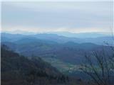 45
45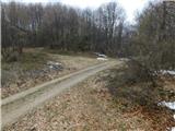 46
46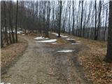 47
47 48
48 49
49 50
50 51
51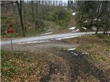 52
52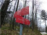 53
53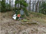 54
54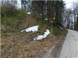 55
55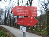 56
56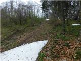 57
57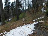 58
58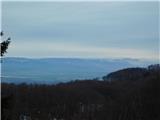 59
59 60
60 61
61 62
62 63
63 64
64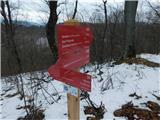 65
65 66
66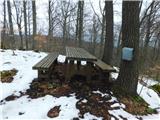 67
67 68
68
Discussion about the trip Pišece (Pri mlinu) - Veliki vrh (Orlica)
To post a comment you must log in:
If you do not yet have a username, you must first
register.