Starting point: Pivka (575 m)
| Latitude/Longitude: | 45,68160°N 14,19280°E |
| |
Walking time: 1 h
Difficulty: easy marked way
Elevation gain: 245 m
Elevation difference along the route: 245 m
Map: Snežnik 1:50.000
Recommended equipment (summer):
Recommended equipment (winter):
Views: 15.150
 | 2 people like this post |
Access to starting point:
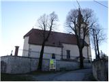
From the highway Ljubljana - Koper, we take the Postojna exit and follow the road ahead towards Ilirska Bistrica. The road then brings us to a crossroads in the village of Pivka, where the road branches off to the left to the village Trnje, straight to Knežak and right to Ilirska Bistrica. Here we continue right but only to the next crossroads, which is only 50 meters away. At this crossroads we leave the main road and turn right onto a side road which is called Pot na Orlek (street name). We follow this road to the church in the village in front of which we park in an appropriate place.
Route description:
From the parking lot at the church, we descend along the road which runs parallel to the railway. Soon we will notice a trail marker on a telegraph pole, which directs us left onto a narrower road. This narrow road brings us after a few steps to the underpass, after which we come to a junction of two cart tracks. We continue along the right cart track, which gently ascends through extensive meadows. At the end of the meadow we continue along the path, which ascends parallel to the fence (straight ahead). The path then begins to ascend moderately up the increasingly vegetated slope. After a further few minutes, the path enters the forest, where we notice a trail marker again (there are none from the underpass to here). The path, which mostly ascends along a cart track, brings us a little higher to a cross from the year 1894. The path continues to the forepeak of Osojnica, from which there follows a short gentle descent and then a moderate ascent to the summit.
Photos:
 1
1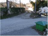 2
2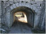 3
3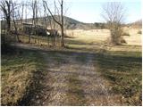 4
4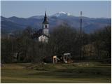 5
5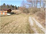 6
6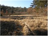 7
7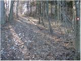 8
8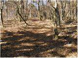 9
9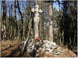 10
10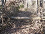 11
11 12
12
Discussion about the trip Pivka - Osojnica
|
| m16. 01. 2012 |
Hello!
ANYWHERE, EVERYWHERE!
These days I took a closer look at the cross and noticed the inscription on it .((photo) .((photo)
Otherwise, this trail is interesting . I also like the variant from Petelinj, especially in summer (more shade). From Selc it's a bit longer. . I also like the variant from Petelinj, especially in summer (more shade). From Selc it's a bit longer.
|
|
|
|
| bizgo9315. 02. 2021 |
Nice path for a bit of recreation with one slightly steeper ascent. Somewhere in the middle of the path, on a nice day, look back, where the view reaches the Kamnik-Savinja Alps, Pivka basin, Sv. Trojica and Snežnik. From the top, the view of Snežnik and Nanos is somewhat obscured by forest, and in summer almost non-existent due to foliage.
For a slightly harder variant, you can choose the path from Kala (especially the last ascent - lasts about 10-15 minutes - is quite steep).
|
|
|
To post a comment you must log in:
If you do not yet have a username, you must first
register.