Starting point: Pivka (565 m)
| Latitude/Longitude: | 45,67030°N 14,19280°E |
| |
Walking time: 25 min
Difficulty: easy marked way
Elevation gain: 153 m
Elevation difference along the route: 153 m
Map: Snežnik 1:50.000
Recommended equipment (summer): lamp
Recommended equipment (winter): lamp
Views: 11.808
 | 1 person like this post |
Access to starting point:
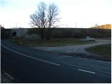
From the highway Ljubljana - Koper, we go to the exit Postojna, and then we continue driving in the direction of Ilirska Bistrica. Only a little after the settlement Pivka, or just before the road goes through the underpass under the railway track, we turn right and park on the parking lot between the railway and the main road.
Route description:
From the parking lot, we first walk to the main road, carefully cross it, and then go on a macadam road in the direction of Primož, Snežnik and Šilentabor. The road first ascends through the forest and then flattens and brings us out of the forest onto a larger meadow. Here, the path branches off to the right towards the museum, and we continue on the road in the direction of fortresses. The road then returns into the forest and again starts moderately ascending. A little higher, in the middle of the left turn, a marked footpath branches off to the right to Šilentabor, and we continue left in the direction of Primož. We still walk on the road for a few minutes, and then we arrive at the old Italian fortresses on Primož. Here we continue sharply left, where after about 10 steps we arrive at a junction, where a short path branches off to the right to the summit.
From the top, we return to the mentioned junction, and then we continue on the circular path, along which we return to the road in 10 minutes.

Photos:
 1
1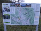 2
2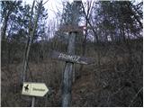 3
3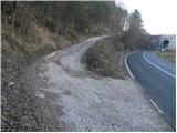 4
4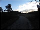 5
5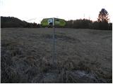 6
6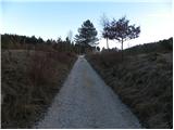 7
7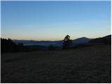 8
8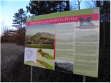 9
9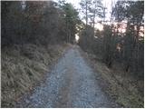 10
10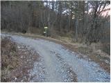 11
11 12
12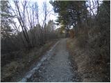 13
13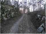 14
14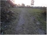 15
15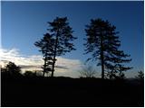 16
16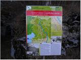 17
17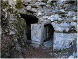 18
18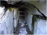 19
19 20
20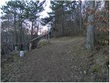 21
21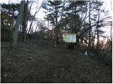 22
22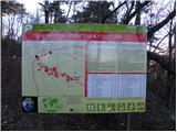 23
23 24
24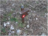 25
25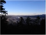 26
26
Discussion about the trip Pivka - Primož
|
| bizgo9315. 02. 2021 |
Completely easy trail without any significant incline, suitable even for small children.
Along the trail there is a nice view of Vremščica and Košanska dolina, Čičarija and Snežnik and Snežniško pogorje as well as surrounding villages up to Koritnice. Just below the summit, a nice view opens to Pivka and Javorniki, and on clear weather all the way to Kamniške Alpe.
Below the summit, next to the bunkers, there are also numerous energy points, nicely described on one of the signs along the trail.
|
|
|
To post a comment you must log in:
If you do not yet have a username, you must first
register.