Planica (Planinšek) - Planina Podvežak
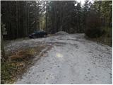
Starting point: Planica (Planinšek) (1085 m)
| Latitude/Longitude: | 46,32990°N 14,69320°E |
| |
Walking time: 1 h 25 min
Difficulty: easy marked way
Elevation gain: 479 m
Elevation difference along the route: 479 m
Map: Kamniške in Savinjske Alpe 1:50.000
Recommended equipment (summer):
Recommended equipment (winter): ice axe, crampons
Views: 9.296
 | 1 person like this post |
Access to starting point:
A) First, we drive to Kamnik, then we continue driving towards Stahovica and the mountain pass Črnivec. A few hundred meters before the mountain pass Črnivec, we leave the main road which leads towards Gornji Grad and we continue driving sharply left in the direction of the mountain pass Volovljek (Kranjski Rak). From the mentioned mountain pass, we continue straight (left road which leads to Velika planina, right Štajerski Rak) and we start descending towards Luče. Lower down, the road flattens a little and brings us into the valley Podvolovljek. Further on, we first drive past the turn-off of the road which leads into the valley Lučka Bela, then also past the bar pri Gamsu. After the bar, we need to pay attention, because only a few hundred meters further, the road which leads towards the mountain pasture Podvežak and Ravne and farm Planinšek branches off to the left (by the spot where we leave the main road, there is a road sign approximately 11 km). Further, we drive on the initially still asphalt road, which then ascends towards the plateau Dleskovška planota. A little above the point where the asphalt ends, the road continues straight towards Luče, but we turn sharply left in the direction of Korošica. Further on, the road ascends towards the plateau Dleskovška planota, and we follow it to the crossroad, where the road towards Planica or farm Planinšek branches off to the right. We park at an appropriate place by the crossroad.
B) First, we drive to Luče, then we continue driving towards Kamnik. When we notice the road sign by the road which shows 10.5 km, we need to pay attention to the right turn-off, because only a little further to the right, the road towards the mountain pasture Podvežak and Ravne and farm Planinšek branches off. Further, we drive on the initially still asphalt road, which then ascends towards the plateau Dleskovška planota. A little above the point where the asphalt ends, the road continues straight towards Luče, but we turn sharply left in the direction of Korošica. Further on, the road ascends towards the plateau Dleskovška planota, and we follow it to the crossroad, where the road towards Planica or farm Planinšek branches off to the right. We park at an appropriate place by the crossroad.
Route description:
From the starting point, we continue on the left road in the direction of Korošica, mountain pasture Podvežak and mountain pasture Ravne (right Planinšek). The road first gently ascends through a strip of forest, then brings us to the grassy hayfields above the farm Planinšek. Here we leave the road and continue left directly across the hayfields upwards. When we arrive at the edge of the forest, a nice passage opens on a narrower "clearing", where we also notice the first blazes. At the top of the grassy tongue, we continue right into the forest and continue on the old cart track, which is already entirely overgrown with grass. A little higher, we turn left and ascend on the cart track to some sort of ridge. Here we continue right and then ascend relatively steeply along an indistinct ridge. Higher up, we leave the ridge, as rare blazes direct us left onto a quite overgrown path that ascends to the left. For some time, we still ascend diagonally, then we ascend to the nearby macadam road, which we follow to the left. From the road on which we continue the ascent, a nice view opens up temporarily, then it returns to the forest. From the road a little higher, a dead-end spur branches off to the left, but from here we walk along the road only a short time, as we soon arrive at the marked crossroad below the mountain pasture Podvežak.
Here we continue right (also possible a few dozen steps earlier, as the marked path branches off from the road already before the crossroad) and on the road or marked footpath in 15 minutes of further walking we ascend to the mountain pasture Podvežak.

Photos:
 1
1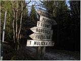 2
2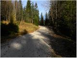 3
3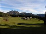 4
4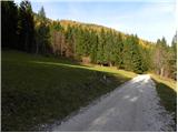 5
5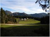 6
6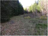 7
7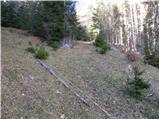 8
8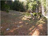 9
9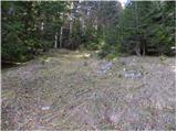 10
10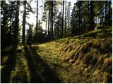 11
11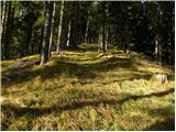 12
12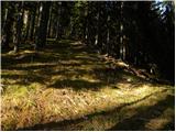 13
13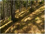 14
14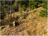 15
15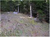 16
16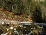 17
17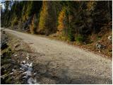 18
18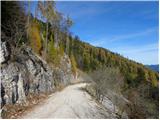 19
19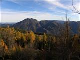 20
20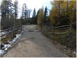 21
21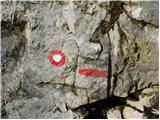 22
22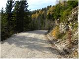 23
23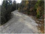 24
24 25
25 26
26 27
27 28
28 29
29 30
30 31
31
Discussion about the trip Planica (Planinšek) - Planina Podvežak
|
| žuli13. 07. 2021 09:26:16 |
Hello. Does this starting point still "exist" or is it still in use? On Saturday I planned to start the Ojstrica trail here instead of the parking below Planina Podvežak, but "everything" was different from the pictures... Picture shows gravel, in reality asphalt, picture has directional signs, reality none. Felt like I wasn't in the right place. Now I see I was, just everything looks different. If the author of this description sees my comment, I can send a photo of the starting point.
|
|
|
|
| garmont13. 07. 2021 14:18:49 |
You're right.  The asphalt surface has been here for a few years, but it really ends after less than a kilometer. Otherwise, this is more of a starting point in winter, when you can't go higher by car… The asphalt surface has been here for a few years, but it really ends after less than a kilometer. Otherwise, this is more of a starting point in winter, when you can't go higher by car…
|
|
|
|
| žuli14. 07. 2021 13:01:55 |
Thanks for the clarification. So could one also leave the car at this point in summer? It wouldn't be "in the way" for anyone?
|
|
|
|
| garmont14. 07. 2021 15:16:09 |
Yes, but keep in mind that trucks with logs drive on this road, which need a lot of space.
|
|
|
|
| žuli16. 07. 2021 13:11:16 |
Thanks for the warning
|
|
|
To post a comment you must log in:
If you do not yet have a username, you must first
register.