Planica (Planinšek) - Planina Ravne (by road)
Starting point: Planica (Planinšek) (1085 m)
| Latitude/Longitude: | 46,32990°N 14,69320°E |
| |
Route name: by road
Walking time: 1 h 15 min
Difficulty: easy marked way
Elevation gain: 415 m
Elevation difference along the route: 415 m
Map: Kamniške in Savinjske Alpe 1:50.000
Recommended equipment (summer):
Recommended equipment (winter): crampons
Views: 7.947
 | 1 person like this post |
Access to starting point:
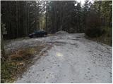
A) First, we drive to Kamnik, and then we continue driving towards Stahovica and the mountain pass Črnivec. A few 100 meters before the mountain pass Črnivec we leave the main road which leads towards Gornji Grad and we continue driving sharply left in the direction of the mountain pass Volovljek (Kranjski Rak). From the mentioned mountain pass we continue straight (left road which leads to Velika planina, right Štajerski Rak) and start descending towards Luče. Lower down the road flattens a bit and brings us into the Podvolovljek valley. Further on we first drive past the branch-off of the road which leads into the Lučka Bela valley, then also past the bar pri Gamsu. After the bar, we need to pay attention, because only a few 100 meters further the road which leads towards the mountain pasture Podvežak and Ravne and farm Planinšek branches off to the left (by the spot where we leave the main road there is a road sign approximately 11 km). Further, we drive on the initially still asphalt road which then ascends towards the Dleskovška planota plateau. A little above where the asphalt ends the road continues straight towards Luče, and we turn sharply left in the direction of Korošica. Further, the road ascends towards the Dleskovška planota plateau, and we follow it to the crossroad where a road branches off to the right towards Planica or farm Planinšek. We park on an appropriate place by the crossroad.
B) First, we drive to Luče, and then we continue driving towards Kamnik. When by the road we notice a road sign which shows 10.5 km, we need to pay attention to the right branch-off, because only a little further to the right the road towards the mountain pasture Podvežak and Ravne and farm Planinšek branches off. Further, we drive on the initially still asphalt road which then ascends towards the Dleskovška planota plateau. A little above where the asphalt ends the road continues straight towards Luče, and we turn sharply left in the direction of Korošica. Further, the road ascends towards the Dleskovška planota plateau, and we follow it to the crossroad where a road branches off to the right towards Planica or farm Planinšek. We park on an appropriate place by the crossroad.
Route description:
From the starting point, we continue on the left road in the direction of Korošica, mountain pasture Podvežak and mountain pasture Ravne (right Planinšek). The road at first gently ascends through a strip of forest and then brings us to the hay meadows above the farm Planinšek. Here a marked, but less trodden path branches off to the left towards the mountain pasture Podvežak, on the right a nice view opens up towards Rogatec and Lepenatka, and we continue straight on the road which returns into the forest and higher brings us to the marked crossroad, where we again continue straight (left mountain pasture Podvežak).
The path ahead leads us in the direction of the mountain pasture Ravne, mountain pasture Molička planina, Veliki vrh and Dleskovec and still continues on the road. Only a little further, we get to a pleasant resting place with a bench and a table, from which a nice view opens up on the Smrekovec mountain range and nearby and distant surroundings. The road which immediately returns into the forest has higher some smaller crossroads, and on all of them we continue on the "main" road which we follow all the way to the mountain pasture Ravne.

Photos:
 1
1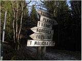 2
2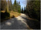 3
3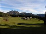 4
4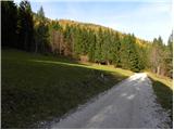 5
5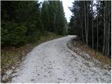 6
6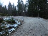 7
7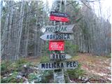 8
8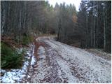 9
9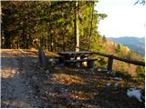 10
10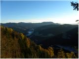 11
11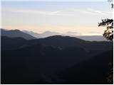 12
12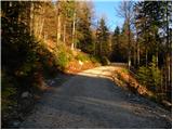 13
13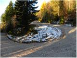 14
14 15
15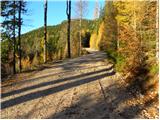 16
16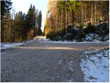 17
17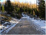 18
18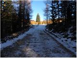 19
19 20
20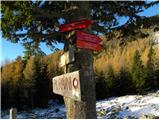 21
21 22
22
Discussion about the trip Planica (Planinšek) - Planina Ravne (by road)
|
| danicak26. 07. 2013 |
from Planinšek we would do a longer circular route tomorrow, to include some 2-thousander (easier) and return to the starting point. or from here the path also to Vodotončnikovo jezero, Korošica, some plateau, and back.
Thanks for a suggestion
|
|
|
|
| Daaam26. 07. 2013 |
You can also drive to Planina Podvežak (option) from there there are quite a few possible circular variants./there are from Planinšek too. The easiest way to organize is to unfold the map and plan any circular tour.. A two-thousander can also be included (Velika Zelenica/Veliki Vrh or Lučki Dedec (partly requires unmarked path) etc etc..
|
|
|
|
| otiv26. 07. 2013 |
@danicak from Planinšek you usually hike only in winter time, because the road is plowed up to here, in summer you can drive even higher, namely to Planina Ravne or Planina Podvežak from where tours to the peaks are possible, there are quite a few of them. They are not all two-thousanders, but standing on them is just as pleasant and gazing at the mountain nature, which is really beautiful here, and now is also the time of flowers, which are full everywhere here.
Good luck!
|
|
|
|
| danicak26. 07. 2013 |
thanks to both for the ideas, we'll drive at least to Planina Ravne (no further- , and from there on, I just hope the road is okay in terms of "non-exposure", that's also the reason we won't go to Podvežak-, because I have very bad memories of driving there.- , and from there on, I just hope the road is okay in terms of "non-exposure", that's also the reason we won't go to Podvežak-, because I have very bad memories of driving there.-
|
|
|
|
| otiv26. 07. 2013 |
@danicak you probably already somewhat forgot where you drove, since the road to Planinšek already leads along the "exposed" slope, higher up there's no more such "horror"
|
|
|
|
| Daaam26. 07. 2013 |
let that slope to Planinšek not be an obstacle if it's not icy (summer? ) there's no reason to have dark thoughts ) there's no reason to have dark thoughts ..etc it's just a couple of minutes driving in between.. courage in hands and let's go ..etc it's just a couple of minutes driving in between.. courage in hands and let's go 
|
|
|
|
| danicak26. 07. 2013 |
- I allow the possibility that I forgot, hi,hi,
|
|
|
|
| t01839621. 12. 2016 |
Hello
Does anyone know the hunting path from the Palčič farm in Luč to Planina Ravne over Belo peč??
Thanks for answers.
|
|
|
To post a comment you must log in:
If you do not yet have a username, you must first
register.