Planina Blato - Kreda (direct way)
Starting point: Planina Blato (1147 m)
Route name: direct way
Walking time: 2 h 55 min
Difficulty: easy unmarked way
Elevation gain: 878 m
Elevation difference along the route: 900 m
Map: Triglav 1:25.000
Recommended equipment (summer):
Recommended equipment (winter): ice axe, crampons
Views: 17.463
 | 2 people like this post |
Access to starting point:
From the Ljubljana-Jesenice motorway take the Lesce exit and follow the road towards Bled and further towards Bohinjska Bistrica. Continue driving towards Lake Bohinj (Ribčev laz), where we reach a junction continuing right towards Stara Fužina. In Stara Fužina at the junction by the chapel turn sharply left onto the ascending road towards Planina Blato, Planina Vogar and Voje valley. The road takes us to the toll and parking collection point, but follow it to the next junction turning left (right Voje). Follow the road to the next junction (after quite some driving), turning sharply right towards Planina Blato (straight Planina Vogar). Follow this road to the parking lot above Planina Blato.
Route description:
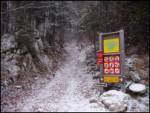
From the marked parking lot before Planina Blato return a little back and head to the wide and initially steep cart track with signs for Planina pri Jezeru. After about ten minutes ascent arrive at marked junction continuing left towards Planina pri Jezeru (slightly right Planina v Lazu and steep path to Planina pri Jezeru).
On the less steep cart track continuing through forest shortly after a marked path joins from left past Kosijev dom on Vogar, continue right on cart track. Higher path leads through small defile then cross steep slopes with high slip risk in ice and snow, otherwise not demanding. At end of steep slope steep path joins unobtrusively from right, cart track turns left into cool Pungrat valley ascending through mostly spruce forest. Higher where path flattens path from Planina Vodični vrh joins left, keep slightly right continuing on cart track where forest thins. Few minutes easy walk to pastures of Planina pri Jezeru with Koča na Planini pri Jezeru on small rise.
At hut path to Planina v Lazu branches right, continue left from hut descending to marked junction with shepherd shelters.
Choose wider right path with signs for Planina Dedno polje and Koča pri Triglavskih jezerih (slightly left Pršivec, Planina Viševnik, Črno jezero).
Continue ascending cart track rocky on steep parts, after ten minutes reach where path over Krištofojca branches left to Planina Viševnik, continue straight on less steep cart track through sparser forest. Some easy walking on path turning right, when turning west reach edge of Planina Dedno polje then walk to central part with marked junction at shepherd huts.
Leave wide path straight to Koča pri Triglavskih jezerih and Planina Ovčariji, continue right towards Zasavska koča na Prehodavcih, Vratca pass, Hribarice saddle. Path past some huts on planina, behind which path to Planina v Lazu, Planina Krstenica, Vodnikov dom na Velem polju branches right.
Continue right towards Planina v Lazu slight descent crossing northern part of Planina Dedno polje eastwards. On NE side arrive at less noticeable junction or trail fork to Kreda.
Where marked path to Planina v Lazu turns right leave it continuing straight on old partly abandoned hunter trail initially gently ascending over fallen trees, higher steeper into sparser forest. Reach interesting defile passage overcome between steep slopes without difficulty, path into scrub carefully follow faint overgrown trail to avoid deeper scrub. Higher turns right through grassier terrain better views to summit of Kreda.
Descent possible longer path over Slatna to start of Za Kopico valley then marked path back to Planina Dedno polje.
Starting point - Planina pri Jezeru 1:00, Planina pri Jezeru - Planina Dedno polje 0:30, Planina Dedno polje - Kreda 1:25.

Photos:
 1
1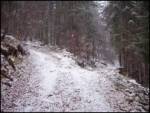 2
2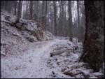 3
3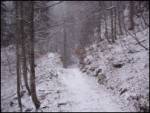 4
4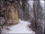 5
5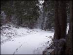 6
6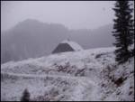 7
7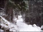 8
8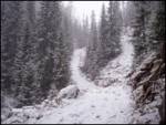 9
9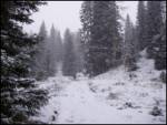 10
10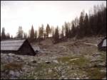 11
11 12
12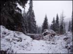 13
13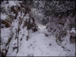 14
14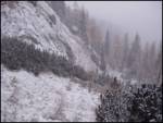 15
15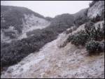 16
16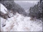 17
17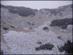 18
18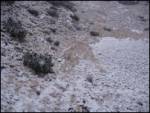 19
19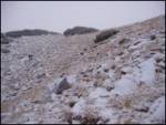 20
20 21
21
Discussion about the trip Planina Blato - Kreda (direct way)
|
| scorpio26. 06. 2011 |
I recommend this direct path from the opposite direction—from the summit, it's easier to follow it. From the summit head towards the pasture, then at the narrowing (100 m below the summit) the path turns left. In any case follow the gully below.
|
|
|
|
| netline18. 08. 2013 |
Even from the top, orientation can be tricky in good weather, especially if we approached the top of Kreda from Slatna.
My tip for descent would be: from the top of Kreda descend along the ridge towards Slatna (direction Sedmih jezer) and after about 50 m turn left. Immediately you should spot a cairn marking the passage through the scree. Past the cairn descend into the sometimes indistinct gully and follow it down towards planina Dedno polje. The path is indistinct in the upper part and if in doubt stick to the right side of the gully and choose right passages. After 20-30 m lower down the path becomes more trodden.
|
|
|
|
| lepenatka13. 10. 2018 |
Has anyone hiked this trail recently?
I'd be very happy for any advice . .
My group and I couldn't find it today.
The start of the trail is promising, then ...
There are many paths. Many end in almost impassable terrain...
Battle with dwarf pines that eventually make the terrain impassable... several attempts ended unsuccessfully. At 1800m we decided that there's no summit today.
|
|
|
|
| garmont13. 10. 2018 |
This August I also stopped at the top of Kreda without finding the passage towards Dedno polje. I had some descriptions, but rather superficial ones. 
Next time though....
|
|
|
|
| mirank13. 10. 2018 |
Last year following chamois tracks in the snow led us too far to the right. It ended with crashing through and bushwhacking Definitely, on descent it's worth looking for the trail or passages more to the left (east). Definitely, on descent it's worth looking for the trail or passages more to the left (east).
|
|
|
|
| lepenatka14. 10. 2018 |
The goal was to make a circular trail Kreda-Slatna-Vogli and back via Dolina za Kopico.
They say it's easier to find the path from the top of Kreda, but even that is probably not easy, as I read.
Well, it was exciting anyway, and some scratches as a souvenir.
Let's enjoy these wonderful days.
Regina
|
|
|
|
| AleksanderJ28. 11. 2021 22:15:15 |
This summer I was at Kreda. That path that's still marked somewhere and goes to Planina v Lazu is completely overgrown with brush. I went through a short section (looking for descent), then when I saw how the brush continues I turned back. Planina Laz - past horse pastures - Slatna - Kreda I don't know, I didn't check that one.
The path to Slatno from the main marked trail (Planina Dedno polje - Za Kopico - Hribarice) can be reached quite nicely uphill, at least I went up there. Two nice unvisited two-thousanders fairly close to the main trail.
Regards
|
|
|
|
| felix29. 11. 2021 17:43:06 |
As predecessors state, this path is very hard to find. A few years ago we managed to find the path at Dedno polje (higher up it's even nicely traceable) and reach Kreda. Some year after that I searched for the path from top to bottom for sure half an hour, but didn't find it.
|
|
|
|
| ceazare29. 11. 2021 23:49:21 |
This year I also failed to find the path coming down from Kreda. While bushwhacking through the brush I noticed some once trimmed branches, but obviously over the years everything has overgrown again.
At least where I was walking.
|
|
|
|
| blazzm30. 11. 2021 15:25:00 |
I went on this path last Sunday. From pl. Dedno polje up and I had no problems. You sort of stick to the "ridge". Towards the top, through the brush it's already easier to follow. The brush is also quite cut back.
|
|
|
To post a comment you must log in:
If you do not yet have a username, you must first
register.