Planina Blato - Velika Zelnarica (via Štapce)
Starting point: Planina Blato (1147 m)
Route name: via Štapce
Walking time: 5 h 45 min
Difficulty: partly demanding marked way, easy pathless terrain
Elevation gain: 1173 m
Elevation difference along the route: 1475 m
Map: Triglav 1:25.000
Recommended equipment (summer):
Recommended equipment (winter): ice axe, crampons
Views: 15.033
 | 3 people like this post |
Access to starting point:
From the Ljubljana - Jesenice motorway, take the Lesce exit and follow the road towards Bled and on to Bohinjska Bistrica. Continue towards Lake Bohinj (Ribčev laz), arriving at a crossroads where you turn right towards Stara Fužina. In Stara Fužina, at the crossroads near the chapel, turn sharp left onto the ascending road towards mountain pasture Blato, mountain pasture Vogar and the Voje valley. The road continues to the place where the toll and parking fees are collected, and we follow it to the next crossroads, where we continue to the left (right Voje). We then follow the road to the next crossroads (we drive for some time), where we take a sharp right in the direction of mountain pasture Blato (straight ahead mountain pasture Vogar). Follow this road to the parking lot above mountain pasture Blato.
Route description:
From the marked parking lot in front of Planina Blato, go back a little and head onto the wide and initially steep cart track, along which there are signs for Planina pri Jezeru. After approximately ten minutes of ascent, arrive at a marked junction, from which continue left in the direction of Planina pri Jezeru (slightly right Planina v Lazu and also the steep path towards Planina pri Jezeru).
Continuing on the less steep cart track, which still leads through the forest, a little further on from the left joins another marked path that leads past Kosijev dom on Vogarju, we continue right and continue walking on the cart track. Higher up the path leads us through a small narrow passage, then we cross quite steep slopes, where there is great danger of slipping in ice and snow, otherwise the path is not demanding. At the end of the steep slope, the previously mentioned steep path joins fairly unobtrusively from the right, the cart track here turns left and passes into the fairly cold valley Pungrat, where we ascend through mostly spruce forest. When higher up the path levels out, a path leading past Planina Vodični vrh joins from the left, we keep slightly right direction and continue walking on the cart track, along which the forest begins to thin. Only a few minutes of easy walking follow and we step onto the pastures of Planina pri Jezeru, where on a small elevation stands Koča na Planini pri Jezeru.
At the hut, a path branches off to the right towards Planina v Lazu, we continue left from the hut and descend to a marked junction, where there are also a few shepherds' huts.
Choose the wider right path along which there are signs for Planina Dedno polje and Koča pri Triglavskih jezerih (slightly left Pršivec, Planina Viševnik and Črno jezero).
Also in the continuation we ascend on the cart track, which is quite stony on steep sections, after approximately ten minutes of ascent we arrive at the place where a path over Krištofojca branches off to the left, leading towards Planina Viševnik, we continue straight on the gradually less steep cart track, which leads us through gradually sparser forest. A few minutes of easy walking on the path follow, which later turns somewhat to the right, when the path turns back towards the west we already reach the edge of Planina Dedno polje, from where a walk to the central part of the pasture follows, where near the shepherds' huts there is also a marked junction.
Bypass the shepherds' huts and dairy on the left side and continue straight in the direction of Koča pri Triglavskih jezerih (right valley Za Kopico). From the pasture onwards we begin to ascend moderately, to us from the left almost unobtrusively joins a path from the nearby hunting hut. A little further the path leads us past another branch of the path towards Planina Viševnik (path along Griva (1758 m)), we in the next few minutes arrive at the upper edge of the extensive Planina Ovčarija, from where a beautiful view opens onto the Bohinjsko - Tolminske mountains, sometimes called Lower Bohinj mountains. From here a short descent follows and we arrive at a junction on the northeastern part of the pasture.
Continue slightly right in the direction of Koča pri Triglavskih jezerih and Male Tičarice (left Planina Viševnik), the path soon splits again.
From the fork follow the signs for the path over Štapce (straight path over Prodov), both lead towards Koča pri Triglavskih jezerih, the right one, which we will continue on, also towards Mala Tičarica and Zelnarice. We soon leave Planina Ovčarija and the path ascends moderately to steeply through increasingly sparse forest, which higher up is replaced by dwarf pines. After a half-hour ascent the path levels out and brings us to Štapce, where there is the next marked junction.
At Štapce continue slightly right in the direction of Tičarice and Zelnarice (slightly left Koča pri Triglavskih jezerih) and continue the ascent on the path that first ascends through a belt of dwarf pines, then brings us to a short steep and especially in wet slippery dangerous jump. Above the jump the path levels out and passes onto moderately steep grassy slopes, along which in a few minutes of further walking we ascend to a small saddle, where a marked path to Mala Tičarica branches off to the left, to which it is approximately ten minutes ascent.
Continue in the direction of Zelnarice on a relatively easy path that first crosses the slopes of Mala and then also Velika Tičarice. Just a few tens of meters behind the sign "Ne trgaj cvetja!" (sign on the rock wall) a passage opens to the left towards Velika Tičarice, to which it is approximately 15 minutes of demanding ascent, we continue straight on the marked path, which north of Velika Tičarice reaches the main ridge.
Behind Velika Tičarice the path passes onto a wide grassy ridge along and beside which we then ascend. After a few minutes of easy walking, the path begins to ascend steeply on a partly grassy slope. The steepness quickly eases, the path brings us to extensive meadows south of the precipitous and overhanging Kopica. Across the extensive meadows we walk to the foot of the summit slope of Kopica, then, when we reach the edge of the wall, the marked path turns right and ascends transversely over a small scree. Behind the scree the path turns left, then begins to ascend steeply in a transverse ascent. The marked path at a small indistinct hollow approaches the ridge and turns slightly to the right.
At this point a passage opens to the left to Kopica, to the top of which it is approximately five minutes, we continue on the marked path, which approaches the ridge and turns right. The path ahead gradually passes onto a very steep and slippery dangerous slope, after approximately 30 meters of somewhat exposed section the slope becomes somewhat less steep. A transverse ascent to the right follows, the path leads us somewhat below the ridge, a little further on we reach the summit slope of Mala Zelnarica. Here the path again begins to ascend more steeply and after approximately 15 minutes of increasingly scenic walking brings us to the top of Mala Zelnarica, from which an exceptional view opens in the direction of the Valley of Triglav Lakes.
From Mala Zelnarica continue slightly right, further on the marked path, which begins to descend towards the pass Vrata, thereby leading us over a short section where there is scree, along which the path runs with increased slipping danger due to considerable steepness. Lower the path levels out and turns somewhat to the left and soon brings us to the notch or saddle between both Zelnarice. From here on the marked path towards Vrata we continue only a few tens of meters, when on our left side a beautiful passage opens then we leave it and head left onto easier pathless terrain.
Continue on the pathless terrain, or initially still a poorer track, which in a few minutes of moderate ascent brings us to the somewhat exposed southern ridge of Velika Zelnarica. The path ahead leads along or slightly right of the ridge, the track partly disappears completely, we follow the ridge to the summit of Velika Zelnarica approximately 15 minutes away, from which a beautiful view opens onto the surrounding mountains and valleys.
Izhodišče - Planina pri Jezeru 1:00, Planina pri Jezeru - Planina Dedno polje 0:30, Planina Dedno polje - Planina Ovčarija 0:45, Planina Ovčarija - Štapce 0:35, Štapce - razpotje pod Malo Tičarico 0:25, razpotje pod Malo Tičarico - odcep za Veliko Tičarico 0:20, odcep za Veliko Tičarico - odcep za Kopico 0:50, odcep za Kopico - Mala Zelnarica 0:45, Mala Zelnarica - Sedlo med Zelnaricama 0:15, Sedlo med Zelnaricama - Velika Zelnarica 0:20.

Along the route: Razpotje Pungrat (1255m), Razpotje pod Vodičnim vrhom (1449m),
Koča na Planini pri Jezeru (1453m), Razpotje Krištofojca (1512m),
Planina Dedno Polje (1560m),
Planina Ovčarija (1660m), Štapce (1851m), Razpotje pod Malo Tičarico (2008m), Odcep za Veliko Tičarico (2020m), Odcep za Kopico (2168m),
Mala Zelnarica (2310m), Sedlo med Zelnaricama (2222m)
Photos:
 1
1 2
2 3
3 4
4 5
5 6
6 7
7 8
8 9
9 10
10 11
11 12
12 13
13 14
14 15
15 16
16 17
17 18
18 19
19 20
20 21
21 22
22 23
23 24
24 25
25 26
26 27
27 28
28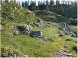 29
29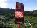 30
30 31
31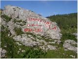 32
32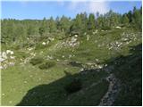 33
33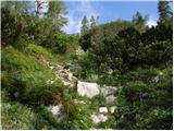 34
34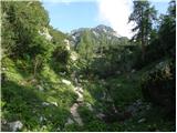 35
35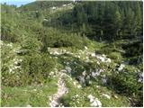 36
36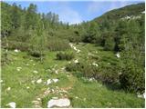 37
37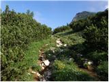 38
38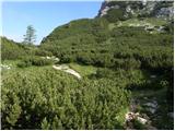 39
39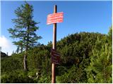 40
40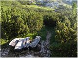 41
41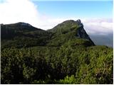 42
42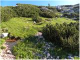 43
43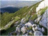 44
44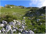 45
45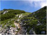 46
46 47
47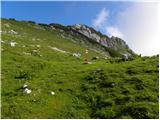 48
48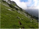 49
49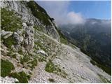 50
50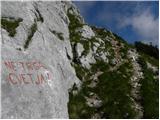 51
51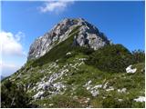 52
52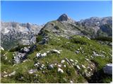 53
53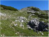 54
54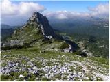 55
55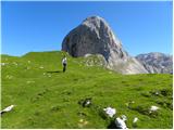 56
56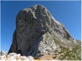 57
57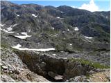 58
58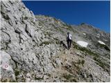 59
59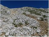 60
60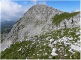 61
61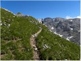 62
62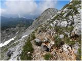 63
63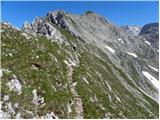 64
64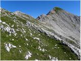 65
65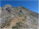 66
66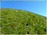 67
67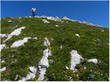 68
68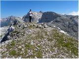 69
69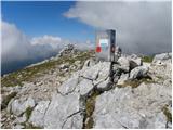 70
70 71
71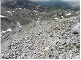 72
72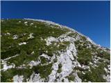 73
73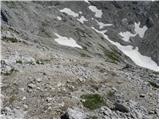 74
74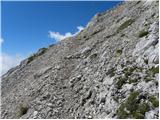 75
75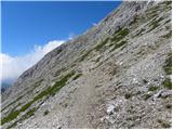 76
76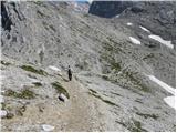 77
77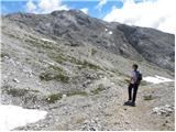 78
78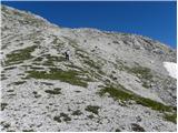 79
79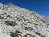 80
80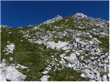 81
81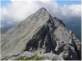 82
82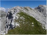 83
83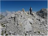 84
84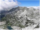 85
85
Discussion about the trip Planina Blato - Velika Zelnarica (via Štapce)
|
| Gost9. 07. 2007 |
The trail is very nice, fully marked throughout.
|
|
|
|
| Gost9. 07. 2007 |
And one more thing - the path is not exposed, but it runs along the ridge, so the weather must be nice - magnificent views. If you choose descent past Triglav Lakes it is very long and strenuous (11 hours, ascents even on descent), so I recommend descent on the eastern side. Also something to add - to drive to Planina Blato you have to pay 10 euros, otherwise you can park before the road but have to pay euro/hour, so you're even. The road is partly gravel, partly asphalted, so passable without issues, just parking spot harder to find late hours. Happy trails
|
|
|
|
| Gost9. 07. 2007 |
Last year I was on Mali and Velika Zelnarica. Path to Mali is marked, to Velika not. Unfortunately on top of Mali there is a stamp for Velika Zelnarica, which can mislead someone. Same mistake on nearby Tičarica. 10€ price for the road which is poorly maintained for that money is very high. Compare to asphalted road to Mangart, which was 2 years ago (don't know now) 700 SIT or 3€ and brings you 1000m higher than this to Blato.
|
|
|
|
| Gost9. 07. 2007 |
Yes, 10 euros is really a bit salty. They already exploited the "tourist destination".
|
|
|
|
| mukica5. 12. 2007 |
This year at Mali Zelnarica via the described trail, but we returned via Prehodavci-7j to the car at pl. Blato. We had a wonderful day, pleasant trail although quite strenuous for one day, but we are well broken in
|
|
|
|
| velkavrh6. 08. 2009 |
At the end of the chain of peaks on the right side of the Triglav Lakes Valley, going upwards of course, is Velika Zelnarica. There is no path anywhere, it was erased by winter and storms. It has become easy pathless terrain that is not demanding. The passages are easily found, but at the top one should be careful because it drops off steeply to the left. Again, it should be surveyed, equipped with a stamp and logbook.
|
|
|
|
| navdušena30. 08. 2016 |
Has anyone been around here this year? Is the path maintained, marked?
|
|
|
|
| garmont30. 08. 2016 |
Maintained, marked....
|
|
|
To post a comment you must log in:
If you do not yet have a username, you must first
register.