Planina Ravne - Planjava (via Dolga trata and Škarje)
Starting point: Planina Ravne (1500 m)
| Latitude/Longitude: | 46,34930°N 14,69970°E |
| |
Route name: via Dolga trata and Škarje
Walking time: 6 h
Difficulty: difficult marked way
Elevation gain: 892 m
Elevation difference along the route: 1300 m
Map: Kamniške in Savinjske Alpe 1:50.000
Recommended equipment (summer): helmet
Recommended equipment (winter): helmet, ice axe, crampons
Views: 4.494
 | 1 person like this post |
Access to starting point:
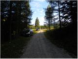
A) First, we drive to Kamnik, and then we continue driving towards Stahovica and mountain pass Črnivec. A few hundred meters before the mountain pass Črnivec we leave the main road which leads towards Gornji Grad and we continue driving sharply left in the direction of the mountain pass Volovljek (Kranjski Rak). From the mentioned mountain pass we continue straight (left road which leads to Velika planina, right Štajerski Rak) and start descending towards Luče. Lower down, the road flattens a little and brings us into the Podvolovljek valley. Further on, we first drive past the turn-off of the road which leads into the Lučka Bela valley, after that also past Bar pri Gamsu. After the bar, we need to pay attention, because only a few hundred meters further the road which leads towards the mountain pasture Podvežak and Ravne and farm Planinšek branches off to the left (by the spot where we leave the main road, there is a road sign approximately 11 km). Further, we drive on at first still asphalt road which then ascends towards the Dleskovška planota plateau. Higher, the road towards Planinšek branches off to the right, and here we continue on the left upper road, which a little further brings us to the next crossroad, where we continue straight in the direction of the mountain pasture Ravne (left mountain pasture Podvežak). Further on a somewhat rougher road, we then follow to the beginning of the mountain pasture Ravne, where we park on an appropriate place by the road.
From the main road to the mountain pasture Ravne is approximately 10 km.
B) First, we drive to Luče, and then we continue driving towards Kamnik. When by the road we notice a road sign which shows 10.5 km, we need to pay attention to the right turn-off, because only a little further to the right the road towards the mountain pasture Podvežak and Ravne and farm Planinšek branches off. Further, we drive on at first still asphalt road which then ascends towards the Dleskovška planota plateau. Higher, the road towards Planinšek branches off to the right, and here we continue on the left upper road, which a little further brings us to the next crossroad, where we continue straight in the direction of the mountain pasture Ravne (left mountain pasture Podvežak). Further on a somewhat rougher road, we then follow to the beginning of the mountain pasture Ravne, where we park on an appropriate place by the road.
Route description:
At the beginning of the mountain pasture Ravne (also Ravni) we notice wooden mountain signposts for Veliki vrh, Korošica, Molička planina and Dolga trata, which point us to the left towards the nearby cottage, which is situated on the edge of the mountain pasture. We bypass the cottage on the left side, and then we pass into a narrow belt of forest, where blazes lead left. The path ahead leads us through the clearing, through which it ascends diagonally into the forest. Further, we ascend through the forest, where we soon cross a grazing fence. Higher, the forest starts to thin out, or changes into a belt of dwarf pines. On some spots somewhat less beaten but always easy to follow, the footpath higher flattens and brings us to the lower edge of the pastures Dolgih trat. Here the path completely flattens and in a few dozen steps of further walking brings us to the shepherd hut on Dolgih tratah.
From the shepherd hut, we continue left in the direction of Molička planina, Korošica, Veliki vrh and Zelenih trat (slightly right Dleskovec). The path ahead leads us across the pastures of Dolge trate and ascends gently to moderately. Higher, the path flattens and brings us to a smaller saddle, after which the path leads us past a watering place for animals. We bypass the watering place on the left side, and the path only a few meters further brings us to a small junction, where we continue slightly right in the direction of Veliki vrh and Korošica (straight downhill Korošica via Vrtač). Further, the path transitions to the panoramic western slopes of Dleskovec, across which it begins to descend transversely towards the junction at Zelenih tratah. After a short descent we arrive at the mentioned junction, from there we continue left in the direction of Korošica (right mountain pasture Ravne via Korita). Only a little further we arrive at the place where the path to Veliki vrh branches off to the right.
We continue straight in the direction of Korošica and Molička planina along the path, which occasionally descends slightly and rises again. The path ahead circles the slopes of Veliki vrh and brings us to a junction, where the path to the mentioned summit branches off to the right upwards. Here we continue straight along the path which only a little further brings us to the saddle Prag, where there is the next junction. We continue straight (sharply left mountain pasture Podvežak) along the marked mountain path, which gradually begins to descend. After more than 10 minutes of descent, the path flattens and brings us to a small marsh, behind which we reach the next junction. We continue slightly left in the direction of Korošica (straight Molička planina, right Robanov kot) along a pleasant mountain path which begins to ascend moderately. Higher the path turns somewhat to the left, then joins the path from mountain pasture Podvežak. We continue right in the direction of Korošica along the transverse path, along which in a few minutes of further walking we ascend to Sedelce (1900 m), where there is a marked junction.
We continue straight downhill (left Prag, right Ojstrica via Mala Ojstrica) along the marked path which begins to descend towards Korošica. After a few minutes of descent we step onto the extensive grassy slopes of Korošica, along which we then walk in a few minutes to the mountain hut.
From Kocbekov dom we continue along the marked path in the direction of Ojstrica. The path already a few meters above the hut enters a belt of dwarf pines, where it gradually begins to ascend ever steeper. After more than 20 minutes of ascent from Kocbekov dom the path flattens, and it transitions to grassy slopes, which are soon replaced by scree. The path ahead crosses two successive gullies, then begins to ascend more steeply along the increasingly panoramic slope. The path ahead brings us to a less noticeable junction, where we continue left in the direction towards Planjava and Škarje (right Ojstrica). Further the path turns slightly to the left, crosses a relatively crumbly gully, then transitions to less steep slopes, across which in a few minutes of further walking we ascend to the saddle Škarje.
On the saddle Škarje an inscription on the rock directs us left. The path ascends steeply and retreats from the ridge somewhat to the south side. We approach the ridge again and ascend along a partly grassy slope. The path then bypasses the summit Baba (Lučka Brana 2244 m), to which from the marked path we have only a few minutes of ascent. The path then becomes less steep and later also descends slightly while crossing the southern slopes. At the end the path turns left and becomes somewhat more demanding again for a short time. During the ascent we cross steep slopes below the summit of Planjava, then reach a junction where we join the other paths to Planjava. At the junction we turn right and only a short ascent along the summit slope of the mountain follows.

Photos:
 1
1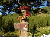 2
2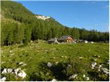 3
3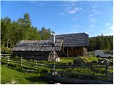 4
4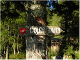 5
5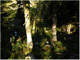 6
6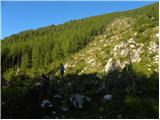 7
7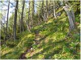 8
8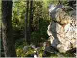 9
9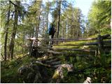 10
10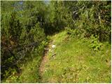 11
11 12
12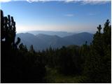 13
13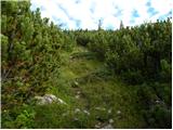 14
14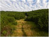 15
15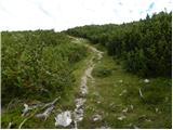 16
16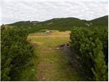 17
17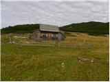 18
18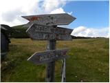 19
19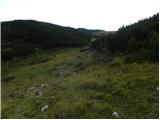 20
20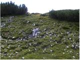 21
21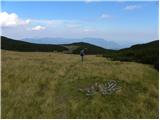 22
22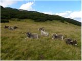 23
23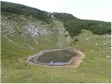 24
24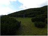 25
25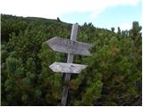 26
26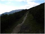 27
27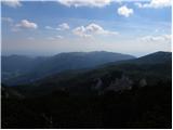 28
28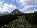 29
29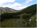 30
30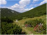 31
31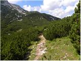 32
32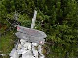 33
33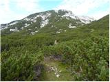 34
34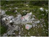 35
35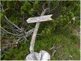 36
36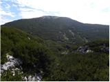 37
37 38
38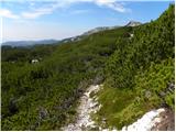 39
39 40
40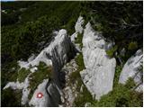 41
41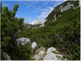 42
42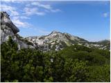 43
43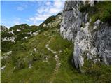 44
44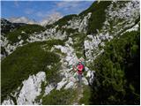 45
45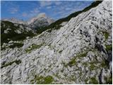 46
46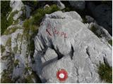 47
47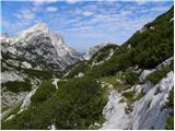 48
48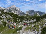 49
49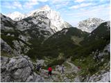 50
50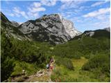 51
51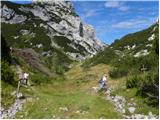 52
52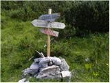 53
53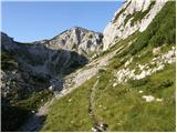 54
54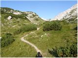 55
55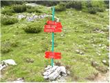 56
56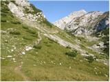 57
57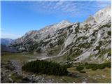 58
58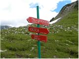 59
59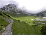 60
60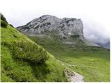 61
61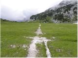 62
62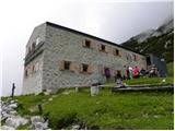 63
63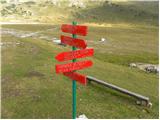 64
64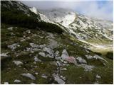 65
65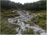 66
66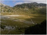 67
67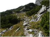 68
68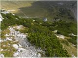 69
69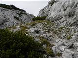 70
70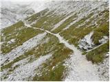 71
71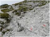 72
72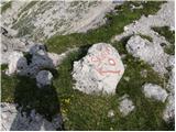 73
73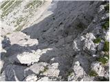 74
74 75
75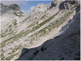 76
76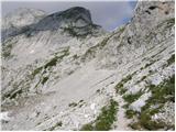 77
77 78
78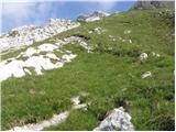 79
79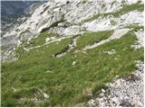 80
80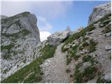 81
81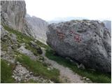 82
82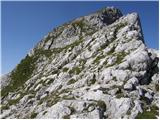 83
83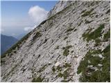 84
84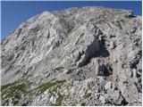 85
85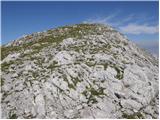 86
86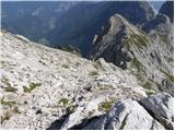 87
87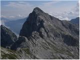 88
88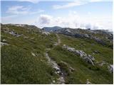 89
89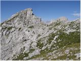 90
90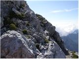 91
91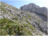 92
92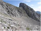 93
93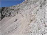 94
94 95
95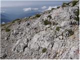 96
96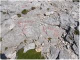 97
97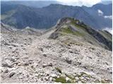 98
98 99
99
Discussion about the trip Planina Ravne - Planjava (via Dolga trata and Škarje)
To post a comment you must log in:
If you do not yet have a username, you must first
register.