Planina Blato - Dom na Komni (via Prodi)
Starting point: Planina Blato (1147 m)
| Latitude/Longitude: | 46,31120°N 13,85010°E |
| |
Route name: via Prodi
Walking time: 5 h 45 min
Difficulty: easy marked way
Elevation gain: 373 m
Elevation difference along the route: 885 m
Map: TNP 1:50.000
Recommended equipment (summer):
Recommended equipment (winter): ice axe, crampons
Views: 1.340
 | 1 person like this post |
Access to starting point:
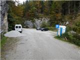
From the Gorenjska motorway (Lesce exit), Železniki or Sorška planina, drive to Bohinjska Bistrica, then continue driving towards Lake Bohinj. In Ribčev Laz, just before the lake, turn right towards Stara Fužina, where we first drive over a bridge with a nice view of Lake Bohinj and past the church of St. John the Baptist. When we arrive in Stara Fužina, at the intersection by the chapel, turn sharply left onto the ascending road towards Planina Blato, Planina Vogar and Voje valley. The road then takes us to the place where they collect toll and parking fees, but we follow it further to the next intersection, where we continue left (right to Voje). Then follow the road to the next intersection (we drive for quite some time), where we turn sharply right towards Planina Blato (straight to Planina Vogar). Follow this road to the marked parking lot above Planina Blato.
Route description:
From the marked parking lot above Planina Blato, return a little back and head onto a wide and initially steep cart track, marked for Planina pri Jezeru. After about ten minutes of ascent, arrive at a marked junction, from where continue left towards Planina pri Jezeru (slightly right Planina v Lazu and also a steep path to Planina pri Jezeru).
Continuing on the less steep cart track that leads further through the forest, a marked path joins from the left a little further on, leading past Kosijev dom on Vogar, but we continue right and keep walking on the cart track. Higher up, the path leads through a narrow passage, then crosses quite steep slopes where there is a high risk of slipping in ice and snow, otherwise the path is not demanding. At the end of the steep slope, the aforementioned steep path joins inconspicuously from the right, the cart track turns left here and enters the rather cool Pungrat valley, where we ascend through mostly spruce forest. When the path levels out higher up, a path joins from the left leading past Planina Vodični vrh, but we keep slightly right and continue walking on the cart track, beside which the forest begins to thin. A few more minutes of easy walking follow and we step onto the pastures of Planina pri Jezeru, where the Koča na Planini pri Jezeru stands on a small hillock.
At the hut, a path branches right towards Planina v Lazu, but we continue left from the hut and descend to a marked junction where there are also a few shepherds' huts.
Choose the wider right path marked for Planina Dedno polje and Koča pri Triglavskih jezerih (slightly left Pršivec, Planina Viševnik and Črno jezero).
Continuing ascent on the cart track, which is quite rocky on steep sections, after about ten minutes of ascent arrive at the point where a path branches left over Krištofojca towards Planina Viševnik, but we continue straight on the gradually less steep cart track leading through increasingly sparse forest. A few more minutes of easy walking follow on the path that later turns slightly right, when the path turns back west, we reach the edge of Planina Dedno polje, from where a walk to the central part of the pasture follows, where there is also a marked junction by the shepherds' huts.
Bypass the shepherds' huts and dairy on the left side and continue straight towards Koča pri Triglavskih jezerih (right valley Za Kopico). From the pasture onwards, we begin a moderate ascent, and a path from the nearby hunting hut joins almost imperceptibly from the left. A little further, the path passes another branch towards Planina Viševnik (path along Griva (1758 m)), and in the next few minutes we arrive at the upper edge of the vast Planina Ovčarija, from where a nice view opens to the Bohinj-Tolmin mountains, sometimes called Lower Bohinj mountains. From here a short descent follows and we arrive at a junction on the northeastern part of the pasture.
Continue slightly right towards Koča pri Triglavskih jezerih and Mala Tičarica (left Planina Viševnik), and the path soon splits again.
From the junction, follow the signs for the path over Prodi (right path over Štapce) and after a few more minutes arrive at a nice vantage point from which a nice view opens to the Komna plateau and Bohinj-Tolmin mountains.
Here the path turns right and from the plateau descends to steep grassy slopes across which we traverse in a moderate descent to the left. Lower down, the path enters dense forest, the slope becomes less steep, and we steeply ascend for a short time. A few minutes further, reach a marked junction above Lopučniška dolina, where we join the path from Koča pri Savici or the path past Črno jezero.
Continue straight towards Koča pri Triglavskih jezerih (left Koča pri Savici) on the path that gently ascends further, bringing us to a point from where a nice view opens to Dvojno jezero. Here we pass the branch to Ruski grob, then the path leads along the right, eastern side of Dvojno jezero, where the path from Planina Blato over Štapce joins from the right.
Continue straight and when we leave the lake shore, only a few dozen steps of easy walking separate us from Koča pri Triglavskih jezerih.
After resting and enjoying the views, continue on the path towards Dom na Komni. The path further leads along the right (western) side of the lake and ascends transversely. A little further, near the hunting hut which is not visible from the path, the path curves semicircularly right and begins to descend gradually. Somewhere in the middle of the descent towards Planina Lopučnica, on a small flat area where the marked path we continue on turns left, an unmarked path branches right leading towards the Zgornje Komne plateau and Gladki and Debelem Lašt (the mentioned path gets lost higher up in the karst world).
When we reach the marked junction on Planina Lopučnica lower down, continue left towards Komna (right on a worse path over Velika vrata pass).
From the Planina Lopučnica mire, ascend transversely to the left, and the path soon splits into two parts. Choose the right marked path, to which the unmarked left path joins a few minutes higher. When both paths merge, pass two older benches and a partly dried-up water trough. A few ascents and descents follow with occasional views of the surrounding mountains, then the path brings us to the marshy Planina na Kalu.
A similar path continues to the abandoned Planina Razor, where we notice some ruins of former huts along the path. After Planina Razor, the path splits again, but we choose the path towards Dom na Komni (right path leads to Koča pod Bogatinom). About 20 minutes of walking follow on a path without major ascents or descents, then a nice view opens towards Dom na Komni and the chain of Bohinj-Tolmin mountains. From here a short descent follows, then we join a wider mule track, which we first follow left (right Koča pod Bogatinom), then after a few steps, at the next junction, choose the right path towards Dom na Komni (straight down Črno jezero and Koča pri Savici).
From the last junction, five minutes of ascent follow and the path brings us to Dom na Komni, which is usually open all year round.
Start - Planina pri Jezeru 1:00, Planina pri Jezeru - Planina Dedno polje 0:30, Planina Dedno polje - Planina Ovčarija 0:45, Planina Ovčarija - Prodi 0:15, Prodi - junction above Lopučniška dolina 0:30, junction above Lopučniška dolina - Dvojno jezero 0:10, Dvojno jezero - Koča pri Triglavskih jezerih 0:05, Koča pri Triglavskih jezerih - Planina Lopučnica 0:30, Planina Lopučnica - Planina na Kalu 0:50, Planina na Kalu - Planina Razor 0:30, Planina Razor - Dom na Komni 0:40.

Along the route: Razpotje Pungrat (1255m), Razpotje pod Vodičnim vrhom (1449m),
Koča na Planini pri Jezeru (1453m), Razpotje Krištofojca (1512m),
Planina Dedno Polje (1560m),
Planina Ovčarija (1660m), Prodi (1660m), Razpotje nad Lopučniško dolino (1671m), Ruski grob (1686m), Dvojno jezero (1689m),
Koča pri Triglavskih jezerih (1685m),
Planina Lopučnica (1558m), Planina na Kalu (1636m), Planina Razor (1550m), Spominska plošča Mateju Koblarju (1481m)
Photos:
 1
1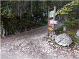 2
2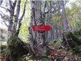 3
3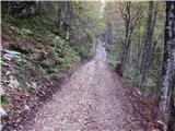 4
4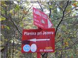 5
5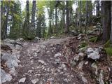 6
6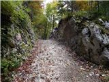 7
7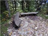 8
8 9
9 10
10 11
11 12
12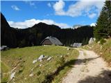 13
13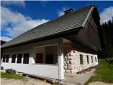 14
14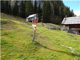 15
15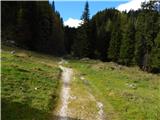 16
16 17
17 18
18 19
19 20
20 21
21 22
22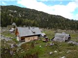 23
23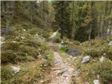 24
24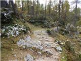 25
25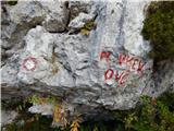 26
26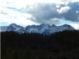 27
27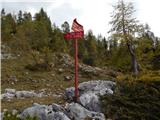 28
28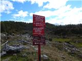 29
29 30
30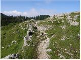 31
31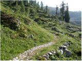 32
32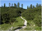 33
33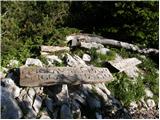 34
34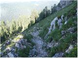 35
35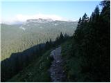 36
36 37
37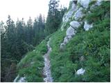 38
38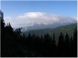 39
39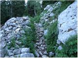 40
40 41
41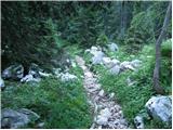 42
42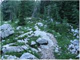 43
43 44
44 45
45 46
46 47
47 48
48 49
49 50
50 51
51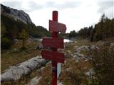 52
52 53
53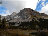 54
54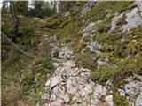 55
55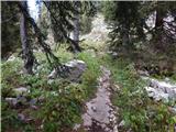 56
56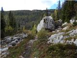 57
57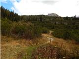 58
58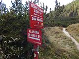 59
59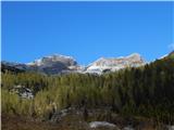 60
60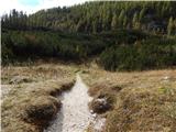 61
61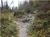 62
62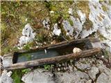 63
63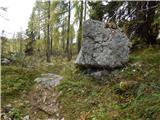 64
64 65
65 66
66 67
67 68
68 69
69 70
70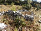 71
71 72
72 73
73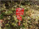 74
74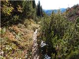 75
75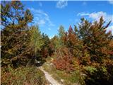 76
76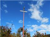 77
77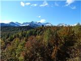 78
78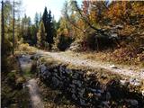 79
79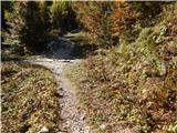 80
80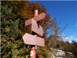 81
81 82
82 83
83 84
84 85
85 86
86 87
87
Discussion about the trip Planina Blato - Dom na Komni (via Prodi)
To post a comment you must log in:
If you do not yet have a username, you must first
register.