Planina Blato - Jezerski Stog
Starting point: Planina Blato (1147 m)
| Latitude/Longitude: | 46,31120°N 13,85010°E |
| |
Walking time: 3 h
Difficulty: partly demanding unmarked way
Elevation gain: 893 m
Elevation difference along the route: 960 m
Map: Triglav 1:25.000
Recommended equipment (summer):
Recommended equipment (winter): ice axe, crampons
Views: 45.146
 | 3 people like this post |
Access to starting point:
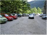
From the Ljubljana - Jesenice motorway, take the Lesce exit and follow the road towards Bled and further towards Bohinjska Bistrica. Continue driving towards Lake Bohinj (Ribčev laz), where we reach a junction, continuing right towards Stara Fužina. In Stara Fužina, at the junction by the chapel, turn sharply left onto the ascending road towards Planina Blato, Planina Vogar and Voje valley. The road then takes us to the toll and parking fee collection point, but we continue following it to the next junction, turning left (right to Voje). We then follow the road to the next junction (driving for quite some time), where we turn sharply right towards Planina Blato (straight to Planina Vogar). Follow this road to the parking lot above Planina Blato.
Route description:
From the parking lot, continue along the gravel road that takes us past the barrier in a few steps to a right bend. On the right side of this bend, we will notice the start of the hunting trail, which with the help of a wire leads us across a short very steep slope. The path soon enters the forest and turns slightly to the right, where it soon crosses a wide cart track (you can also go along the road up to here, or higher along the cart track).
Further, we ascend along a pleasant forest path that rises parallel to a relatively steep cart track. Higher up, the path turns left, and from the right, a trail joins us that leaves the cart track about 15 minutes above Planina Blato.
The hunting trail continues through the forest with some short steep ascents and after about an hour of walking brings us to a small hunting hut located on the left side of the path. Here, a one-minute path branches off to the left to a viewpoint where we can see Planina Blato below us.
From the hunting hut onwards, the path soon takes us out of the forest, where we rejoin the cart track. Only about five minutes of walking remain to Planina Krstenica, where a beautiful view opens up to Ograde, Krn and Bohinj-Tolmin mountains, sometimes called Lower Bohinj mountains.
At the pasture, we join the path that leads via Planina Zgornja Grintovica and through Bušnica from Planina Blato, but we keep to the direction, i.e., the path leading further towards Planina Jezerce, Lazovski and Jezerski pass, and Vodnikov dom (slightly left Planina v Lazu). Initially several small paths along the western part of the pasture soon merge into one nice traceable trail, which first ascends transversely along the slopes of Krsteniški or Mali Stog, then for some time crosses the western slopes of this peak without major elevation changes. The path continues northwards with beautiful views of the neighboring Ograde and Jezerski Stog, the path to Krsteniški passes turns somewhat left and ascends transversely to the valley between Ograde on the left and Jezerski Stog on the right. Here the path flattens, and in a few minutes of further walking, we reach the central part of the abandoned Planina Jezerce.
At Planina Jezerce, the marked path forks, and we choose the right path leading to Jezerski pass (slightly left path to Lazovski pass). On the upper part of the pasture, before the marked path starts to ascend steeply, a traceable but unmarked path branches off to the left leading to Mišeljski pass, but we follow the marked path which starts to ascend in switchbacks towards Jezerski pass. The picturesque path, ascending under the cliffs of Adam and Eve on the left and steep slopes of Jezerski Stog on the right, brings us after about 40 minutes from the central part of Planina Jezerce to Jezerski pass, from which a beautiful view opens to Triglav and other surrounding mountains.
At Jezerski pass, we leave the marked path that starts descending towards Planina pod Mišelj vrh and continue walking right along the unmarked path that leads along the increasingly panoramic ridge, or slightly to the right of it. Such a path brings us after about ten minutes below the steep summit slope, where the path becomes steep again and starts ascending through fairly crumbly terrain, where extra caution is needed especially on descent to avoid slipping. Just below the summit, the path flattens, and we reach the panoramic summit.
Starting point - hunting hut 1:15, hunting hut - Planina Krstenica 0:15, Planina Krstenica - Planina Jezerce 0:30, Planina Jezerce - Jezerski pass 0:40, Jezerski pass - Jezerski Stog 0:20.

Photos:
 1
1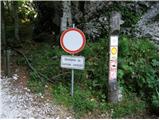 2
2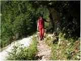 3
3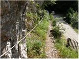 4
4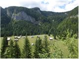 5
5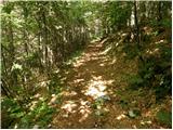 6
6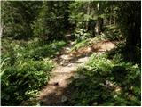 7
7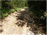 8
8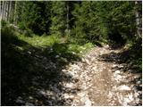 9
9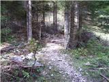 10
10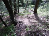 11
11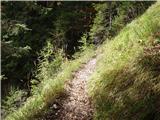 12
12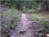 13
13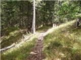 14
14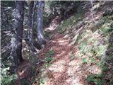 15
15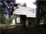 16
16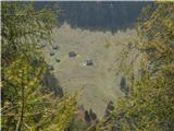 17
17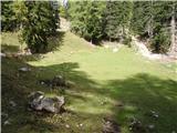 18
18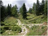 19
19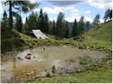 20
20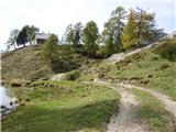 21
21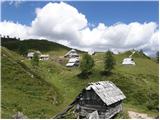 22
22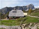 23
23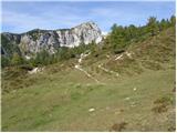 24
24 25
25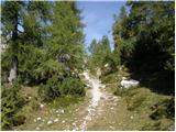 26
26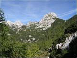 27
27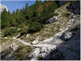 28
28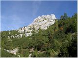 29
29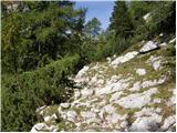 30
30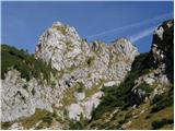 31
31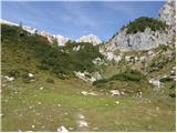 32
32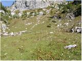 33
33 34
34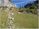 35
35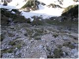 36
36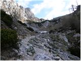 37
37 38
38 39
39 40
40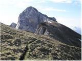 41
41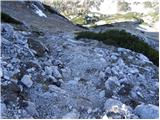 42
42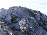 43
43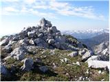 44
44
Discussion about the trip Planina Blato - Jezerski Stog
|
| Gost24. 08. 2006 |
Nice tour, suitable for the upcoming autumn days. And they stop collecting tolls! At least I hope so! Regards.
|
|
|
|
| Gost28. 08. 2006 |
Our time is coming. The crowds of loud "hikers" are slowly dying down. Peace is returning to the hills and mountains, and beautiful autumn strolls await us. This month truly offers us plenty of beauties and quiet experiences.
|
|
|
|
| Gost29. 08. 2006 |
I agree, that the time of "the real ones" is coming, when we enjoy the golden colors of autumn, the wind racing among the larches... now and then we meet a kindred spirit, chat a little and go our separate ways. Batteries are charged and the soul sings for the whole week afterwards in the grayness of everyday life....
|
|
|
|
| Gost9. 02. 2007 |
I walked this path in early autumn, it was wonderful and peaceful, no one anywhere, only at the top we waved to a couple who was simultaneously at the top of Ogradov. However, I have two remarks on the description - first, the path to Jezerski Stog is actually not marked (certainly not from the saddle onwards) and is described as "pathless" in the guidebook as well. Second, it's not that easy all the time, since the path description itself says to be careful on the ridge and towards the summit (which I fully agree with).
|
|
|
|
| bobo24. 04. 2008 |
Does anyone know the current conditions - snow? Has anyone been on this path recently? I plan to go for the May Day holidays.
Best regards,
|
|
|
|
| klukc291. 07. 2008 |
Is it really such a steep path and does anyone know an easier one? Let them tell me.
|
|
|
|
| Kriška2. 07. 2008 |
It's not that steep that you have to be afraid of it . Mostly it's quite gradual, only from Jezerca to the ridge your knees hurt a bit more, and a bit before the summit again (even more so). I don't know any less "steep" paths to this summit. . Mostly it's quite gradual, only from Jezerca to the ridge your knees hurt a bit more, and a bit before the summit again (even more so). I don't know any less "steep" paths to this summit.
|
|
|
|
| Jože.2. 08. 2010 |
Yesterday ascended the summit. The path start is now much lower than described (about a minute from the forest road start - cairn on the left). Some caution needed only along the ridge above planina Jezerce (wet grass) and short ascent to the top. Nice tour.
|
|
|
|
| darh28. 08. 2010 |
We climbed to the summit along the path described here last Saturday. Although the fog deprived us of some views, the trip was really pleasant. We overlooked the cairn at the beginning of the logging trail, but now there is also a cairn at the junction mentioned in the path description that points to it. So as not to return the same way, we climbed from Planina Jezerce to Lazovski preval and descended from there to the planina in Lazu. More about our impressions here.
|
|
|
|
| francimedved19. 10. 2014 |
Today we were up there, excellent topo conditions and wonderful views.
|
|
|
|
| Grenaleva8. 06. 2015 |
We visited this beautiful mountain on Saturday and it really offers wonderful views of the beautiful Slovenian mountains. We did a circular tour with return to Planina Jezerce, ascent to Lazoviški preval (here the path gets lost a bit in between, but just follow the steep wall to the left) and then also to Ogradi, then from Ogradi along the beautiful grassy path to Planina Laz (you can of course turn back to Blato or Krstenica earlier), from Laz to the mountain hut at Jezero and from there to the starting point. Entire tour with stops 9.5 hours. Recommended
|
|
|
|
| Marjetica Možina2. 10. 2018 |
"From Planina Jezerce continue right on the marked path" In fact, this path is not marked, so as not to mislead anyone, like me, who thought I missed it because there were no markings.
|
|
|
|
| garmont2. 10. 2018 |
That part of the path mentioned in the description is marked and leads further towards Planina pod Mišelj vrhom.
The unmarked part is only from Jezerski preval to the summit of Stog, as already nicely described.
|
|
|
|
| julius2. 10. 2018 |
Garmont!
The path from Planina Krstenica via Planina Jezerce to Planina pod Mišelj vrhom has not been marked for many years - checked just over a month ago.
It is drawn on all hiking maps, but unfortunately they ran out of money for two kilos of paint, two Carniolan sausages and four cans of beer.
Of course, in the wider area from Triglav to Bohinj, this is completely normal: faded markings, missing signposts, overgrown paths, fallen trees, missing fixed protections, etc.
That's why the GRZS rescuers had a lot of work this year, especially with foreigners.
If the municipalities of Bohinj, Bled, Kranjska Gora, Bovec and the owners of Slovenia's smelliest WC contributed just 1€ from the collected tourist tax, they could fix everything without problems.
Unfortunately, greed prevailed.
|
|
|
|
| serznoz2. 10. 2018 |
I confirm that the path from Jezerce right to Jezerski preval is not marked, but it is well trodden and therefore unmistakable.
|
|
|
|
| ločanka3. 10. 2018 |
This is exactly what julius says, an incredibly poorly marked area. Of course, this is not critical for hikers who have been there many times before, but for those going there for the first time and relying on maps. Just on one tour this year, specifically in the Velega polja area, two smaller groups of foreigners (young people) asked me about the correctness of the path or where they even were.
|
|
|
|
| piranha5. 10. 2018 |
Dear madam,
One does not hike in the hills without maps. Pathless areas remain so for a reason and should stay that way. There are already too many people in the mountains who have no business there and should rather stay in the valley.
Best regards, gornica
|
|
|
|
| felix18. 10. 2021 13:08:52 |
I join piranha. For many years I've been hiking in that area, only the trail from Planina Laz to Vodnikova koča is marked. The rest should stay that way. Everything can be nicely traversed without markers.
|
|
|
|
| Hribovc8220. 11. 2021 22:27:36 |
Today hiked Planina Blato, Planina Krstenica, Jezerski Stog and over Lazovski Preval to Planina Lazo, one of the nicest pastures for me.
Great weather and a short video
https://youtu.be/ojfqfcRRXkU
Oh, the path is dry.
|
|
|
|
| BorStenar3. 12. 2022 23:14:12 |
Hi
Can someone tell me which are the first days of the year long enough for this hike?
|
|
|
|
| franca4. 12. 2022 09:51:24 |
Given my (non)speed and having hiked this tour multiple times, together with Krsteniški Stog and Prevalski Stog, I can tell you that the length or shortness of the day is not an obstacle for this hike. Conditions, especially snowy ones, can be an obstacle
|
|
|
|
| BorStenar4. 12. 2022 14:56:41 |
Aha.
So, given my speed (or lack thereof), I can go there as soon as the snow melts.
Besides, has anyone tried to make a circular tour returning via the path over the pasture below Mišelj vrh?
|
|
|
|
| franca4. 12. 2022 15:03:02 |
@BorStenar it's also a nice hike in the snow, just it gets much longer, have to go on foot from the valley
|
|
|
|
| BorStenar4. 12. 2022 15:06:22 |
How long does it take you?
|
|
|
|
| Enka19. 08. 2025 23:10:27 |
The path to the ridge (which from there leads to Velo polje) is (again) nicely marked. To the summit of Jezerski Stog it's unmarked, but can't be missed.
|
|
|
To post a comment you must log in:
If you do not yet have a username, you must first
register.