Planina Blato - Kanjavec (via Dolina za Debelim vrhom)
Starting point: Planina Blato (1147 m)
| Latitude/Longitude: | 46,31120°N 13,85010°E |
| |
Route name: via Dolina za Debelim vrhom
Walking time: 5 h 45 min
Difficulty: easy pathless terrain
Elevation gain: 1422 m
Elevation difference along the route: 1620 m
Map: TNP 1 : 50.000
Recommended equipment (summer):
Recommended equipment (winter): ice axe, crampons
Views: 16.810
 | 3 people like this post |
Access to starting point:
From the highway Ljubljana - Jesenice, we take the exit Lesce and follow the road towards Bled and further towards Bohinjska Bistrica. We continue driving towards Lake Bohinj (Ribčev laz), where we come to a junction, where we continue right in the direction of Stara Fužina. In Stara Fužina, at the junction by the chapel, we turn sharply left onto an ascending road in the direction of Planina Blato, Planina Vogar and valley Voje. The road then takes us to the spot where toll and parking fees are collected, and we follow it to the next junction, where we continue left (right Voje). We then follow the road to the next junction (we drive for quite some time), where we turn sharply right in the direction of Planina Blato (straight Planina Vogar). We follow this road to the parking lot above Planina Blato.
Route description:
From the parking lot on Planina Blato we go back along the road a little to the signposts at the cart track. Here we take the cart track, which first ascends steeply then moderately ascends and in ten minutes of walking brings us to a junction, where we go right in the direction of Planina v Lazu (left Planina pri Jezeru). Already after a few dozen steps of further walking, we come to the next junction, where we again continue right on the increasingly poor cart track (straight Planina pri Jezeru steep path). The path ahead moderately ascends and mostly runs through the forest. After an hour and a half of walking, a path to Planina Krstenica branches off to the right, and we continue straight in the direction of Planina Laz. The path ahead starts to descend a little and then quickly brings us to the Planina.
From the Planina we continue right on the marked path, which goes over Lazovški preval towards Vodnikov dom. The path first ascends gently through sparse forest. The path soon comes out of the forest and ascends somewhat more steeply.
On Lazovški preval we leave the marked path and turn left towards Debeli vrh (marked with cairns). After a short ascent, we turn slightly right onto the northern side of Debeli vrh. Here we need to be somewhat careful, as there are also some sinkholes along the path. We follow the cairns over the slopes below the northern wall of Debeli vrh and begin to descend fairly steep terrain. After the descent we turn right (towards the north), cross the valley and then begin to ascend below the western slopes of Vrh Hribaric (2388 m). On the terrain marked with cairns we continue to ascend gently towards the north all the way to Hribaric, where we reach a marked path again. We go straight towards Kanjavec. The path ascends quite steeply and runs through an indistinct valley between the eastern and western peaks of Kanjavec. On the saddle between both peaks we go right and in a few minutes reach the summit.

Photos:
 1
1 2
2 3
3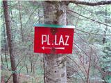 4
4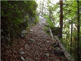 5
5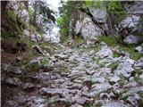 6
6 7
7 8
8 9
9 10
10 11
11 12
12 13
13 14
14 15
15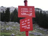 16
16 17
17 18
18 19
19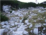 20
20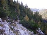 21
21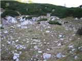 22
22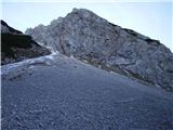 23
23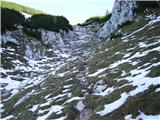 24
24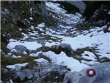 25
25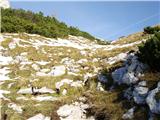 26
26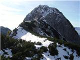 27
27 28
28 29
29 30
30 31
31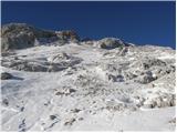 32
32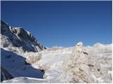 33
33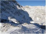 34
34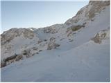 35
35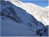 36
36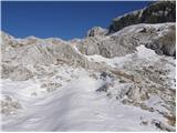 37
37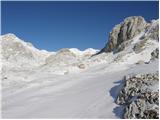 38
38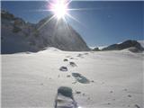 39
39 40
40 41
41 42
42 43
43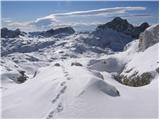 44
44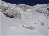 45
45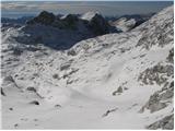 46
46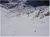 47
47 48
48 49
49 50
50 51
51 52
52
Discussion about the trip Planina Blato - Kanjavec (via Dolina za Debelim vrhom)
|
| IDAS8. 08. 2020 |
Is this path behind Debelim vrhom still active, since it's not on the map? Are there cairns to the marked path to Kanjavec?
|
|
|
|
| matej7128. 08. 2020 |
Passages can still be found with the help of cairns. But you can see that not many people walk it. I walked it about 2 weeks ago.
|
|
|
|
| IDAS9. 08. 2020 |
Cairns were present up to the ridge on the north side of Debeleg vrh, then nothing more... whether the path on the ridge goes more left or right, as there are double cairns up to the ridge (two directions)...
|
|
|
|
| matej7129. 08. 2020 |
In the upper third of the valley the path goes more on the right side of the valley, viewed in the direction of Kanjavec. Before that on the left, under the northern face of DV.
|
|
|
|
| IDAS10. 08. 2020 |
Thank you very much! It seems it really is doable, I found two more path descriptions and some photos. I'll go when I have time.
|
|
|
To post a comment you must log in:
If you do not yet have a username, you must first
register.