Planina Blato - Kopica (via Štapce)
Starting point: Planina Blato (1147 m)
| Latitude/Longitude: | 46,31120°N 13,85010°E |
| |
Route name: via Štapce
Walking time: 4 h 30 min
Difficulty: easy marked way, easy pathless terrain
Elevation gain: 1043 m
Elevation difference along the route: 1150 m
Map: Triglav 1:25.000
Recommended equipment (summer):
Recommended equipment (winter): ice axe, crampons
Views: 17.198
 | 2 people like this post |
Access to starting point:
From the Ljubljana - Jesenice motorway, take the Lesce exit and follow the road towards Bled and further towards Bohinjska Bistrica. Continue driving towards Lake Bohinj (Ribčev Laz), where we arrive at a junction, where we continue right towards Stara Fužina. In Stara Fužina, at the junction by the chapel, turn sharply left onto the ascending road towards Planina Blato, Planina Vogar and the Voje valley. The road then takes us to the place where toll and parking fees are collected, but we follow it further to the next junction, where we continue left (right Voje). We then follow the road to the next junction (we drive for quite some time), where we turn sharply right towards Planina Blato (straight Planina Vogar). We then follow this road to the parking lot above Planina Blato.
Route description:
From the marked parking lot in front of Planina Blato, we return a little back and head onto the wide and initially steep cart track, along which there are signs for Planina pri Jezeru. After approximately ten minutes of ascent, we arrive at a marked junction, from where we continue left in the direction of Planina pri Jezeru (slightly right Planina v Lazu and also the steep path towards Planina pri Jezeru).
Continuing on the less steep cart track, which still leads us through the forest, a little further a marked path joins from the left, leading past Kosijev dom on Vogarju, but we continue right and continue walking on the cart track. Higher, the path leads us through a small narrowing, then we cross quite steep slopes, where there is a high risk of slipping in ice and snow, otherwise the path is not demanding. At the end of the steep slope, the previously mentioned steep path joins quite unnoticeably from the right, the cart track turns left here and transitions into the fairly cool Pungrat valley, where we ascend through mostly spruce forest. When the path levels out higher, another path joins from the left leading past Planina Vodični vrh, but we stick to the slightly right direction and continue walking on the cart track, along which the forest begins to thin. Only a few minutes of easy walking follow and we step onto the pastures of Planina pri Jezeru, where on a small elevation stands Koča na Planini pri Jezeru.
At the hut, a path branches off to the right towards Planina v Lazu, but we continue left from the hut and descend to the marked junction, where there are also some shepherd's dwellings.
We choose the wider right path along which there are signs for Planina Dedno polje and Koča pri Triglavskih jezerih (slightly left Pršivec, Planina Viševnik and Črno jezero).
We also ascend on the cart track in the continuation, which is quite rocky on steep sections, after approximately ten minutes of ascent we arrive at the place where a path branches left over Krištofojca, leading towards Planina Viševnik, but we continue straight on the gradually less steep cart track, which leads us through gradually sparser forest. A few minutes of easy walking follow on the path, which later turns slightly to the right, when the path turns back towards the west we already reach the edge of Planina Dedno polje, from where a walk to the central part of the pasture follows, where by the shepherd's huts there is also a marked junction.
We bypass the shepherd's huts and the cheese dairy on the left side and continue straight in the direction of Koča pri Triglavskih jezerih (right dolina Za Kopico). From the pasture onwards we begin to ascend moderately, and from the left almost unnoticeably a path from the nearby hunting hut joins. A little further the path leads us past another branch of the path towards Planina Viševnik (path along Grivi (1758 m)), but in the next few minutes we arrive at the upper edge of the vast Planina Ovčarija, from where a beautiful view opens to the Bohinjsko - Tolminske gore, sometimes called Spodnje Bohinjske gore. From here a short descent follows and we arrive at the junction in the northeastern part of the pasture.
We continue slightly right in the direction of Koča pri Triglavskih jezerih and Male Tičarice (left Planina Viševnik), the path quickly forks again.
From the fork we follow the signs for the path over Štapce (straight path over Prodov), both lead towards Koča pri Triglavskih jezerih, the right one, which we will continue on, also towards Mali Tičarici and Zelnaricama. We soon leave Planina Ovčarija and the path ascends moderately to steeply through increasingly sparse forest, which higher is replaced by dwarf pines. After a half-hour ascent the path levels out and brings us to Štapce, where the next marked junction is.
At Štapcah we continue slightly right in the direction of Tičarice and Zelnarice (slightly left Koča pri Triglavskih jezerih) and continue the ascent on the path, which first ascends through a belt of dwarf pines, then brings us to a short steep and especially in wet dangerous for slipping jump. Above the jump the path levels out and transitions to moderately steep grassy slopes, along which in a few minutes of further walking we climb to a smaller saddle, where a marked path branches left to Malo Tičarico, to which is approximately ten minutes ascent.
We continue in the direction of Zelnarice on a relatively even path, which first crosses the slopes of Male and then also Velike Tičarice. Just a few tens of meters behind the sign "Ne trgaj cvetja!" (sign on the wall) a passage opens to the left towards Veliki Tičarici to which is approximately 15 minutes demanding ascent, but we continue straight on the marked path, which north of Velike Tičarice reaches the main ridge.
Behind Velika Tičarica the path transitions to a wide grassy ridge along and on which we then ascend. After a few minutes of easy walking, the path begins to ascend steeply on partly grassy slope. The steepness quickly eases, the path brings us to vast meadows south of the precipitous and overhanging Kopica. Across the vast meadows we walk to the foot of the summit slope of Kopica, then, when we reach the edge of the cliff, the marked path turns to the right and transversely ascends over a smaller scree. Behind the scree the path turns to the left, then in the transverse ascent begins to ascend steeply. The marked path at a smaller indistinct depression approaches the ridge and turns slightly to the right. Just at this place we leave the marked path (in fog we can quickly overlook the branch) and on easier pathless terrain across moderately steep grassy slope in a few steps climb to the ridge of Kopica. Here we continue left and continue the path on the increasingly narrower, but technically undemanding ridge. After less than five minutes of walking from the place where we left the marked path we reach the panoramic and precipitous summit of Kopica.
Starting point - Planina pri Jezeru 1:00, Planina pri Jezeru - Planina Dedno polje 0:30, Planina Dedno polje - Planina Ovčarija 0:45, Planina Ovčarija - Štapce 0:35, Štapce - junction below Malo Tičarica 0:25, junction below Malo Tičarica - branch for Velika Tičarica 0:20, branch for Velika Tičarica - branch for Kopica 0:50, branch for Kopica - Kopica 0:05.

Photos:
 1
1 2
2 3
3 4
4 5
5 6
6 7
7 8
8 9
9 10
10 11
11 12
12 13
13 14
14 15
15 16
16 17
17 18
18 19
19 20
20 21
21 22
22 23
23 24
24 25
25 26
26 27
27 28
28 29
29 30
30 31
31 32
32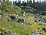 33
33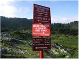 34
34 35
35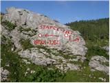 36
36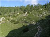 37
37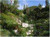 38
38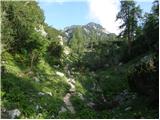 39
39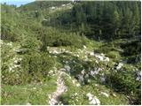 40
40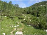 41
41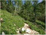 42
42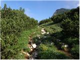 43
43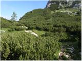 44
44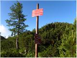 45
45 46
46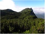 47
47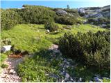 48
48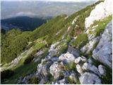 49
49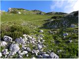 50
50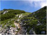 51
51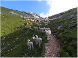 52
52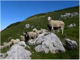 53
53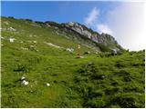 54
54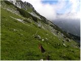 55
55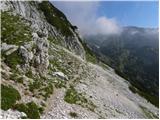 56
56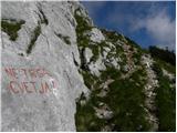 57
57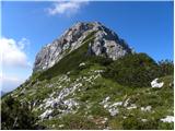 58
58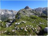 59
59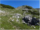 60
60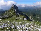 61
61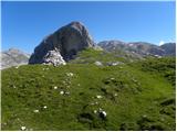 62
62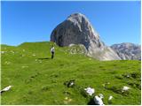 63
63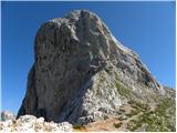 64
64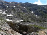 65
65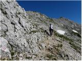 66
66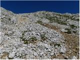 67
67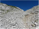 68
68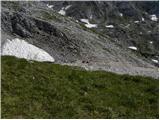 69
69 70
70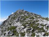 71
71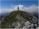 72
72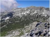 73
73
Discussion about the trip Planina Blato - Kopica (via Štapce)
|
| velkavrh6. 08. 2009 |
Indeed, it can be pathless terrain, but it has already become an unmarked trodden path. It is short, and it should also be surveyed and equipped with a stamp and logbook. There is nothing special at the top, but from below it looks like a mighty rock.
|
|
|
|
| katty30. 11. 2011 |
I would write about Kopica like this: it is a quite neglected peak that is also extremely easy to access. Given how imposing it looks from the Valley of the Seven Lakes and from Velega polja, it really deserves a stamp and a summit logbook.
|
|
|
|
| Barpka30. 11. 2011 |
But I like it just the way it is. Do we humans really have to leave our traces everywhere? I think we can leave some things just as they are.
I'm also adding a few photos of Kopica that I took last Friday on the way to Vogle. I saw five people and 30 chamois. 
|
|
|
|
| Barpka30. 11. 2011 |
Aha, apparently I can't add photos here.  Next time somewhere else... Next time somewhere else...
|
|
|
|
| katty30. 11. 2011 |
Yes, otherwise I agree with you @Barpka, but given that stamps and crosses and I don't know what else are placed on various peaks, I think there could be one here too . It is true that this way you experience that primal essence of hiking in the mountains where there is nothing. And, as said, it is a quite neglected peak. Let it stay as it is (in its own way), at least you have more peace . It is true that this way you experience that primal essence of hiking in the mountains where there is nothing. And, as said, it is a quite neglected peak. Let it stay as it is (in its own way), at least you have more peace  . .
|
|
|
|
| Laščan2. 07. 2020 |
How is the continuation of the path towards the Vrata saddle?
How much time is needed from Vrh Kopice to the mentioned saddle? LP Janez
|
|
|
To post a comment you must log in:
If you do not yet have a username, you must first
register.