Planina Blato - Lake Rjavo jezero (via Prodi)
Starting point: Planina Blato (1147 m)
| Latitude/Longitude: | 46,31120°N 13,85010°E |
| |
Route name: via Prodi
Walking time: 5 h 5 min
Difficulty: easy marked way
Elevation gain: 859 m
Elevation difference along the route: 1030 m
Map: TNP 1:50.000
Recommended equipment (summer):
Recommended equipment (winter): ice axe, crampons
Views: 770
 | 1 person like this post |
Access to starting point:
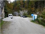
From the Upper Carniola motorway (Lesce exit), via Železniki or Soriska Planina, we drive to Bohinjska Bistrica, then continue towards Lake Bohinj. In Ribčev Laz, just before the lake, we turn right towards Stara Fužina, where we first cross a bridge with a beautiful view of Lake Bohinj and pass by the little church of St. John the Baptist. Upon reaching Stara Fužina, at the intersection by the chapel, we turn sharply left onto the ascending road towards Planina Blato, Planina Vogar and Voje Valley. The road leads us further to the toll and parking collection point, but we continue to the next intersection, turning left (right to Voje). We follow the road to the next intersection (after quite some driving), where we turn sharply right towards Planina Blato (straight to Planina Vogar). We then follow this road to the marked parking lot above Planina Blato.
Route description:
From the marked parking lot in front of Planina Blato, we return a bit back and head onto a wide and initially steep cart track, marked towards Planina pri Jezeru. After about ten minutes of ascent, we reach a marked junction, from where we continue left towards Planina pri Jezeru (slightly right Planina v Lazu and also a steep path to Planina pri Jezeru).
Continuing on the less steep cart track leading through the forest, a marked path joins from the left shortly after, leading past Kosijev dom on Vogarju; we continue right and proceed along the cart track. Higher up, the path leads through a narrow passage, then crosses quite steep slopes where there is a high risk of slipping on ice and snow, but otherwise the path is not demanding. At the end of the steep slope, the aforementioned steep path joins inconspicuously from the right, the cart track turns left here and enters the rather cool Pungrat valley, where we ascend through mostly spruce forest. Higher up, where the path levels out, another path joins from the left leading past Planina Vodični vrh; we keep slightly right and continue walking along the cart track, beside which the forest begins to thin. A few minutes of easy walking follow, and we step onto the pastures of Planina pri Jezeru, where the Koča na Planini pri Jezeru stands on a small hillock.
At the hut, a path branches right towards Planina v Lazu; we continue left from the hut and descend to a marked junction with some shepherd huts.
We choose the wider right path marked towards Planina Dedno polje and Koča pri Triglavskih jezerih (slightly left Pršivec, Planina Viševnik and Črno jezero).
We continue ascending the cart track, which is quite rocky on steep sections; after about ten minutes, we reach a point where a path branches left over Krištofojca towards Planina Viševnik; we go straight on the gradually less steep cart track leading through increasingly sparse forest. A bit more easy walking follows on the path that later turns slightly right; when it turns back west, we reach the edge of Planina Dedno polje, from where a short walk leads to the central part of the pasture with a marked junction by the shepherd huts.
We bypass the shepherd huts and cheese dairy on the left and continue straight towards Koča pri Triglavskih jezerih (right Za Kopico valley). From the pasture, we begin a moderate ascent, and a path from a nearby hunting hut joins almost imperceptibly from the left. A bit further, the path passes another branch towards Planina Viševnik (path along Griva (1758 m)); after a few more minutes, we reach the upper edge of the vast Planina Ovčarija, from where a beautiful view opens to the Bohinj-Tolmin mountains, sometimes called Lower Bohinj mountains. From here, a short descent follows to a junction on the northeastern part of the pasture.
We continue slightly right towards Koča pri Triglavskih jezerih and Mala Tičarica (left Planina Viševnik); the path soon forks again.
From the fork, we follow the marks for the path over Prodi (right path over Štapce), and after a few more minutes, we reach a nice vantage point with a view of the Komna plateau and Bohinj-Tolmin mountains.
Here the path turns right and from the plateau descends transversely on steep grassy slopes to the left in a moderate descent. Lower down, the path enters dense forest, the slope becomes less steep, and we ascend steeply for a short time. A few minutes further, we reach a marked junction above Lopučniška dolina, where we join the path from Koča pri Savici or the path past Črno jezero.
We continue straight towards Koča pri Triglavskih jezerih (left Koča pri Savici) on a path that gently ascends further, leading us to a point with a nice view of Dvojno jezero. Here we pass a branch to Ruski grob, then the path leads along the right, eastern side of Dvojno jezero, where the path from Planina Blato over Štapce joins from the right.
We continue straight, and after leaving the lake shore, only a few dozen steps of easy walking separate us from Koča pri Triglavskih jezerih.
From the hut, we continue towards Triglav, Dolič, Hribarice, Prehodavci and Veliki Špič; the path first leads past the dam and artificial Močivec lake. The path bypasses the lake on the right, eastern side and then moderately ascends through the Valley of Triglav Lakes, overgrown with increasingly sparse forest.
Still in the belt of sparse forest, the path forks; we take the slightly right path continuing towards Prehodavci and Hribarice (left to Velika or Lepa Špičja over Zgornje Komne plateau), leading first through sparse larch forest, then below the scree of mighty Kopica and later Male Zelnarice. Later, the path ascends a bit more transversely to a small pass, from which a nice view opens to Jezero v Ledvicah.
The marked path bypasses the lake on the right side, continuing over extensive scree at the foot of both Zelnarice. After the lake, the path returns from scree to the Valley of Triglav Lakes, along which we continue a relatively gentle ascent. Already fully alpine path steepens briefly higher up, then levels out completely and after a few minutes of further walking brings us to Zeleno jezero.
From Zeleno jezero, we continue straight towards Prehodavci (right Hribarice, Dolič and Triglav); the path soon forks again.
Again we go straight, this time towards Rjavo jezero and Zasavska koča (left Veliko Špičje and Zasavska koča), and after a few minutes of further walking, we reach Rjavo jezero.
Starting point - Planina pri Jezeru 1:00, Planina pri Jezeru - Planina Dedno polje 0:30, Planina Dedno polje - Planina Ovčarija 0:45, Planina Ovčarija - Prodi 0:15, Prodi - junction above Lopučniška dolina 0:30, junction above Lopučniška dolina - Dvojno jezero 0:10, Dvojno jezero - Koča pri Triglavskih jezerih 0:05, Koča pri Triglavskih jezerih - branch to Veliko Špičje 0:25, branch to Veliko Špičje - branch to Jezero v Ledvicah 0:30, branch to Jezero v Ledvicah - Zeleno jezero 0:45, Zeleno jezero - Rjavo jezero 0:10.

Along the route: Razpotje Pungrat (1255m), Razpotje pod Vodičnim vrhom (1449m),
Koča na Planini pri Jezeru (1453m), Razpotje Krištofojca (1512m),
Planina Dedno Polje (1560m),
Planina Ovčarija (1660m), Prodi (1660m), Razpotje nad Lopučniško dolino (1671m), Ruski grob (1686m), Dvojno jezero (1689m),
Koča pri Triglavskih jezerih (1685m), Močivec (1690m), Odcep za Veliko Špičje (1762m), Odcep k Jezeru v Ledvicah (1854m),
Lake Jezero v Ledvicah (1831m),
Lake Zeleno jezero (1988m)
Photos:
 1
1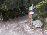 2
2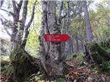 3
3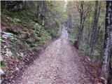 4
4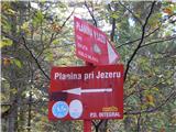 5
5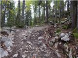 6
6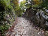 7
7 8
8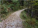 9
9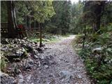 10
10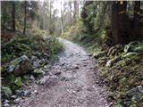 11
11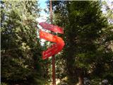 12
12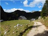 13
13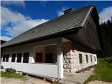 14
14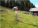 15
15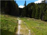 16
16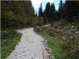 17
17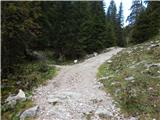 18
18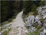 19
19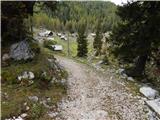 20
20 21
21 22
22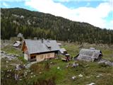 23
23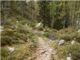 24
24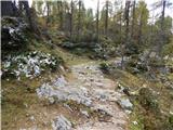 25
25 26
26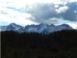 27
27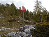 28
28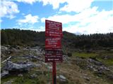 29
29 30
30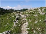 31
31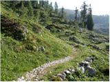 32
32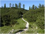 33
33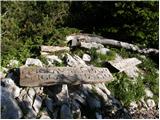 34
34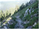 35
35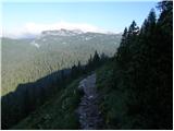 36
36 37
37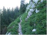 38
38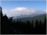 39
39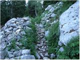 40
40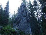 41
41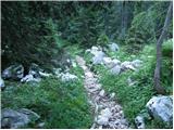 42
42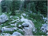 43
43 44
44 45
45 46
46 47
47 48
48 49
49 50
50 51
51 52
52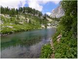 53
53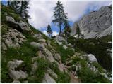 54
54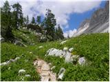 55
55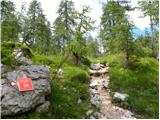 56
56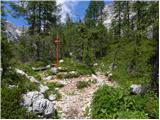 57
57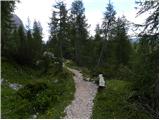 58
58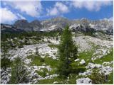 59
59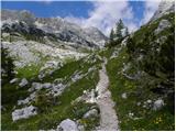 60
60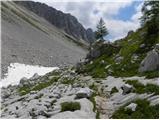 61
61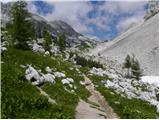 62
62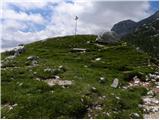 63
63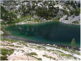 64
64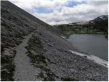 65
65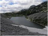 66
66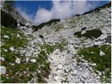 67
67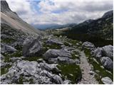 68
68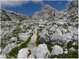 69
69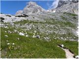 70
70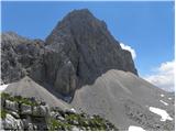 71
71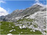 72
72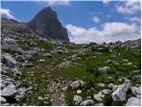 73
73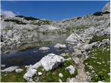 74
74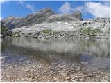 75
75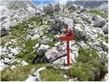 76
76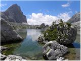 77
77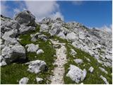 78
78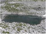 79
79
Discussion about the trip Planina Blato - Lake Rjavo jezero (via Prodi)
To post a comment you must log in:
If you do not yet have a username, you must first
register.