Planina Blato - Mala Tičarica (via Štapce)
Starting point: Planina Blato (1147 m)
| Latitude/Longitude: | 46,31120°N 13,85010°E |
| |
Route name: via Štapce
Walking time: 3 h 25 min
Difficulty: easy marked way
Elevation gain: 924 m
Elevation difference along the route: 1035 m
Map: Triglav 1:25.000
Recommended equipment (summer):
Recommended equipment (winter): ice axe, crampons
Views: 65.657
 | 6 people like this post |
Access to starting point:
From the Ljubljana - Jesenice motorway, we head to the Lesce exit and follow the road towards Bled and further towards Bohinjska Bistrica. We continue driving towards Lake Bohinj (Ribčev laz), where we arrive at a junction and continue right in the direction of Stara Fužina. In Stara Fužina, at the junction by the chapel, we turn sharply left onto the ascending road in the direction of Planina Blato, Planina Vogar and Voje valley. The road then takes us to the place where toll and parking fees are collected, but we continue to follow it to the next junction, where we continue left (right Voje). We then follow the road to the next junction (we drive for quite some time), where we turn sharply right in the direction of Planina Blato (straight Planina Vogar). We then follow this road to the parking lot above Planina Blato.
Route description:
From the marked parking lot in front of Planina Blato, we return a little back and head to a wide and initially steep cart track, along which there are signs for Planina pri Jezeru. After approximately ten minutes of ascent, we arrive at a marked junction, from which we continue left in the direction of Planina pri Jezeru (slightly right Planina v Lazu and also the steep path to Planina pri Jezeru).
In the continuation of the less steep cart track, which continues to lead us through the forest, a marked path joins from the left a little further on, which leads past Kosijev dom on Vogar, we continue right and continue walking on the cart track. Higher up, the path leads through a small narrowing, then we cross quite steep slopes, where there is a great danger of slipping in ice and snow, but otherwise the path is not difficult. At the end of the steep slope, the previously mentioned steep path joins from the right quite unnoticeably, the cart track turns left here and transitions into the fairly cold Pungrat valley, where we ascend through mostly spruce forest. When the path levels out higher up, a path joins from the left that leads past Planina Vodični vrh, we keep to the slightly right direction and continue walking on the cart track, along which the forest begins to thin. Only a few minutes of easy walking follow and we step onto the pastures of Planina pri Jezeru, where the Koča na Planini pri Jezeru stands on a small rise.
At the hut, a path branches off to the right towards Planina v Lazu, we continue left of the hut and descend to a marked junction, where there are also a few shepherd's huts.
We choose the wider right path along which there are signs for Planina Dedno polje and Koča pri Triglavskih jezerih (slightly left Pršivec, Planina Viševnik and Črno jezero).
Even in the continuation, we ascend along the cart track, which is quite rocky on steep sections, after approximately ten minutes of ascent we arrive at the place where a path branches off to the left over Krištofojca, which leads towards Planina Viševnik, we continue straight on the gradually less steep cart track, which leads us through gradually sparser forest. A few more minutes of easy walking follow on the path, which later turns slightly to the right, when the path turns back towards the west we already reach the edge of Planina Dedno polje, from which a walk follows to the central part of the pasture, where there is also a marked junction by the shepherd's huts.
We bypass the shepherd's huts and the dairy on the left side and continue straight in the direction of Koča pri Triglavskih jezerih (right valley Za Kopico). From the pasture onwards, we begin to ascend moderately, and from the left an almost unnoticeable path joins from the nearby hunting hut. A little further, the path leads past another branch of the path towards Planina Viševnik (path along Griva (1758 m)), and in the next few minutes we arrive at the upper edge of the vast Planina Ovčarija, from which a beautiful view opens up to the Bohinj-Tolmin mountains, sometimes called the Lower Bohinj mountains. From here, a short descent follows and we arrive at a junction in the northeastern part of the pasture.
We continue slightly right in the direction of Koča pri Triglavskih jezerih and Mala Tičarica (left Planina Viševnik), and the path soon splits again.
From the fork, we follow the signs for the path over Štapce (straight path over Prode), both of which lead towards Koča pri Triglavskih jezerih, the right one, which we will continue on, also towards Mala Tičarica and Zelnarice. We soon leave Planina Ovčarija and the path ascends moderately to steeply through increasingly sparse forest, which higher up is replaced by dwarf pine. After a half-hour ascent, the path levels out and brings us to Štapce, where the next marked junction is.
At Štapce, we continue slightly right in the direction of Tičarica and Zelnarica (slightly left Koča pri Triglavskih jezerih) and continue the ascent on the path that first climbs through a belt of dwarf pine, then brings us to a short steep and especially dangerous for slipping when wet jump. Above the jump, the path levels out and transitions to moderately steep grassy slopes, over which we ascend to a small saddle in a few minutes of further walking, where a marked path to Mala Tičarica branches off to the left.
We continue in the mentioned direction (straight Mala Zelnarica) and ascend over the grassy slope to the ridge of Mala Tičarica. Here the path turns right and continues along and beside the ridge. We follow this increasingly panoramic path, which a little below the summit crosses a short slightly exposed slope, all the way to the summit, which we reach after a few steps of further walking.
Starting point - Planina pri Jezeru 1:00, Planina pri Jezeru - Planina Dedno polje 0:30, Planina Dedno polje - Planina Ovčarija 0:45, Planina Ovčarija - Štapce 0:35, Štapce - junction below Mala Tičarica 0:25, junction below Mala Tičarica - Mala Tičarica 0:10.

Photos:
 1
1 2
2 3
3 4
4 5
5 6
6 7
7 8
8 9
9 10
10 11
11 12
12 13
13 14
14 15
15 16
16 17
17 18
18 19
19 20
20 21
21 22
22 23
23 24
24 25
25 26
26 27
27 28
28 29
29 30
30 31
31 32
32 33
33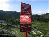 34
34 35
35 36
36 37
37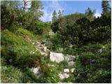 38
38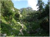 39
39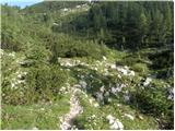 40
40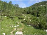 41
41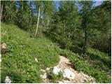 42
42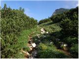 43
43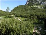 44
44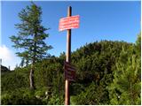 45
45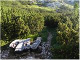 46
46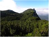 47
47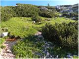 48
48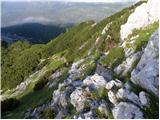 49
49 50
50 51
51 52
52 53
53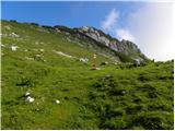 54
54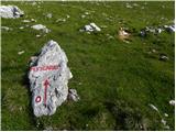 55
55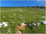 56
56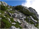 57
57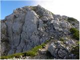 58
58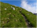 59
59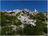 60
60 61
61
Discussion about the trip Planina Blato - Mala Tičarica (via Štapce)
|
| ROBERT22. 08. 2006 |
In winter and spring a nightmare awaits you if you choose this otherwise not so high mountain.
|
|
|
|
| ljubica23. 08. 2006 |
Robert, why a nightmare?! Because of the snow? For me it was a wonderful hike (in July). LpLj
|
|
|
|
| Gost23. 08. 2006 |
ljubica, July is not winter or spring. I went end of April, there was snow up to your neck and you couldn't walk normally. lp RO
|
|
|
|
| Gost26. 08. 2006 |
Robert, in winter stay nicely at home by the stove. One of the nicer winter tours, for connoisseurs of sevada, right ljubica.
|
|
|
|
| velkavrh6. 08. 2009 |
Today I decided to hike the mountains that look so majestic when viewed on the right from the Triglav Lakes valley. It naturally starts with Mala Tičarica. Easily accessible summit. But it seems a bit lonely. Mainly hikers wander around the Triglav Lakes valley.
|
|
|
|
| EUGEN10. 09. 2009 |
In August I went to the summit to see the lakes and hut from another perspective.
|
|
|
|
| darh9. 09. 2012 |
Yesterday we climbed Mala Tičarica via this path and to our surprise we weren't alone at the summit yet. Clear weather contributed to excellent views in all directions. Pictures and more about our impressions here.
|
|
|
|
| MONIK8. 06. 2014 |
The path to Mala Tičarica is very nice. Still some snow, but no problem. We had wonderful weather and of course wonderful views.
|
|
|
|
| MONIK8. 06. 2014 |
The path to Mala Tičarica is very nice. Still some snow, but no problem. We had wonderful weather and of course wonderful views.
|
|
|
|
| SuzanaM11. 09. 2015 |
The trail is freshly marked, which helps especially just below the summit, as the markings nicely guide us through the least demanding passages.
A few years ago when I was first on M. Tičarica, I was tempted to continue the trail towards M. and V. Zelnarica. This year I finally walked this interesting, but on shorter sections somewhat more demanding trail. Description on the link: http://www.hribi.net/trenutnerazmere.asp?slo=1&gorovjeid=1&id=2810
|
|
|
|
| Enka5. 08. 2016 |
How long does it take from the junction at Štapce to the summit?
|
|
|
|
| Enka5. 08. 2016 |
So few? Then next time when I pass by there, definitely up .
|
|
|
|
| mornar5. 10. 2016 |
On Saturday I'd go to Mala Tičarica and I'm curious about the conditions on the approach to the summit.

|
|
|
|
| pikica15. 10. 2016 |
@mornar you can't upload images here, check under current conditions. I'll post it there, under Mala Tičarica.
|
|
|
|
| tango1. 10. 2020 |
Today was an ideal day and the circular tour Planina Blato - Planina pri Jezeru - pl. Dedno polje - pl. Ovčarija - Štapce - Mala Tičarica and back via Štapc to Triglavskih and over Prode to Ovčarijo, from there via planina Viševnik to Jezero and to Blato, was the right choice. From Štapc towards the summit of M. Tičarice there is a little snow, so caution in sections where snow has covered the grass is advisable. Really nice start to October!
|
|
|
|
| golica6. 10. 2020 |
I'm interested how much snow there is on the trail from Planina Blato towards Triglav Lakes. Are the trees (larches) starting to turn yellow yet?
Thanks
|
|
|
|
| tango6. 10. 2020 |
No snow up to the junction shown in picture 54 practically. Larches are turning yellow with a bit of imagination
|
|
|
|
| golica7. 10. 2020 |
thanks for the explanation. Anyway it might snow today, so conditions might change by Saturday
|
|
|
|
| brett18. 08. 2025 12:34:14 |
Tomorrow I'm going with my daughter to the hut at the double lake. Then I'm thinking of "taking" her to Mala Tičarica. A few years ago I went from the latter to the hut... But I forgot roughly how long the ascent takes. To the summit I'd say approx. 1h?! I know there are some fixed cables and a so-called chimney, but I forgot if it's suitable for 10-year-old children. She has some experience with climbing or cables: Ciprnik, Osojnica, Ratitovec etc.
Thanks for the help!
|
|
|
|
| ppegan18. 08. 2025 12:47:07 |
If the child is used to hiking in the mountains, there shouldn't be any problems here, so go ahead boldly I think the cable over Štapce will be a little challenge for the girl, but mainly a pleasant addition to the tour. And yes, normally it takes 1 hour from the hut to MT, but it can be a few minutes more 
|
|
|
|
| Enka18. 08. 2025 12:51:14 |
Yes, approx. 1 hour. The path is no harder than Ciprnik.
|
|
|
To post a comment you must log in:
If you do not yet have a username, you must first
register.