Planina Blato - Mala Zelnarica (Za Kopico)
Starting point: Planina Blato (1147 m)
| Latitude/Longitude: | 46,31120°N 13,85010°E |
| |
Route name: Za Kopico
Walking time: 4 h 15 min
Difficulty: partly demanding marked way
Elevation gain: 1163 m
Elevation difference along the route: 1250 m
Map: Triglav 1:25.000
Recommended equipment (summer):
Recommended equipment (winter): ice axe, crampons
Views: 22.964
 | 1 person like this post |
Access to starting point:
From the Ljubljana - Jesenice motorway, take the Lesce exit and follow the road towards Bled and on to Bohinjska Bistrica. Continue towards Bohinjsko jezero (Ribčev laz), at which you will come to a crossroads where you will turn right towards Stara Fužina. At Stara Fužina, at the crossroads by the chapel, turn sharp left onto the ascending road towards mountain pasture Blato, mountain pasture Vogar and the Voje valley. The road continues to the place where the toll and parking fees are collected, and we follow it to the next crossroads, where we continue to the left (right Voje). We then follow the road to the next crossroads (we drive for some time), where we take a sharp right in the direction of mountain pasture Blato (straight ahead mountain pasture Vogar). Follow this road to the parking lot above mountain pasture Blato.
Route description:
From the marked parking lot in front of Planina Blato, we return a little back and head to a wide and initially steep cart track, alongside which there are signs for Planina pri Jezeru. After about ten minutes of ascent, we arrive at a marked junction, from which we continue left towards Planina pri Jezeru (slightly right Planina v Lazu and also the steep path to Planina pri Jezeru).
In the continuation to the less steep cart track, which still leads us through the forest, a little further a marked path joins from the left that leads past Kosijev dom on Vogar, but we continue right and continue walking on the cart track. Higher, the path leads us through a small narrowing, then we cross quite steep slopes, where there is a great risk of slipping in ice and snow, otherwise the path is not demanding. At the end of the steep slope, the previously mentioned steep path joins quite unnoticeably from the right, the cart track turns left here and passes into a fairly cool Pungrat valley, where we ascend through mostly spruce forest. When the path levels higher, a path joins from the left that leads past Planina Vodični vrh, but we keep the slightly right direction and continue walking on the cart track, alongside which the forest begins to thin. Only a few minutes of easy walking follow and we step onto the pastures of Planina pri Jezeru, where the Koča na Planini pri Jezeru stands on a small elevation.
At the hut, a path branches off to the right towards Planina v Lazu, but we continue left from the hut and descend to a marked junction, where there are also some shepherd huts.
We choose the wider right path alongside which there are signs for Planina Dedno polje and Koča pri Triglavskih jezerih (slightly left Pršivec, Planina Viševnik and Črno jezero).
Also in the continuation, we ascend on the cart track, which is quite rocky on steep places, after about ten minutes of ascent we arrive at the place where a path branches off to the left over Krištofojca, which leads towards Planina Viševnik, but we continue straight on the gradually less steep cart track that leads us through gradually sparser forest. A few more minutes of easy walking on the path follow, which later turns slightly to the right, when the path turns back towards the west, we already reach the edge of Planina Dedno polje, from which a walk to the central part of the planina follows, where next to the shepherd huts there is also a marked junction.
Here we leave the wide path that leads straight towards Koča pri Triglavskih jezerih and nearby Planina Ovčarija and continue with the path to the right in the direction of Zasavska koča na Prehodavcih, pass Vrata and saddle Hribarice. The path further leads us past some huts on the planina, behind which a path branches off to the right towards Planina v Lazu, Planina Krstenica and Vodnikov dom on Velem polju, but we continue straight to the northwest part of the planina, where the path begins to ascend. Here the path first leads us past the animal watering place, which is dry, then the path becomes steeper and ascends through mostly coniferous forest of spruces and larches. After about thirty minutes of steep ascent, the path levels and brings us to a kind of saddle between Kovačičeva glava on the left and Kredo on the right.
A little further from the saddle, for which we can trace the name Stog, an unmarked path branches off to the right towards Slatna, but the first beautiful views of the mountains that rise above the Za Kopico valley open up to us. A traverse ascent follows above the abandoned Planina Ščavje, the path gradually passes from the slopes of Slatna to the slopes of Prvi Vogel, and higher the view more frequently turns to the interesting rocky peak Kopica, which rises on the left, western side of the Za Kopico valley.
Higher we gradually arrive in the central part of the valley, where from the slopes we arrive in a series of several smaller valleys, through which we mostly ascend moderately, only here and there a shorter steeper part follows. With beautiful views we continue upwards through the wonderful landscape, the valley narrows higher and at an elevation of 2192 meters we reach the Vrata pass, which separates the Za Kopico valley from the Triglav Lakes Valley.
From the pass, which is located between Velika Zelnarica on the left and Zadnji Vogel on the right, from the marked junction we continue sharply left in the direction of Mala Zelnarica and Koča pri Triglavskih jezerih (straight Zasavska koča na Prehodavcih, Hribarice, Dolič and Triglav) on the path that traverses up over relatively steep slopes of Velika Zelnarica and after a little more than ten minutes brings us to Sedlo med Zelnaricama, where a poorer path branches off to the right towards Velika Zelnarica, but we keep the left, marked path, which first traverses up over the scree, then gradually passes to quite steep slopes of Mala Zelnarica, where due to the debris on the path more caution is needed so as not to slip. After the more demanding part we step into a more grassy world, where at the edge of the grassy part we ascend to the panoramic summit of Mala Zelnarica.
Starting point - Planina pri Jezeru 1:00, Planina pri Jezeru - Planina Dedno polje 0:30, Planina Dedno polje - Stog 0:30, Stog - Vrata 1:40, Vrata - Sedlo med Zelnaricama 0:15, Sedlo med Zelnaricama - Mala Zelnarica 0:20.

Photos:
 1
1 2
2 3
3 4
4 5
5 6
6 7
7 8
8 9
9 10
10 11
11 12
12 13
13 14
14 15
15 16
16 17
17 18
18 19
19 20
20 21
21 22
22 23
23 24
24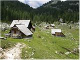 25
25 26
26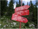 27
27 28
28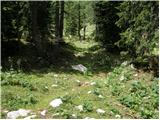 29
29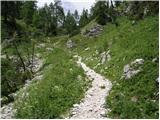 30
30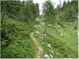 31
31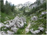 32
32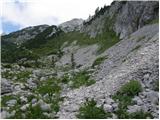 33
33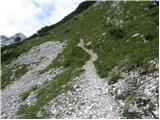 34
34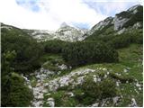 35
35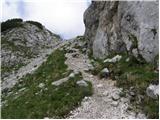 36
36 37
37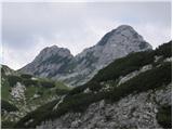 38
38 39
39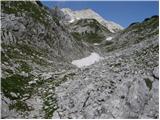 40
40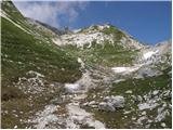 41
41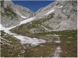 42
42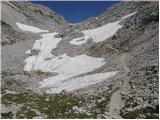 43
43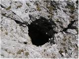 44
44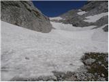 45
45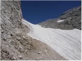 46
46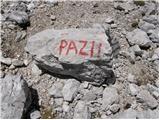 47
47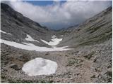 48
48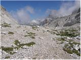 49
49 50
50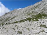 51
51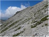 52
52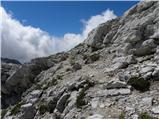 53
53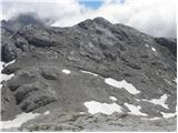 54
54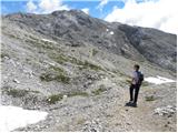 55
55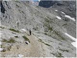 56
56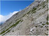 57
57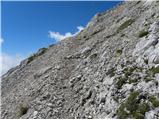 58
58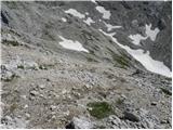 59
59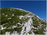 60
60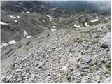 61
61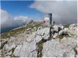 62
62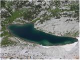 63
63
Discussion about the trip Planina Blato - Mala Zelnarica (Za Kopico)
|
| Gost1. 11. 2007 |
A somewhat longer hike on a beautiful sunny day. The path to the saddle drags a bit, but in the end the effort is rewarded with a fine view. From Dedno polje, beautiful vistas of the two-thousanders unfold around every corner.
Snow was soft in the lower section, frozen from the saddle onwards. From there to the summit, ice axe and crampons mandatory.
Regards, Grega 
|
|
|
|
| henrio5. 07. 2010 |
I did this trail on Saturday 3.7., starting from the parking lot in Stara Fužina, where after a good four hours of walking I reached the summit. I returned along the ridge through planina Ovčarija to Dedno polje (they have very good sour milk). Fortunately, due to the clouds there was no severe heat, but on the way back a thunderstorm chased me from Planina pri jezeru. The trail was strenuous due to its length, but it was worth doing it.
|
|
|
|
| krist26. 07. 2015 |
I would warn that some 10 m of the path from Vratc to Mala Zelnarica (with "Zelnarca" stamp on it) is at least partially demanding. I'm warning because I saw very scared people with my own eyes who are used to usual easy paths. Better to rank the path as a bit harder, otherwise an accident can happen.
|
|
|
|
| mornar27. 10. 2016 |
Has anyone perhaps walked along the ridge between Mala Ticarica and Zelnarica. What are the snow conditions like. Thanks for the information.
|
|
|
|
| bo_zl7. 07. 2021 20:51:43 |
Today I returned from Zelnarica via this path. There is really still a lot of snow, but at 12 o'clock it was already softened enough that it didn't pose problems. Quite a few went the opposite direction without any winter gear, in low sneakers.
|
|
|
|
| Tina A. 806. 08. 2022 21:57:45 |
Is there still any snow on the path to Mala Zelnarica?
|
|
|
|
| Enka6. 08. 2022 22:01:07 |
No (except in the sinkhole along the path  ). ).
|
|
|
To post a comment you must log in:
If you do not yet have a username, you must first
register.