Planina Blato - Malo Špičje (Za Kopico)
Starting point: Planina Blato (1147 m)
| Latitude/Longitude: | 46,31120°N 13,85010°E |
| |
Route name: Za Kopico
Walking time: 6 h 5 min
Difficulty: easy marked way, easy unmarked way
Elevation gain: 1165 m
Elevation difference along the route: 1475 m
Map: Triglav 1:25.000
Recommended equipment (summer): helmet
Recommended equipment (winter): helmet, ice axe, crampons
Views: 7.288
 | 2 people like this post |
Access to starting point:
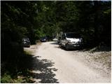
From the Ljubljana - Jesenice motorway, take the Lesce exit and follow the road towards Bled and further towards Bohinjska Bistrica. Continue driving towards Lake Bohinj (Ribčev laz), where we reach a junction, continuing right towards Stara Fužina. In Stara Fužina, at the junction by the chapel, turn sharply left onto the ascending road towards Planina Blato, Planina Vogar and Voje Valley. The road then takes us to the toll and parking fee collection point, but we continue following it to the next junction, where we turn left (right to Voje). We then follow the road to the next junction (we drive for quite some time), where we turn sharply right towards Planina Blato (straight to Planina Vogar). Follow this road to the parking lot above Planina Blato.
Route description:
From the marked parking lot in front of Planina Blato, return a little back and head onto a wide and initially steep cart track, alongside which there are signs for Planina pri Jezeru. After about ten minutes of ascent, arrive at a marked junction, from which continue left towards Planina pri Jezeru (slightly right Planina v Lazu and also steep path towards Planina pri Jezeru).
Continuing on the less steep cart track that still leads through the forest, a little further a marked path leading past Kosijev dom on Vogar joins from the left, we continue right and keep walking on the cart track. Higher up, the path leads through a small narrow passage, then cross quite steep slopes where there is great danger of slipping in ice and snow, otherwise the path is not demanding. At the end of the steep slope, the previously mentioned steep path joins inconspicuously from the right, the cart track turns left here and passes into a fairly cold valley Pungrat, where we ascend through mostly spruce forest. When higher up the path levels out, a path leading past Planina Vodični vrh joins from the left, we stick to the slightly right direction and continue walking on the cart track, alongside which the forest begins to thin. Only a few minutes of easy walking follow and we step onto the pastures of Planina pri Jezeru, where Koča na Planini pri Jezeru stands on a small rise.
At the hut, the path towards Planina v Lazu branches right, we continue left from the hut and descend to a marked junction where there are also some shepherds' huts.
Choose the wider right path alongside which there are signs for Planina Dedno polje and Koča pri Triglavskih jezerih (slightly left Pršivec, Planina Viševnik and Črno jezero).
Also further on, ascend on the cart track which is quite rocky on steep sections, after about ten minutes of ascent arrive at the place where the path over Krištofojca branches left towards Planina Viševnik, we continue straight on the gradually less steep cart track that leads through gradually sparser forest. A few minutes of easy walking on the path follow, which later turns somewhat right, when the path turns back towards the west we reach the edge of Planina Dedno polje, from where a walk to the central part of the pasture follows, where by the shepherds' huts there is also a marked junction.
Here leave the wide path that leads straight towards Koča pri Triglavskih jezerih and nearby Planina Ovčarija and continue right on the path towards Zasavska koča na Prehodavcih, pass Vratca and saddle Hribarice. The path further leads past some huts on the pasture, behind which the path towards Planina v Lazu, Planina Krstenica and Vodnikov dom na Velem polju branches right, we continue straight to the northwest part of the pasture, where the path begins to ascend. Here the path first leads past a dry watering place for animals, then the path becomes steeper and ascends through mostly coniferous forest of spruce and larch. After about thirty minutes of steep ascent, the path levels out and brings us to a kind of saddle between Kovačičeva glava on the left and Kredo on the right.
A little further from the saddle, which can be traced by the name Stog, an unmarked path towards Slatna branches right, and the first beautiful views open up to the mountains rising above the valley Za Kopico. A traverse ascent above the abandoned Planina Ščavje follows, the path gradually passes from the slopes of Slatna to the slopes of Prvi Vogal, and higher up the gaze more frequently turns to the interesting rocky peak Kopica rising on the left, western side of the valley Za Kopico.
Higher up gradually arrive in the central part of the valley, where from the slopes we enter a series of smaller valleys, through which we mostly ascend moderately, only here and there a shorter steeper section follows. With beautiful views continue upwards through the wonderful landscape, the valley narrows higher up and at 2192 m altitude we reach the pass Vratca, which separates the valley Za Kopico from the Triglav Lakes Valley.
From the pass, located between Velika Zelnarica on the left and Zadnji Vogal on the right, from the marked junction continue straight towards Prehodavci, Hribarice and Dolič (sharply left Mala Zelnarica, Mala Tičarica, Štapce, Planina Ovčarija and Koča pri Triglavskih jezerih) and begin descending transversely across the screes of Zadnji Vogal. The path further levels out transversely and leads for a short time through flatter terrain, then arrive at the slopes of Vršaki, where the slope gradually becomes steeper, on a short section also somewhat slippery, when the slopes become less steep reach the marked junction below Hribarice.
Continue left downhill towards Prehodavci (right Kanjavec, Hribarice, Dolič and Triglav) and begin descending transversely across the screes below Poprovec, lower down the path turns somewhat left and brings us to a junction, from which continue slightly right towards Zasavska koča na Prehodavcih (left Zeleno jezero and Koča pri Triglavskih jezerih). A few minutes of moderate descent follow and arrive at Rjavo jezero or Rjava mlaka.
At the lake, another path branches left to Zeleno jezero, which then leads lower to Koča pri Triglavskih jezerih, we continue straight, or right and begin ascending towards the rise above Rjavo jezero. More than ten minutes of ascent follow and reach a scenic ridge at the winter room on Prehodavci, we go right here and quickly arrive at Zasavska koča na Prehodavcih.
From Zasavska koča return to the winter room or winter bivouac and continue towards Zadnjica, Koča pri Triglavskih jezerih and Veliki Špičje. Already after a short descent, the path towards Zadnjica and Trenta branches right, we continue south to the next, only slightly distant junction, where go right towards Veliki Špičje (slightly left Zeleno jezero and Koča pri Triglavskih jezerih). The path ahead is initially somewhat harder to follow and gently ascends along the left, southern side of Zadnja Lopa (2102 m). Further on, the path becomes steeper and passes to the slopes of Malo Špičje, where it ascends quite steeply for some time. The marked path leading to Veliko Špičje turns left just below the summit of Malo Špičje, we leave it at this point and ascend to the scenic summit of Malo Špičje in a few dozen steps.
Starting point - Planina pri Jezeru 1:00, Planina pri Jezeru - Planina Dedno polje 0:30, Planina Dedno polje - Stog 0:30, Stog - Vratca 1:40, Vratca - junction under Vršaki 0:45, junction under Vršaki - Rjavo jezero 0:25, Rjavo jezero - Zasavska koča 0:15, Zasavska koča - Plate 0:05, Plate - Malo Špičje 0:55.

Along the route: Razpotje Pungrat (1255m), Razpotje pod Vodičnim vrhom (1449m),
Koča na Planini pri Jezeru (1453m), Razpotje Krištofojca (1512m),
Planina Dedno Polje (1560m), Stog (1740m), Vrata (2192m), Razpotje pod Vršaki (2192m), Razpotje nad Rjavim jezerom (2087m),
Lake Rjavo jezero (2006m),
Zasavska koča na Prehodavcih (2071m), Plate (2056m)
Photos:
 1
1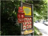 2
2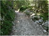 3
3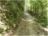 4
4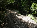 5
5 6
6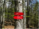 7
7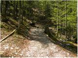 8
8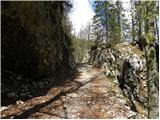 9
9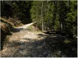 10
10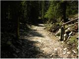 11
11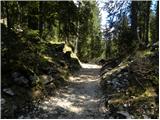 12
12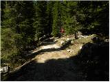 13
13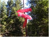 14
14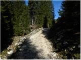 15
15 16
16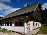 17
17 18
18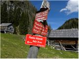 19
19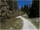 20
20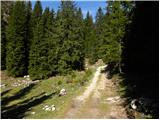 21
21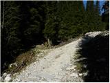 22
22 23
23 24
24 25
25 26
26 27
27 28
28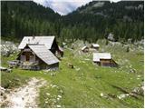 29
29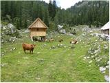 30
30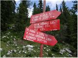 31
31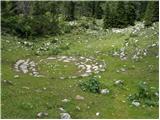 32
32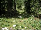 33
33 34
34 35
35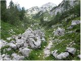 36
36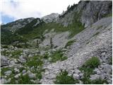 37
37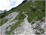 38
38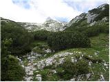 39
39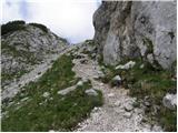 40
40 41
41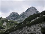 42
42 43
43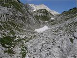 44
44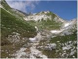 45
45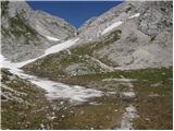 46
46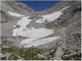 47
47 48
48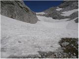 49
49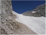 50
50 51
51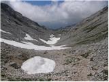 52
52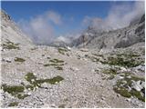 53
53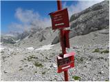 54
54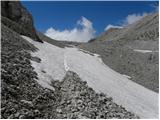 55
55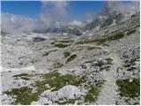 56
56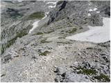 57
57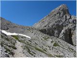 58
58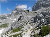 59
59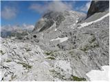 60
60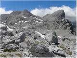 61
61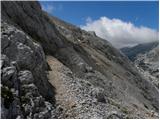 62
62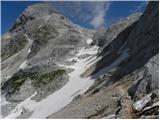 63
63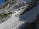 64
64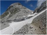 65
65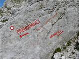 66
66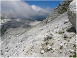 67
67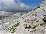 68
68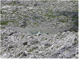 69
69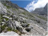 70
70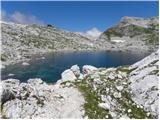 71
71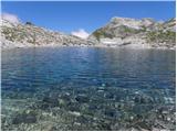 72
72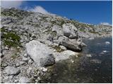 73
73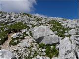 74
74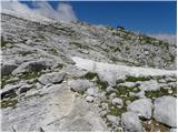 75
75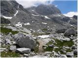 76
76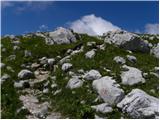 77
77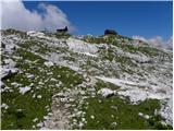 78
78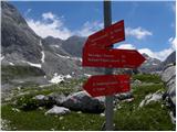 79
79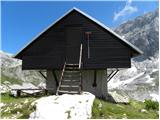 80
80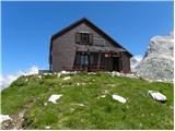 81
81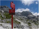 82
82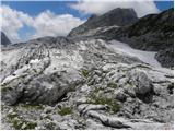 83
83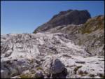 84
84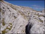 85
85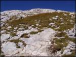 86
86 87
87
Discussion about the trip Planina Blato - Malo Špičje (Za Kopico)
To post a comment you must log in:
If you do not yet have a username, you must first
register.