Planina Blato - Ogradi (via Planina Krstenica)
Starting point: Planina Blato (1147 m)
| Latitude/Longitude: | 46,31120°N 13,85010°E |
| |
Route name: via Planina Krstenica
Walking time: 3 h 15 min
Difficulty: easy unmarked way
Elevation gain: 940 m
Elevation difference along the route: 1050 m
Map: TNP 1:50.000
Recommended equipment (summer):
Recommended equipment (winter): ice axe, crampons
Views: 15.632
 | 3 people like this post |
Access to starting point:
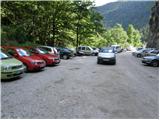
From the Ljubljana - Jesenice motorway, take the Lesce exit and follow the road towards Bled and further towards Bohinjska Bistrica. Continue driving towards Lake Bohinj (Ribčev laz), where we reach a junction and continue right towards Stara Fužina. In Stara Fužina, at the junction by the chapel, turn sharply left onto the ascending road towards Planina Blato, Planina Vogar and Voje valley. The road then takes us to the toll and parking fee collection point, which we follow to the next junction, continuing left (right Voje). Then follow the road to the next junction (we drive for quite some time), where we turn sharply right towards Planina Blato (straight Planina Vogar). Follow this road to the parking lot above Planina Blato.
Route description:
From the parking lot, continue on the gravel road which takes us past the barrier in a few steps to a right bend. On the right side of this bend, we will notice the start of the hunting trail, which with the aid of a wire cable leads us across a short very steep slope. The path soon enters the forest and turns slightly right, where it soon crosses a wide cart track (up to here also possible by road, or higher on the cart track).
Further we ascend on a pleasant forest path ascending parallel to a relatively steep cart track. Higher the path turns left, and from the right a trail joins us which leaves the cart track about 15 minutes above Planina Blato.
The hunting path continues through the forest with some short steep ascents and after a good hour of walking brings us to a small hunting hut on the left side of the path. Here a one-minute path branches left to a viewpoint where we can observe Planina Blato below us.
From the hunting hut the path soon takes us out of the forest, where we rejoin the cart track. Only another good five minutes of walking to Planina Krstenica follow, where a nice view opens up of Ograde, Krn and the Bohinj-Tolmin mountains, sometimes called the Lower Bohinj mountains.
At Planina Krstenica we also reach the marked path from Stara Fužina to Jezerski Pass, but we follow the mentioned path to the western part of the pasture, where we notice signs for Planina v Lazu. We continue in the direction of the mentioned pasture and first begin descending towards the valley separating Ograde from the Stogov ridge. When the descent ends, the path leads through occasionally denser forest, crossing first the valley, then the slopes at the foot of Ogradov towards the east. A bit further the path begins to ascend more noticeably and turns right. The ascent does not last long, as the path soon levels out. A few minutes of walking with slight ascents and descents follow, then we arrive at a junction where a cairn usually stands.
Here continue sharply right (straight Planina v Lazu) on the unmarked path leading towards the summit of Ogradi.
The well-visible but unmarked path then ascends steeply and brings us in a few minutes to the ruins of an abandoned pasture on the southern slopes of Ogradi. Here the path turns left and the steepness gradually eases. Further we ascend on an occasionally somewhat less visible trail ascending over the grassy slope of the mountain. The increasingly panoramic path then ascends somewhat more steeply again and brings us to the summit in a few more minutes of walking.
Starting point - hunting hut 1:15, hunting hut - Planina Krstenica 0:15, Planina Krstenica - junction for Ograde 0:45, Junction for Ograde - Ogradi 1:15.

Photos:
 1
1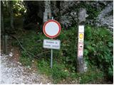 2
2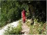 3
3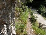 4
4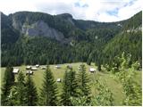 5
5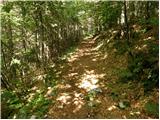 6
6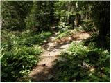 7
7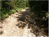 8
8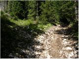 9
9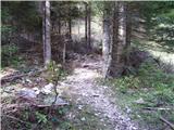 10
10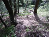 11
11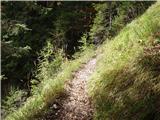 12
12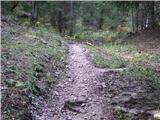 13
13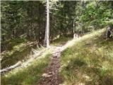 14
14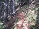 15
15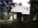 16
16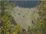 17
17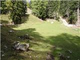 18
18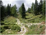 19
19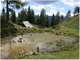 20
20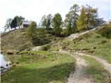 21
21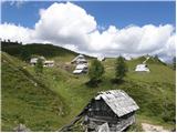 22
22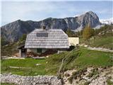 23
23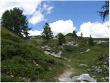 24
24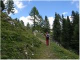 25
25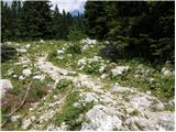 26
26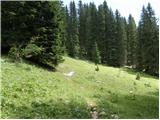 27
27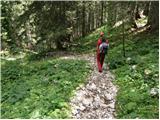 28
28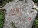 29
29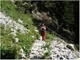 30
30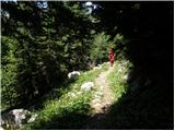 31
31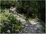 32
32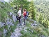 33
33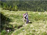 34
34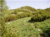 35
35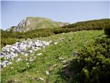 36
36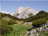 37
37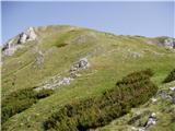 38
38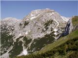 39
39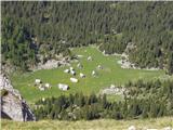 40
40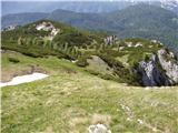 41
41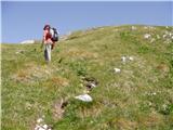 42
42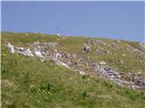 43
43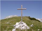 44
44 45
45
Discussion about the trip Planina Blato - Ogradi (via Planina Krstenica)
|
| zavratčan20. 10. 2015 |
really nice mountain path full of wonderful views
|
|
|
|
| Grenaleva21. 10. 2015 |
You can also go from Planina Krstenica left towards Planina Jezerce, below Jezerski Stog and Adama and Eva, then to the summit via the saddle, but there are a few tricky 10 meters from the saddle where you have to scramble a bit on rocks, then walk along the ridge, and then descend via the described path
|
|
|
|
| zavratčan29. 10. 2015 |
Isn't there another path at the top that descends a bit steeper?
Has anyone tried it?
|
|
|
|
| Grenaleva30. 10. 2015 |
Well, we went up that one, so from Planina Krstenica we turned to Planina Jezerce, then to the saddle (that part is poorly marked) and to Ogradi - for the descent it might be those 10-20 m quite nasty, but from the saddle you can make a loop via Planina Laz
|
|
|
|
| Grenaleva30. 10. 2015 |
Mountain lover: is this photo taken from the path to Debeli vrh? How much further from the pass to the summit?
|
|
|
|
| ljubitelj gora30. 10. 2015 |
Yes, there's still about an hour of walking.
|
|
|
|
| tango9. 10. 2020 |
Today a circular tour: Planina Blato - Planina Krstenica - Lazoviški preval - Ogradi - Planina v Lazu - Planina Blato. The path to Planina Krstenica is completely different from what I remembered. The storm caused a real massacre, additionally the bark beetle, so there will soon be no more spruces, and with the forestry tractors the path has turned into muddy ditches. Fortunately, the continuation from Krstenica to the top of Ogradi is such that your heart is pounding, so even a little path searching, because the markers have faded, and the junctions are not so obvious as clearly described in the route "Vrh Hribaric čez Lazoviški preval", is no big problem. The summit is a summit after all, the real pleasure is the peaceful Planina v Lazu, which in its slumber is guarded by Debeli vrh and Ogradi. No one anywhere, just the murmur of water and admiring the shyly yellowing larches. Great end to the warm days above 2000m.
|
|
|
|
| bo_zl29. 06. 2024 19:12:10 |
from Planina Blato stick to that widest, steepest cart track, when it levels out turn left, soon you'll spot the Krstenica sign on a tree. When you join the path at Krstenica don't go right towards the huts, turn left on the path that starts descending. The turn-off for Ogradi has a cairn on the rock as well as a large Ogradi sign, so you can't miss it anymore.
|
|
|
To post a comment you must log in:
If you do not yet have a username, you must first
register.