Planina Blato - Planina Viševnik
Starting point: Planina Blato (1147 m)
| Latitude/Longitude: | 46,31120°N 13,85010°E |
| |
Walking time: 1 h 30 min
Difficulty: easy marked way
Elevation gain: 478 m
Elevation difference along the route: 485 m
Map: Triglav 1:25.000
Recommended equipment (summer):
Recommended equipment (winter):
Views: 27.172
 | 2 people like this post |
Access to starting point:
From the Ljubljana-Jesenice motorway, take the Lesce exit and follow the road towards Bled and further towards Bohinjska Bistrica. Continue driving towards Lake Bohinj (Ribčev laz), where we reach a junction and continue right towards Stara Fužina. In Stara Fužina, at the junction by the chapel, turn sharply left onto the ascending road towards Planina Blato, Planina Vogar and Voje Valley. The road then leads to the toll and parking fee collection point, but we follow it further to the next junction, continuing left (right to Voje). Then follow the road to the next junction (we drive for quite some time), where we turn sharply right towards Planina Blato (straight to Planina Vogar). Follow this road to the parking lot above Planina Blato.
Route description:
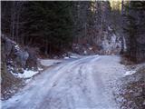
From the marked parking lot in front of Planina Blato, we return a little back and head onto a wide and initially steep cart track, along which there are signs for Planina pri Jezeru. After about ten minutes of ascent, we arrive at a marked junction, from where we continue left towards Planina pri Jezeru (slightly right Planina v Lazu and also a steep path towards Planina pri Jezeru).
We continue on the less steep cart track that still leads through the forest; a little further, a marked path joins from the left leading past Kosijev dom on Vogarju, but we continue right and keep walking on the cart track. Higher up, the path leads through a small narrow passage, then crosses quite steep slopes where there is a great risk of slipping in ice and snow, otherwise the path is not demanding. At the end of the steep slope, the aforementioned steep path joins inconspicuously from the right, the cart track turns left here and enters a fairly cool valley Pungrat, where we ascend through mostly spruce forest. When higher up the path levels out, a path joins from the left leading past Planina Vodični vrh, but we keep slightly right and continue walking on the cart track, along which the forest begins to thin. Only a few minutes of easy walking follow and we step onto the pastures of Planina pri Jezeru, where on a small rise stands Koča na Planini pri Jezeru.
At the hut, a path branches right towards Planina v Lazu, but we continue left from the hut and descend to a marked junction where there are also a few shepherd huts.
We choose the left path, along which there are signs for Planina Viševnik, Pršivec and Črno jezero (slightly right Planina Dedno polje and Koča pri Triglavskih jezerih and Planina Viševnik via Krištofojca), we first go past a few huts, then transversely ascend the southwestern part of the planina. Higher up, the path enters the forest, where it steeply ascends for a while, then levels somewhat, but ascends through the forest to the eastern edge of Planina Viševnik. Here a path joins from the right via Krištofojca, but we ascend with some views of the surroundings to Bregarjevo zavetišče na Planini Viševnik.
Starting point - Planina pri Jezeru 1:00, Planina pri Jezeru - Planina Viševnik 0:30.

The trip can be extended to the following destinations: Planina Blato (5 h 30 min),
The lake Črno jezero (1 h 10 min),
Dom na Komni,
Planina Lopučnica,
Planina Dedno Polje,
Planina Ovčarija,
Koča pri Triglavskih jezerih,
Pršivec,
Mala Tičarica,
Slatna,
Velika Tičarica,
Kopica,
Čelo
Photos:
 1
1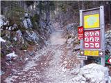 2
2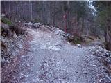 3
3 4
4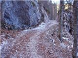 5
5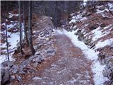 6
6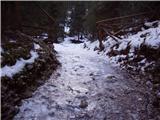 7
7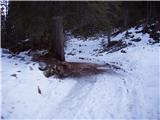 8
8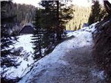 9
9 10
10 11
11 12
12 13
13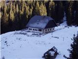 14
14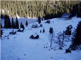 15
15 16
16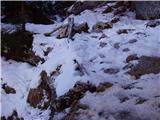 17
17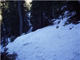 18
18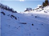 19
19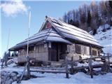 20
20
Discussion about the trip Planina Blato - Planina Viševnik
|
| Kriška17. 08. 2009 |
Trip done yesterday. Highly recommend visiting Bregar's shelter when passing Planina Viševnik! Modest, small shelter in a fairly remote area, where crowds of hikers don't flock, but you'll find a pleasant environment for rest, you can get some refreshing drinks, overnight stay is also possible. Above all, you'll receive genuine, sincere welcome and friendliness - not the professional kind.
|
|
|
|
| Martin Dercar28. 01. 2026 18:40:12 |
I'm interested in the trip, is it possible to reach the starting point in winter or is there a barrier somewhere below?
|
|
|
To post a comment you must log in:
If you do not yet have a username, you must first
register.