Planina Blato - Prevalski Stog (via Adam & Eva)
Starting point: Planina Blato (1147 m)
| Latitude/Longitude: | 46,31120°N 13,85010°E |
| |
Route name: via Adam & Eva
Walking time: 3 h 45 min
Difficulty: easy pathless terrain
Elevation gain: 928 m
Elevation difference along the route: 1000 m
Map: Triglav 1:25.000
Recommended equipment (summer): helmet
Recommended equipment (winter): helmet, ice axe, crampons
Views: 14.138
 | 1 person like this post |
Access to starting point:
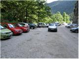
From the Ljubljana - Jesenice motorway, take the Lesce exit and follow the road towards Bled and further towards Bohinjska Bistrica. Continue driving towards Lake Bohinj (Ribčev laz), where we reach a junction, continuing right towards Stara Fužina. In Stara Fužina, at the junction by the chapel, turn sharply left onto the ascending road towards Planina Blato, Planina Vogar and Voje Valley. The road then takes us to the toll and parking fee collection point, from where we continue to the next junction, turning left (right to Voje). We then follow the road to the next junction (after quite some time driving), where we turn sharply right towards Planina Blato (straight to Planina Vogar). Follow this road to the parking lot above Planina Blato.
Route description:
From the parking lot, continue along the gravel road, which takes us past the barrier in a few steps to a right bend. On the right side of this bend, we will notice the start of the hunting trail, which with the aid of a fixed cable leads us across a short but very steep slope. The path soon enters the forest and turns slightly to the right, where it soon crosses a wide cart track (you can also go by road up to here, or higher along the cart track).
Further on, we ascend along a pleasant forest path that runs parallel to a relatively steep cart track. Higher up, the path turns left, and from the right, a trail joins us that leaves the cart track about 15 minutes above Planina Blato.
The hunting trail continues through the forest with some short steep ascents and after about an hour of walking brings us to a small hunting hut located on the left side of the path. Here, a one-minute path branches left to a viewpoint where we can see Planina Blato below us.
From the hunting hut onwards, the path soon takes us out of the forest, where we rejoin the cart track. It is then just over five minutes' walk to Planina Krstenica, where we get a nice view of Ograde, Krn and the Bohinj - Tolmin mountains, sometimes called the Lower Bohinj mountains.
At the pasture, we join the path that leads via Planina Zgornja Grintovica and via the Bušnica approach from Planina Blato, but we keep to the direction, i.e., the path leading further towards Planina Jezerce, Lazovski and Jezerski pass and Vodnikov dom (slightly left to Planina v Lazu). Initially several small paths leading across the western part of the pasture soon merge into one nice traceable trail, which first ascends transversely across the slopes of Krsteniski or Mali Stog, then for some time without major changes in elevation crosses the western slopes of this peak. The path then leads us northwards with nice views of the neighbouring Ograde and Jezerski Stog, while the path to Krsteniski passes turns slightly left and ascends transversely to the valley between Ograde on the left and Jezerski Stog on the right. Here the path levels out, and after a few more minutes of walking we arrive at the central part of the abandoned Planina Jezerce.
At Planina Jezerce, the marked path forks, and we choose the right path leading towards Jezerski pass (slightly left path leads to Lazovski pass). On the upper part of the pasture, a little above the water trough and before the marked path starts to ascend more steeply, a traceable but unmarked path branches left leading to Mišeljski pass.
On the section of Planina Jezerce, the trail is still harder to follow, but when we ascend transversely under the scree of Adam into a small valley between Glava nad Planino on the left and Adam on the right, the trail becomes clearer; when we leave the valley, the path leads us transversely to the left, first slightly upwards, later even slightly downwards, and our path runs parallel to the marked one leading to Lazovski pass for some time. The traverse takes us under cliffs, where especially in spring and after rain there is an increased risk of falling rocks; when the slope on the right becomes less steep, the trail also turns right and begins to ascend more steeply along an occasionally poorly trodden pathlet. This is followed by an ascent through a series of small valleys that brings us to the southwestern slopes of Prevalski Stog.
Here, a passage opens to the right into a small valley between Prevalski Stog, Eva and Adam. Head into this valley (straight along the Mišeljski pass trail), along which there is a poorly visible pathlet, and follow it almost to the saddle between Adam on the right and Eva on the left. Here, turn right and in a few minutes of walking through pathless terrain reach the precipitous summit of Adam.
From the summit of Adam, descend a few metres to the saddle between Adam and Eva, then ascend to the summit of Eva, which is northeast of Adam, via easier pathless terrain partly through dwarf pines.
From Eva, descend a few metres northwards to northwest, then continue along the ridge path with nice views towards Prevalski Stog. The ridge, although precipitous, poses no major danger as the path veers onto the grassy slopes. After about ten minutes of further ascent, we reach the summit of Prevalski Stog.
Starting point - hunting hut 1:15, hunting hut - Planina Krstenica 0:15, Planina Krstenica - Planina Jezerce 0:30, Planina Jezerce - Adam 1:20, Adam - Eva 0:10, Eva - Prevalski Stog 0:15.

Photos:
 1
1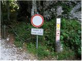 2
2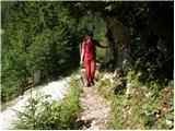 3
3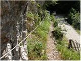 4
4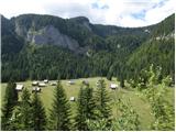 5
5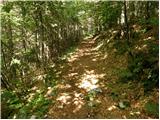 6
6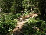 7
7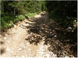 8
8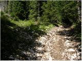 9
9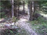 10
10 11
11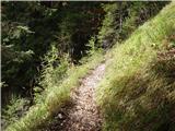 12
12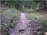 13
13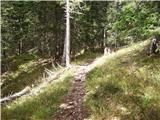 14
14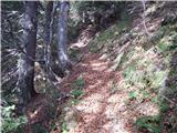 15
15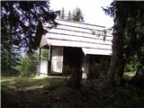 16
16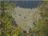 17
17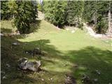 18
18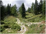 19
19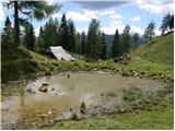 20
20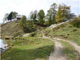 21
21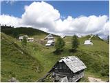 22
22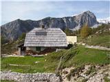 23
23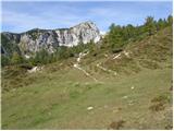 24
24 25
25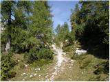 26
26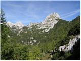 27
27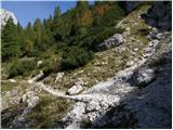 28
28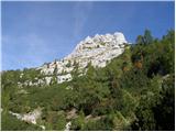 29
29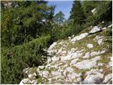 30
30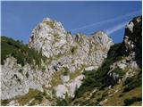 31
31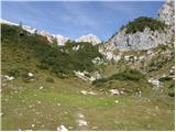 32
32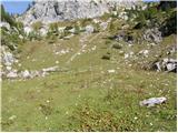 33
33 34
34 35
35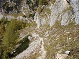 36
36 37
37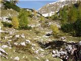 38
38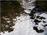 39
39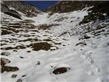 40
40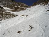 41
41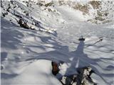 42
42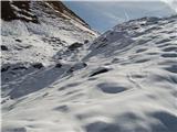 43
43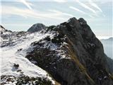 44
44 45
45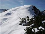 46
46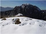 47
47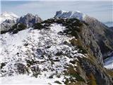 48
48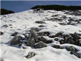 49
49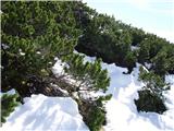 50
50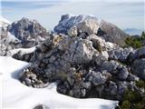 51
51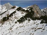 52
52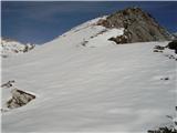 53
53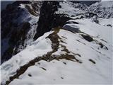 54
54 55
55
Discussion about the trip Planina Blato - Prevalski Stog (via Adam & Eva)
|
| damijanp29. 10. 2009 |
Yesterday's beautiful autumn day we set off along the described path to Adam, Evo and Prevalski Stog. We were accompanied by beautiful views, wonderful autumn colors and peace. Highly recommended. The path is very nice, except for the first 15 min on the forest road, which is quite rutted due to timber extraction. Pictures at:
Prevalski Stog
|
|
|
|
| aleš4330. 10. 2009 |
Damijan
last weekend we were also out of breath around Viševnik, this weekend I'm also going on a trip around Ogradi, Stog, Adam, Eva, ...
BTW: do they collect toll?
|
|
|
|
| damijanp30. 10. 2009 |
No, they didn't collect tolls. Have a pleasant trip.
|
|
|
|
| damijanp25. 10. 2015 |
After six years we repeated this trip again. On such a wonderful day it was appropriate to extend it to Planina Laz and Planina pri Jezeru. The path between these two pastures is in poor condition - torn up and muddy.
Pictures at:
Adam - Eva - Prevalski Stog
|
|
|
|
| BorStenar21. 09. 2024 18:10:18 |
A little while ago I went on the tour, excellent views, the path is in good condition, and from Jezerca to the summit despite the "pathless" sign the path is actually excellently trodden, but you can encounter sunbathing snakes while crossing Adam. The best descent is over Mišeljski preval, but the marked path to Laz turns too high up if you want to return to Jezerca. Excellent views too
|
|
|
To post a comment you must log in:
If you do not yet have a username, you must first
register.