Planina Blato - Prvi Vogel
Starting point: Planina Blato (1147 m)
| Latitude/Longitude: | 46,31120°N 13,85010°E |
| |
Walking time: 3 h 50 min
Difficulty: easy pathless terrain
Elevation gain: 1034 m
Elevation difference along the route: 1060 m
Map: Triglav 1:25.000
Recommended equipment (summer):
Recommended equipment (winter): ice axe, crampons
Views: 11.959
 | 4 people like this post |
Access to starting point:
From the Ljubljana - Jesenice motorway, take the Lesce exit and follow the road towards Bled and further towards Bohinjska Bistrica. Continue driving towards Lake Bohinj (Ribčev laz), where you reach a junction; continue right towards Stara Fužina. In Stara Fužina, at the junction by the chapel, turn sharply left onto the ascending road towards Planina Blato, Planina Vogar and Voje Valley. The road then takes you to a toll and parking fee collection point; continue following it to the next junction, where you go left (right to Voje). Follow the road to the next junction (after quite some time), where you turn sharply right towards Planina Blato (straight to Planina Vogar). Follow this road to the parking lot above Planina Blato.
Route description:
From the parking lot at Planina Blato, head back slightly along the road to the signposts at the forest road. Here, take the forest road that first ascends steeply, then moderately, bringing you in ten minutes of walking to a junction where you go left (straight to Planina v Lazu). Follow the forest road through the forest all the way to Koča na Planini pri Jezeru. Here, a view opens up to the surrounding hills.
Bypass the mountain hut on the left side and the path leads you in a slight descent to a junction where you continue straight on the forest road (left to Planina Viševnik). The mostly rocky forest road, running through an indistinct valley, ascends steeper several times and after half an hour from Planina pri Jezeru brings you to Planina Dedno polje, where you reach the next junction.
Here, leave the wide path leading to Koča pri Triglavskih jezerih and continue right (direction saddle Vratca, Hribarice and Prehodavci) initially slightly downhill past the shepherd huts on the mentioned alpine pasture. On the other side of the pasture, the path starts ascending again and brings you to a less noticeable junction where the path to Planina v Lazu branches right. Continue straight uphill on the path that gradually starts to ascend steeper. The path, leading past a watering place for animals (the watering place is dry), ascends mostly through coniferous forest (larches and spruces). After about half an hour from Planina Dedno polje, the terrain levels out and a nice view opens to the peaks surrounding the beginning of the Za Kopico valley. The path ahead ascends along the southern slopes of Slatna and Prvi Vogel.
When you reach the southern slope of Prvi Vogel, leave the marked path and head right onto pathless terrain. Find a spot with not too much scrub and start steep ascent. When you reach the ridge of the forepeak, you can already see the summit of Prvi Vogel. From the forepeak, descend a few meters and follow the last fairly steep ascent along the southern slope to the summit.
Starting point - Planina pri Jezeru 1:00, Planina pri Jezeru - Planina Dedno polje 0:30, Planina Dedno polje - Stog 0:30, Stog - Prvi Vogel 1:50.

Photos:
 1
1 2
2 3
3 4
4 5
5 6
6 7
7 8
8 9
9 10
10 11
11 12
12 13
13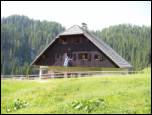 14
14 15
15 16
16 17
17 18
18 19
19 20
20 21
21 22
22 23
23 24
24 25
25 26
26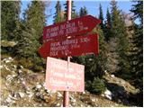 27
27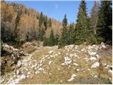 28
28 29
29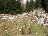 30
30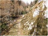 31
31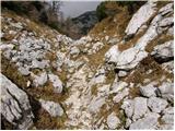 32
32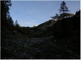 33
33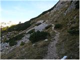 34
34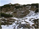 35
35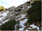 36
36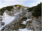 37
37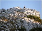 38
38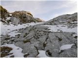 39
39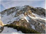 40
40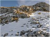 41
41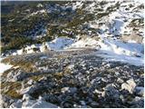 42
42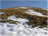 43
43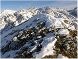 44
44
Discussion about the trip Planina Blato - Prvi Vogel
|
| lukk23. 06. 2014 |
I'm interested in what the conditions are like on this path
|
|
|
|
| Daaam23. 06. 2014 |
No noteworthy snow... the ridge towards Zadnji Vogel looks nicely passable/climbable I don't dare say.. but there's snow in the valley behind Kopica if you think of making a loop by chance..
|
|
|
|
| lukk23. 06. 2014 |
How much snow is still there and how long do you think it will last.
|
|
|
|
| slainter23. 06. 2014 |
Greeting, was at Prvi and Drugi Vogel on Saturday, didn't go to the third due to large amounts of snow in the valley behind Kopica. The path is snow-free, only some snow in the gullies which can be crossed without problems. But in the valley behind Kopica there's still a lot of snow that requires some more fitness. According to predictions, it won't melt until mid-July. And many beautiful views from all three Vogels, I wish!
|
|
|
|
| Daaam23. 06. 2014 |
We two went on Saturday via the valley behind Kopica to Prehodavci.. to Vratca despite snow it's possible to reach without problem ..further towards Prehodavci winter gear is mandatory..especially the last ladder under Hribarice.. not to think of going across without crampons and ice axe.. Probably it will be like that for quite some time. If the descent from Zadnji Vogel to Vratca is climbable (don't dare say, because focus was on the path ahead ) then you can make a nice loop.. ) then you can make a nice loop..
|
|
|
|
| lukk23. 06. 2014 |
Is the path to Vogel difficult?
|
|
|
|
| slainter24. 06. 2014 |
The path to Vogel is not demanding. Towards the top of Prvi Vogel there is a bit of steepness, that's all the difficulty. Best regards
|
|
|
|
| lukk25. 06. 2014 |
Thank you all for the useful and smart answers.
|
|
|
To post a comment you must log in:
If you do not yet have a username, you must first
register.