Planina Blato - Rušnata glava
Starting point: Planina Blato (1147 m)
| Latitude/Longitude: | 46,31120°N 13,85010°E |
| |
Walking time: 2 h 55 min
Difficulty: easy pathless terrain
Elevation gain: 752 m
Elevation difference along the route: 800 m
Map: Triglav 1:25.000
Recommended equipment (summer):
Recommended equipment (winter): ice axe, crampons
Views: 5.774
 | 3 people like this post |
Access to starting point:
From the Ljubljana - Jesenice motorway, take the Lesce exit and follow the road towards Bled and further towards Bohinjska Bistrica. Continue driving towards Lake Bohinj (Ribčev laz), where we reach a junction, continuing right towards Stara Fužina. In Stara Fužina, at the junction by the chapel, turn sharply left onto the ascending road towards Planina Blato, Planina Vogar and Voje Valley. The road then takes us to a point where toll and parking fees are collected, but we continue following it to the next junction, turning left (right to Voje). We then follow the road to the next junction (after quite some driving), turning sharply right towards Planina Blato (straight to Planina Vogar). Follow this road to the parking lot above Planina Blato.
Route description:
From the marked parking lot in front of Planina Blato, return a little back and head onto a wide and initially also steep cart track, alongside which are signs for Planina pri Jezeru. After about ten minutes of ascent, we reach a marked junction, from where we continue left towards Planina pri Jezeru (slightly right Planina v Lazu and also the steep path towards Planina pri Jezeru).
Continuing on the less steep cart track, which continues to lead through the forest, a marked path joins from the left a little further on, leading past Kosijev dom on Vogar; we continue right and keep walking on the cart track. Higher up, the path leads through a narrow passage, then crosses quite steep slopes where there is a high risk of slipping on ice and snow, otherwise the path is not demanding. At the end of the steep slope, the aforementioned steep path joins inconspicuously from the right, the cart track turns left here and enters the fairly cool Pungrat valley, where we ascend through mostly spruce forest. When the path levels out higher up, a path leading past Planina Vodični vrh joins from the left; we keep slightly to the right and continue walking on the cart track, alongside which the forest begins to thin. A few minutes of easy walking follow, and we step onto the pastures of Planina pri Jezeru, where the Koča na Planini pri Jezeru stands on a small hillock.
At the hut, a path branches right towards Planina v Lazu; we continue left from the hut and descend to a marked junction where there are also a few shepherds' huts.
We choose the wider right path alongside which are signs for Planina Dedno polje and Koča pri Triglavskih jezerih (slightly left Pršivec, Planina Viševnik and Črno jezero).
We also continue ascending on the cart track, which is quite rocky in steep sections; after about ten minutes of ascent, we reach a point where a path over Krištofojca branches left towards Planina Viševnik; we continue straight on the gradually less steep cart track leading through gradually sparser forest. A few minutes of easy walking follow on the path, which later turns slightly right; when the path turns back towards the west, we reach the edge of Planina Dedno polje, from where a short walk follows to the central part of the pasture, where there is also a marked junction by the shepherds' huts.
We bypass the shepherds' huts and cheese dairy on the left side and continue straight towards Koča pri Triglavskih jezerih (right valley Za Kopico). From the pasture onwards, we begin a moderate ascent, and a path from the nearby hunting hut joins almost imperceptibly from the left. A little further, the path passes another branch towards Planina Viševnik (path along Griva (1758 m)); we arrive in the next few minutes at the upper edge of the vast Planina Ovčarija, from where a beautiful view opens up to the Bohinjsko - Tolminske gore, sometimes called Spodnje Bohinjske gore. From here, a short descent follows, and we reach a junction in the northeastern part of the pasture.
Continue slightly right towards Koča pri Triglavskih jezerih and Mala Tičarica (left Planina Viševnik); the path soon splits again.
From the fork, follow the signs for the path over Štapc (straight path over Prode), both leading towards Koča pri Triglavskih jezerih; the right one, which we will follow, also towards Mala Tičarica and Zelnarice. We soon leave Planina Ovčarija, and the path ascends moderately to steeply through increasingly sparse forest, which higher up is replaced by dwarf pines. After a half-hour ascent, the path levels out; at this point, located about five minutes before the junction at Štapc, we leave it and continue left onto a trail that is initially quite hard to find and difficult to follow further on.
Follow the poor and quite overgrown trail leading among the dwarf pines southwards; a little below the summit, go right towards the west, quickly reaching the mostly dwarf pine-covered panoramic summit via the trail or pathless terrain.
Starting point - Planina pri Jezeru 1:00, Planina pri Jezeru - Planina Dedno polje 0:30, Planina Dedno polje - Planina Ovčarija 0:45, Planina Ovčarija - junction to Rušnata glava 0:30, junction to Rušnata glava - Rušnata glava 0:10.

Photos:
 1
1 2
2 3
3 4
4 5
5 6
6 7
7 8
8 9
9 10
10 11
11 12
12 13
13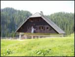 14
14 15
15 16
16 17
17 18
18 19
19 20
20 21
21 22
22 23
23 24
24 25
25 26
26 27
27 28
28 29
29 30
30 31
31 32
32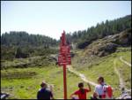 33
33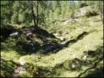 34
34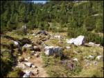 35
35 36
36 37
37 38
38 39
39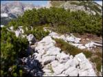 40
40
Discussion about the trip Planina Blato - Rušnata glava
|
| ločanka19. 10. 2008 |
I have a question. On some maps this path to the mentioned summit is marked. I couldn't find it. I also couldn't find the mentioned unmarked paths. How trodden is this path?
|
|
|
|
| bumbi29. 07. 2017 |
Today I was on Rušnata glava. I checked the passages in advance from the saddle below M. Tičarica and somehow got to the summit. On the way back I even saw a red ribbon on two trees - those were the "markers" and a cigarette butt on the summit. In places you could see traces of some old abandoned path. With a bit of luck you get to the top.
|
|
|
To post a comment you must log in:
If you do not yet have a username, you must first
register.