Starting point: Planina Blato (1147 m)
| Latitude/Longitude: | 46,31120°N 13,85010°E |
| |
Walking time: 3 h 5 min
Difficulty: easy pathless terrain
Elevation gain: 930 m
Elevation difference along the route: 950 m
Map: Triglav 1:25.000
Recommended equipment (summer): helmet
Recommended equipment (winter): helmet, ice axe, crampons
Views: 13.798
 | 3 people like this post |
Access to starting point:
From the Ljubljana - Jesenice motorway take the Lesce exit and follow the road towards Bled and further towards Bohinjska Bistrica. Continue driving towards Lake Bohinj (Ribčev laz), where we reach a junction, continuing right towards Stara Fužina. In Stara Fužina at the junction by the chapel turn sharply left onto the ascending road towards planina Blato, planina Vogar and Voje valley. The road then takes us to the place where toll and parking fees are collected; we follow it further to the next junction where we continue left (right Voje). Follow the road to the next junction (after driving for quite some time) where we turn sharply right towards planina Blato (straight planina Vogar). Follow this road to the parking lot above planina Blato.
Route description:
From the marked parking lot before Planina Blato return a little back and head onto the wide and initially also steep cart track alongside which there are signs for Planina pri Jezeru. After about ten minutes of ascent arrive at a marked junction from where continue left towards Planina pri Jezeru (slightly right Planina v Lazu and also steep path towards Planina pri Jezeru).
Continuing on the less steep cart track, which still leads through the forest, a marked path joins from the left a little further, which leads past Kosijev dom on Vogar; we continue right and continue walking on the cart track. Higher the path leads through a small defile, then cross quite steep slopes where there is great slip danger in ice and snow; otherwise the path is not demanding. At the end of the steep slope the previously mentioned steep path joins quite unobtrusively from the right; the cart track turns left here and passes into the fairly cold Pungrat valley, where we ascend through mostly spruce forest. When higher the path levels, a path joins from the left leading past Planina Vodični vrh; we keep slightly right direction and continue walking on the cart track alongside which the forest begins to thin. Follows only a few minutes of easy walking and step onto the pastures of Planina pri Jezeru, where on a small elevation stands Koča na Planini pri Jezeru.
At the hut a path branches right towards Planina v Lazu; we continue left from the hut and descend to the marked junction where there are also some shepherd huts.
Choose the wider right path alongside which are signs for Planina Dedno polje and Koča pri Triglavskih jezerih (slightly left Pršivec, Planina Viševnik and Črno jezero).
Also continuing ascend on the cart track, which on steep sections is quite rocky; after about ten minutes of ascent arrive at the point where a path branches left over Krištofojca, leading towards Planina Viševnik; we continue straight on the gradually less steep cart track which leads through gradually sparser forest. Follows some easy walking on the path which later turns slightly right; when the path turns back towards the west already reach the edge of Planina Dedno polje, from where follows a walk to the central part of the planina where at the shepherd huts there is also a marked junction.
Here leave the wide path leading straight towards Koča pri Triglavskih jezerih and nearby Planina Ovčarija and with the path continue right towards Zasavska koča na Prehodavcih, Vratca pass and Hribarice saddle. The path further leads past some huts on the planina, behind which a path branches right towards Planina v Lazu, Planina Krstenica and Vodnikov dom na Velem polju; we continue straight to the northwest part of the planina where the path begins to ascend. Here the path first leads past a dry animal watering place, then the path becomes steeper and ascends through mostly coniferous spruce and larch forest. After about thirty minutes of steep ascent the path levels and brings to a kind of saddle between Kovačičeva glava on the left and Kredo on the right.
A little further from the saddle, for which the name Stog can be traced, an unmarked path branches right towards Slatna, and the first beautiful views open to the mountains rising above the valley Za Kopico.
Here, at the cairn, head right onto the unmarked path which ascends transversely across a small scree, soon transitioning to grassy slopes up which ascend to a small indistinct pass where the trail is lost for a short time, but in fine weather this causes no orientation problems.
The path continues up the valley between Prvi Vogal on the left and Slatna on the right; the valley gradually narrows higher up. The occasionally quite steep path levels higher and brings to the saddle between the aforementioned mountains where a pathless approach from Planina v Lazu joins, running up the gully between the two mountains.
Here the trail is finally lost; go right and in ten minutes of undemanding ascent on the grassy slope of Slatna ascend to the 2077 m high summit.
Starting point - Planina pri Jezeru 1:00, Planina pri Jezeru - Planina Dedno polje 0:30, Planina Dedno polje - Stog 0:30, Stog - Slatna 1:05.

Photos:
 1
1 2
2 3
3 4
4 5
5 6
6 7
7 8
8 9
9 10
10 11
11 12
12 13
13 14
14 15
15 16
16 17
17 18
18 19
19 20
20 21
21 22
22 23
23 24
24 25
25 26
26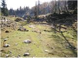 27
27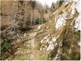 28
28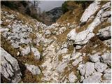 29
29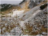 30
30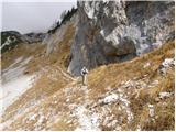 31
31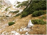 32
32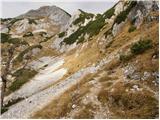 33
33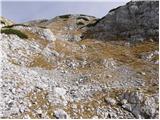 34
34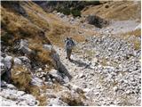 35
35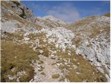 36
36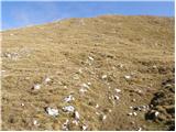 37
37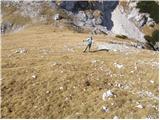 38
38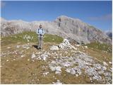 39
39
Discussion about the trip Planina Blato - Slatna
|
| Gost2. 12. 2007 |
Yesterday 1.12. Majda, Joži, Tomo and Miha set out on the described tour. The trail was dry up to about 1900m, further on a bit "trodden" with snow. The trail was enlivened by a herd of chamois that we disturbed in the silence of their kingdom. The view from the top was wonderful: Ogradi, Tosc, Debeli vrh, Stol, on the other side Krn, Vogel, Rodica.
Best regards
Miha
|
|
|
|
| tango29. 06. 2023 17:56:11 |
The forecasted nice weather lured my wife and me to Slatna and Kredo. The parking lot at Blato was decently occupied, and there were already quite a few hikers to the lake. From Dedno polje onwards, we were completely alone. We missed the turn-off to Slatna at first, but in the section where the path from the grassy slope leads to a small indistinct pass, we continued straight and then up the gully towards the saddle between Prvi Vogal and Slatna. It would have been better to turn right at the saddle already and "catch" the path that leads along the top of the scree. From the saddle easily to Slatna, extension to Kredo. But you need to watch your step, not so as not to trample the multitude of alpine flowers (alpine pasque, gentians, edelweiss,...), but so as not to step on some snake. About 20 meters below the summit of Kredo, we almost stepped on a really lively "capital one". Beautiful tour, wonderful views and of course, the Vogels beckon!
|
|
|
To post a comment you must log in:
If you do not yet have a username, you must first
register.