Planina Blato - Srednji Vogel
Starting point: Planina Blato (1147 m)
| Latitude/Longitude: | 46,31120°N 13,85010°E |
| |
Walking time: 4 h
Difficulty: easy pathless terrain
Elevation gain: 1079 m
Elevation difference along the route: 1100 m
Map: Triglav 1:25.000
Recommended equipment (summer):
Recommended equipment (winter): ice axe, crampons
Views: 8.296
 | 4 people like this post |
Access to starting point:
From the Ljubljana-Jesenice motorway, take the Lesce exit and follow the road towards Bled and further towards Bohinjska Bistrica. Continue driving towards Lake Bohinj (Ribčev laz), where we reach a junction and continue right towards Stara Fužina. In Stara Fužina, at the junction by the chapel, turn sharply left onto the ascending road towards Planina Blato, Planina Vogar and Voje Valley. The road then takes us to the toll and parking fee point, but we follow it further to the next junction, where we continue left (right to Voje). Then follow the road to the next junction (after quite some driving), where we turn sharply right towards Planina Blato (straight to Planina Vogar). Follow this road to the parking lot above Planina Blato.
Route description:
From the parking lot at Planina Blato, head back slightly along the road to the signposts at the forest road. Here, take the forest road that first ascends steeply, then moderately uphill, bringing us in ten minutes of walking to a junction, where we turn left (straight Planina v Lazu). Follow the forest road through the forest all the way to Koča na Planini pri Jezeru. Here, a view opens to the surrounding hills.
Bypass the mountain hut on the left and the path in a slight descent brings us to a junction, where we continue straight on the forest road (left Planina Viševnik). The mostly rocky forest road running through an indistinct valley ascends steeper several times and after half an hour of walking from Planina pri Jezeru brings us to Planina Dedno polje, where we reach the next junction.
Here, leave the wide path leading to Koča pri Triglavskih jezerih and continue right (direction pass Vratca, Hribarice and Prehodavci) initially slightly downhill past shepherds' huts on the mentioned alpine pasture. On the other side of the pasture, the path starts ascending again and brings us to a less noticeable junction, where the path to Planina v Lazu branches right. Continue straight uphill on the path that gradually ascends steeper. The path leading past the animal watering place (dry) ascends mostly through coniferous forest (larches and spruces). After about half an hour from Planina Dedno polje, the terrain levels and a nice view opens to the peaks surrounding the start of the Za Kopico valley. The path ahead ascends along the southern slopes of Slatna and Prvi Vogel, then gradually enters the central part of the Za Kopico valley.
Here be attentive, as an indistinct valley branches right from the marked path, running between Srednji and Zadnji Vogel (passage located when level with Kopica (2190 m, recognized by the overhanging wall)). Head into this valley, which ascends steeply and higher up through a series of smaller valleys brings us to more plateau-like terrain (between Zadnji and Srednji Vogel).
Here, head slightly right (left Zadnji Vogel) and a short ascent follows to the ridge of Srednji Vogel. From the ridge, only a few minutes to the summit.
Starting point - Planina pri Jezeru 1:00, Planina pri Jezeru - Planina Dedno polje 0:30, Planina Dedno polje - Stog 0:30, Stog - Srednji Vogel 2:00.

Photos:
 1
1 2
2 3
3 4
4 5
5 6
6 7
7 8
8 9
9 10
10 11
11 12
12 13
13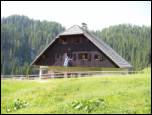 14
14 15
15 16
16 17
17 18
18 19
19 20
20 21
21 22
22 23
23 24
24 25
25 26
26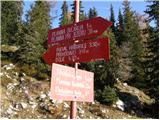 27
27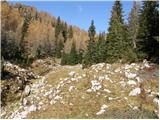 28
28 29
29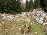 30
30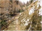 31
31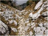 32
32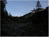 33
33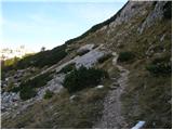 34
34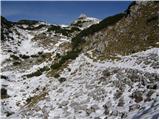 35
35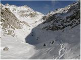 36
36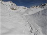 37
37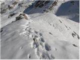 38
38 39
39 40
40 41
41 42
42 43
43 44
44
Discussion about the trip Planina Blato - Srednji Vogel
To post a comment you must log in:
If you do not yet have a username, you must first
register.