Planina Blato - Velika Tičarica (via Štapce)
Starting point: Planina Blato (1147 m)
| Latitude/Longitude: | 46,31120°N 13,85010°E |
| |
Route name: via Štapce
Walking time: 3 h 50 min
Difficulty: difficult pathless terrain
Elevation gain: 944 m
Elevation difference along the route: 1040 m
Map: Triglav 1:25.000
Recommended equipment (summer): helmet
Recommended equipment (winter): helmet, ice axe, crampons
Views: 26.286
 | 2 people like this post |
Access to starting point:
From the Ljubljana - Jesenice highway, we turn onto the Lesce exit and follow the road towards Bled and further towards Bohinjska Bistrica. We continue driving towards Lake Bohinj (Ribčev laz), where we come to an intersection, where we continue right in the direction of Stara Fužina. In Stara Fužina, however, at the intersection near the chapel, we turn sharply left onto the ascending road in the direction of the Blato pasture, the Vogar pasture and the Voje valley. The road then takes us to a place where they collect tolls and parking fees, we follow it further to the next intersection, where we continue left (right Voje). We then follow the road to the next intersection (we drive for quite some time), where we turn sharply right in the direction of the Blato pasture (straight to the Vogar pasture). We then follow this road to the parking lot above the Blato pasture.
Route description:
From the designated parking lot in front of Planina Blato, we go back a bit and head onto a wide road, initially also steep, along which there are signs for Planina pri Jezeru. After approximately ten minutes of ascent, we arrive at the marked junction, from where we continue left towards Planina pri Jezeru (slightly right Planina v Lazu and also the steep path towards Planina pri Jezeru).
In the continuation on the less steep road, which still leads us through the forest, a marked path joins from the left shortly ahead, which leads past Kosijev dom na Vogarju, but we continue right and still walk on the road. Higher up, the path leads us through a smaller hollow, then we cross quite steep slopes, where there is a great danger of slipping in ice and snow, otherwise the path is not demanding. At the end of the steep slope, the previously mentioned steep path joins us inconspicuously from the right, the road turns left here and enters a rather cold Pungrat valley, where we ascend through mostly spruce forest. When the path flattens higher up, a path joins us from the left, which leads past Planina Vodični vrh, but we stick to the slightly right direction and continue walking on the road, beside which the forest begins to thin out. It follows just a few minutes of light walking and we step onto the pastures of Planina pri Jezeru, where on a small hill stands Koča na Planini pri Jezeru.
At the hut, a path branches off to the right towards Planina v Lazu, but we continue left from the hut and descend to the marked junction, where there are also some shepherd's huts.
We choose the wider right path along which there are signs for Planina Dedno polje and Koča pri Triglavskih jezerih (slightly left Pršivec, Planina Viševnik and Črno jezero).
We also continue ascending on the road, which is quite rocky in the steep places, after approximately ten minutes of ascent we arrive at the place where a path branches off to the left over Krištofojca, which leads towards Planina Viševnik, but we continue straight on the gradually less steep road, which leads us through gradually sparser forest. This is followed by some easy walking on the path, which later turns slightly to the right, when the path turns back towards the west, we already reach the edge of Planina Dedno polje, from which there is still a walk to the central part of the pasture, where next to the shepherd's huts there is also a marked junction.
We bypass the shepherd's huts and the dairy on the left side and continue straight in the direction of Koča pri Triglavskih jezerih (right valley Za Kopico). From the pasture onwards, we begin to ascend moderately, and from the left, a path from the nearby hunting hut joins us almost imperceptibly. A little further on, the path leads us past another branch of the path towards Planina Viševnik (path along Grivi (1758 m)), but we arrive at the upper edge of the vast Planina Ovčarija in the next few minutes, from where a beautiful view opens up to the Bohinj-Tolmin mountains, sometimes called the Lower Bohinj mountains. From here follows a short descent and we arrive at the junction on the northeastern part of the pasture.
We continue slightly right in the direction of Koča pri Triglavskih jezerih and Mala Tičarica (left Planina Viševnik), the path soon branches again.
From the branch, we follow the signs for the path over Štapce (straight path over Prodov), both lead towards Koča pri Triglavskih jezerih, the right one, which we will continue on, also towards Mala Tičarica and Zelnarice. We soon leave Planina Ovčarija and the path ascends moderately to steeply through increasingly sparse forest, which higher up is replaced by dwarf pines. After a half-hour ascent, the path levels out and takes us to Štapce, where the next marked junction is.
At Štapce, we continue slightly right in the direction of Tičarice and Zelnarice (slightly left Koča pri Triglavskih jezerih) and continue the ascent on the path, which first climbs through a belt of dwarf pines, then takes us to a short steep jump that is especially dangerous for slipping when wet. Above the jump, the path levels out and passes to moderately steep grassy slopes, on which in a few minutes of further walking we climb to a small saddle, where a marked path branches off to the left to Mala Tičarica, to which it is approximately ten minutes ascent.
We continue in the direction of Zelnarice on a relatively gentle path, which first crosses the slopes of Mala and then also Velika Tičarice. Just a few tens of meters behind the sign "Ne trgaj cvetja!" (sign on the wall) we leave the marked path and continue the ascent left off-path upwards. We ascend the grassy slope towards the ridge of Velika Tičarice. In the upper part of the ascent towards the ridge, the slope becomes quite steep and also dangerous for slipping. On this otherwise short part of the ascent, great caution is needed.
When we reach the ridge, we continue left and on a somewhat less demanding slope soon reach the summit of Velika Tičarice.
Starting point - Planina pri Jezeru 1:00, Planina pri Jezeru - Planina Dedno polje 0:30, Planina Dedno polje - Planina Ovčarija 0:45, Planina Ovčarija - Štapce 0:35, Štapce - junction below Mala Tičarica 0:25, junction below Mala Tičarica - branch for Velika Tičarice 0:20, branch for Velika Tičarice - Velika Tičarice 0:15.

Photos:
 1
1 2
2 3
3 4
4 5
5 6
6 7
7 8
8 9
9 10
10 11
11 12
12 13
13 14
14 15
15 16
16 17
17 18
18 19
19 20
20 21
21 22
22 23
23 24
24 25
25 26
26 27
27 28
28 29
29 30
30 31
31 32
32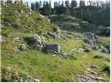 33
33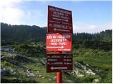 34
34 35
35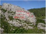 36
36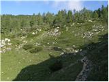 37
37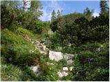 38
38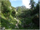 39
39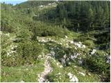 40
40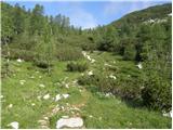 41
41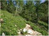 42
42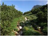 43
43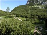 44
44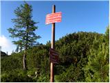 45
45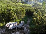 46
46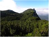 47
47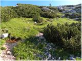 48
48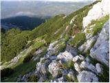 49
49 50
50 51
51 52
52 53
53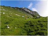 54
54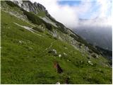 55
55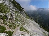 56
56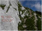 57
57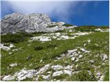 58
58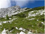 59
59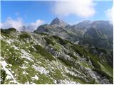 60
60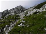 61
61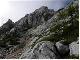 62
62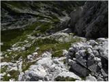 63
63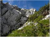 64
64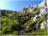 65
65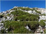 66
66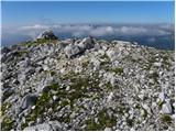 67
67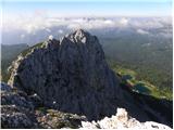 68
68
Discussion about the trip Planina Blato - Velika Tičarica (via Štapce)
|
| velkavrh6. 08. 2009 |
Unfortunately, I only passed by Velika Tičarica. The description of the pathless terrain scared me a bit, so I didn't decide to look for passages myself. Since it's not a major path, it would be appropriate to suggest to the trail markers to mark the path and install a box with a summit stamp and logbook. I think the suggestion is appropriate.
|
|
|
|
| scorpio26. 06. 2011 |
It's not even that demanding. I approached Tičarica via the water holes (I went to Bele glave before) and then at the far right edge of V. Tič. followed a smaller path. Then with some caution nicely to the summit.
|
|
|
|
| frenk 4520. 07. 2011 |
I'm interested if there are stamps on Tičaricas and Zelnaricas
|
|
|
|
| ajda20. 07. 2011 |
Hi frenk45, stamps are on Mali and Veliki Tičarici, Mala Zelnarica also has a stamp and is 10m higher than Velika Zelnarica, which doesn't have one. Lp
|
|
|
|
| bos20. 07. 2011 |
I think there are only 2 stamps to stamp
two years ago I went along the ridge and have one from Zelnarica and one from Tičarica
|
|
|
|
| katty22. 08. 2011 |
Yes, stamps are everywhere, on both summits. You need to bring an ink pad for stamps. You need to bring an ink pad for stamps.
On this occasion, I would ask if they perhaps have a stamp at Kredarica or Planika? Last time I didn't have an ink pad with me, but I'd still like to get the stamp. I know it sounds a bit silly, but I really wouldn't go up there again this year:-).
|
|
|
|
| katty22. 08. 2011 |
Oh, and also, up there the logbook (notebook) is already completely full, unless they replaced it this week.
Best regards, Katy
|
|
|
|
| goginho212. 03. 2012 |
Stamp from V. Tičarica is at the hut by Triglav lakes.
|
|
|
|
| katty12. 03. 2012 |
Is this the new way ? When I hiked up here in August, the stamps were stolen ? When I hiked up here in August, the stamps were stolen , so they didn't have them in the hut. But apparently the stamp for both Tičaricas is now at this Mali one , so they didn't have them in the hut. But apparently the stamp for both Tičaricas is now at this Mali one . Just for your information. . Just for your information.
|
|
|
|
| garmont29. 08. 2012 |
The easiest passage to the summit is left up the gully along the wall (cairn), then through the chimneys up steep grass to the top. Very difficult when wet - not recommended.
|
|
|
|
| lukk23. 06. 2014 |
I'm wondering what the conditions on the path are like
|
|
|
|
| slainter23. 06. 2014 |
on Saturday to Vogels. From Vogels no snow was visible, maybe only in some gully towards Sedmeri jezera. But on Saturday and Sunday many people went towards Sedmeri, since they opened the hut at Sedmerih. lp
|
|
|
|
| trdi7729. 06. 2022 12:53:35 |
Hello! I'm interested in the path from Planina Blato to Prehodavci. Is it possible to hike it via Tičarica and Zelnarica and then descend to Prehodavci?
Best, Uroš
|
|
|
|
| Janez Seliškar29. 06. 2022 13:54:39 |
Possible, take the mountaineering map of the Julian Alps, eastern part.
|
|
|
|
| djimuzl29. 06. 2022 14:02:57 |
Of course. At Štapci you start the ridge path over Tičarice, Kopica and Mala Zelnarica, only Velika Zelnarica is slightly off the mentioned path. When you descend from Zelnarica to saddle Vrata, two (larger) marked junctions await you to Prehodavci - at the first keep left, at the second right. And the hut is nicely visible most of the way from Vrata.
|
|
|
|
| trdi7729. 06. 2022 19:58:30 |
Thanks for the info!
Best, Uroš
|
|
|
To post a comment you must log in:
If you do not yet have a username, you must first
register.