Planina Blato - Velika Zelnarica (Za Kopico)
Starting point: Planina Blato (1147 m)
| Latitude/Longitude: | 46,31120°N 13,85010°E |
| |
Route name: Za Kopico
Walking time: 4 h 15 min
Difficulty: easy pathless terrain
Elevation gain: 1173 m
Elevation difference along the route: 1210 m
Map: Triglav 1:25.000
Recommended equipment (summer):
Recommended equipment (winter): ice axe, crampons
Views: 27.380
 | 10 people like this post |
Access to starting point:
From the Ljubljana - Jesenice motorway, take the Lesce exit and follow the road towards Bled and further towards Bohinjska Bistrica. Continue driving towards Lake Bohinj (Ribčev laz), where we reach a junction and continue right towards Stara Fužina. In Stara Fužina, at the junction by the chapel, turn sharply left onto the ascending road towards Planina Blato, Planina Vogar and Voje Valley. The road then leads to the toll and parking collection point, but we follow it further to the next junction, continuing left (right to Voje). Then follow the road to the next junction (driving for quite some time), where we turn sharply right towards Planina Blato (straight to Planina Vogar). Follow this road to the parking lot above Planina Blato.
Route description:
From the marked parking lot in front of Planina Blato, return a little back and head onto a wide and initially also steep cart track, alongside which there are signs for Planina pri Jezeru. After about ten minutes of ascent, we arrive at a marked junction, from where we continue left towards Planina pri Jezeru (slightly right Planina v Lazu and also a steep path towards Planina pri Jezeru).
Continuing on the less steep cart track that still leads through the forest, a little further on the left joins a marked path leading past Kosijev dom on Vogar, but we continue right and keep walking on the cart track. Higher up, the path leads through a narrow passage, then crosses fairly steep slopes where there is a high risk of slipping on ice and snow, but otherwise the path is not demanding. At the end of the steep slope, the aforementioned steep path joins inconspicuously from the right, and the cart track turns left here and enters the fairly cool Pungrat valley, where we ascend through mostly spruce forest. When the path levels out higher up, a path joins from the left leading past Planina Vodični vrh, but we keep slightly to the right direction and continue walking on the cart track, alongside which the forest begins to thin. A few minutes of easy walking follow, and we step onto the pastures of Planina pri Jezeru, where the Koča na Planini pri Jezeru stands on a small hillock.
At the hut, a path branches right towards Planina v Lazu, but we continue left from the hut and descend to a marked junction where there are also a few shepherds' huts.
We choose the wider right path alongside which there are signs for Planina Dedno polje and Koča pri Triglavskih jezerih (slightly left Pršivec, Planina Viševnik and Črno jezero).
We also continue ascending on the cart track, which is quite rocky on steep sections, and after about ten minutes of ascent, we arrive at a point where a path branches left over Krištofojca towards Planina Viševnik, but we continue straight on the gradually less steep cart track leading through gradually sparser forest. A little more easy walking follows on the path that later turns slightly right; when the path turns back towards the west, we reach the edge of Planina Dedno polje, from where a walk to the central part of the alpine pasture follows, where there is also a marked junction by the shepherds' huts.
Here we leave the wide path leading straight towards Koča pri Triglavskih jezerih and nearby Planina Ovčarija, and continue right on the path towards Zasavska koča na Prehodavcih, Vratca pass and Hribarice saddle. The path further leads past a few huts on the alpine pasture, after which a path branches right towards Planina v Lazu, Planina Krstenica and Vodnikov dom na Velem polju, but we continue straight to the northwestern part of the alpine pasture, where the path begins to ascend. Here the path first leads past a dry watering place for animals, then becomes steeper and ascends through mostly coniferous forest of spruces and larches. After about thirty minutes of steep ascent, the path levels out and brings us to a kind of saddle between Kovačičeva glava on the left and Kredo on the right.
A little further from the saddle, which can be traced by the name Stog, an unmarked path branches right towards Slatna, and we get the first beautiful views of the mountains rising above the Za Kopico valley. A traverse ascent follows above the abandoned Planina Ščavje, and the path gradually moves from the slopes of Slatna to the slopes of Prvi Vogel, and higher up our gaze is increasingly drawn to the interesting rocky peak of Kopica rising on the left, western side of the Za Kopico valley.
Higher up we gradually arrive in the central part of the valley, where from the slopes we enter a series of several small valleys, along which we mostly ascend moderately, with only occasional shorter steeper sections here and there. With beautiful views, we continue upwards through the wonderful landscape, and the valley narrows higher up, reaching the Vratca pass at 2192 meters above sea level, which separates the Za Kopico valley from the Dolina Triglavskih jezer.
From the pass, located between Velika Zelnarica on the left and Zadnji Vogel on the right, from the marked junction we continue sharply left towards Mala Zelnarica and Koča pri Triglavskih jezerih (straight Zasavska koča na Prehodavcih, Hribarice, Dolič and Triglav) on a path that traverses relatively steep slopes of Velika Zelnarica and after a little more than ten minutes brings us to Sedlo med Zelnaricama, where we leave the marked path and head right onto a less visible trail that in a few minutes of moderate ascent brings us to the somewhat exposed southern ridge of Velika Zelnarica. The path further leads along or slightly right of the ridge, the trail gets lost in places, but we follow the ridge to the summit of Velika Zelnarica about 15 minutes away, from which a beautiful view opens up to the surrounding mountains and valleys.
Starting point - Planina pri Jezeru 1:00, Planina pri Jezeru - Planina Dedno polje 0:30, Planina Dedno polje - Stog 0:30, Stog - Vratca 1:40, Vratca - Sedlo med Zelnaricama 0:15, Sedlo med Zelnaricama - Velika Zelnarica 0:20.

Photos:
 1
1 2
2 3
3 4
4 5
5 6
6 7
7 8
8 9
9 10
10 11
11 12
12 13
13 14
14 15
15 16
16 17
17 18
18 19
19 20
20 21
21 22
22 23
23 24
24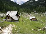 25
25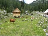 26
26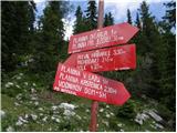 27
27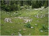 28
28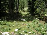 29
29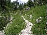 30
30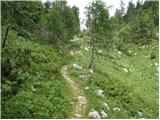 31
31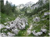 32
32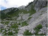 33
33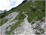 34
34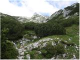 35
35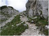 36
36 37
37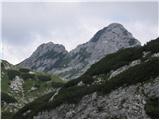 38
38 39
39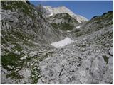 40
40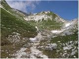 41
41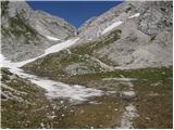 42
42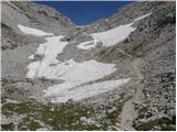 43
43 44
44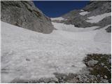 45
45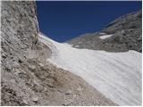 46
46 47
47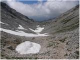 48
48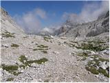 49
49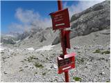 50
50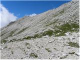 51
51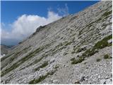 52
52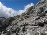 53
53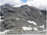 54
54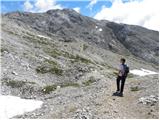 55
55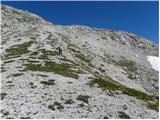 56
56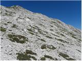 57
57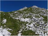 58
58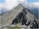 59
59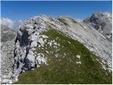 60
60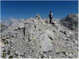 61
61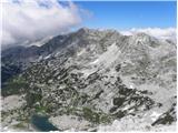 62
62
Discussion about the trip Planina Blato - Velika Zelnarica (Za Kopico)
|
| Gost24. 07. 2006 |
Excellent excursion, it's great to extend to Zasavska koča, where, if we want, we can spend the night or continue towards koča 7J and from there over planina Ovčarija back to Blato. Possible to do in one day, but I recommend two days of leisurely walking in, probably, the most beautiful alpine landscape. A bit of a bad impression is left by the exceptionally high road toll (2400 SIT for a car and 3 people) for the forest road (driving at your own risk).
|
|
|
|
| Gost24. 07. 2006 |
but is this price for two days or do you have to pay again the next day (if you go for two days)?
|
|
|
|
| Gost27. 07. 2006 |
I parked for 3 days, but you pay the same 2400 (since they don't go to the parking lot to count cars)
|
|
|
|
| Gost9. 07. 2007 |
If you park below you pay euro/hour, so you're even, but you save an hour and a half of walking. And you have to come early to park normally.
|
|
|
|
| pupek16. 06. 2013 |
I'm wondering if anyone knows how much snow is still on the path and where it starts. I'm also interested in the distance from Vratc (2192m) to Velika Zelnarica
|
|
|
|
| Fulcrum27. 07. 2016 |
Today I was at both Zelnaricas from Blato. I think the peaks on this portal are swapped. Correctly, Mala Zelnarica should be to the north and Velika to the south.
On the top of the hill named Mala Zelnarica on hribi.net there is the stamp of Velika Zelnarica. But when you reach the top of "Velika" Zelnarica, you can already see with the naked eye that it is lower than the neighbor.
|
|
|
|
| matej71221. 10. 2018 |
According to all maps, this is not Velika Zelnarica, but the peak north of it. On (in my opinion) Velika Zelnarica there is a stamp with elevation mark (2320 m) and logbook. According to geopedia, Mala Zelnarica is an indistinct peak in the ridge south of Velika Zelnarica. The peak from this description is not marked on geopedia, but clearly visible on orthophoto. According to the map on this portal (Synergise), Mala Zelnarica is much lower (2215 m) than Velika (2320 m), the unnamed peak from this description is marked with 2321 m, although from it Velika Zelnarica looks higher. Everything is clearly visible if you switch to orthophoto - Velika Zelnarica is the one with the box - north of it a distinct saddle is clearly visible.
Even greater confusion on maps (checked Trenta (1990, 1:25000), Triglav (2004, 1:25000), TNP (1996, 1:50000) and JA - Triglav (1979, 1:20000).
|
|
|
|
| ana22. 10. 2018 |
Where does it say that Velika must be higher than Mala? Peaks can be named big or small for other attributes too.
The Golak example is already like that. Veliki Golak is lower than Mali Golak, but has a larger bald top.
Also Velika Zelnarica = much more greenery than Mala Zelnarica
|
|
|
|
| matej71223. 10. 2018 |
This is true, but on (printed) maps the elevations are also wrong. The summit from this description (no name on digital maps) is lower than the one with the V. Zelnarica stamp. I haven't checked newer printed maps. 
|
|
|
|
| J.P.30. 10. 2019 |
Interesting, the map shows (Julijske alpe, 1:50 000, 2012), that this peak is V. Zelnarica at 2310m and a dot further south Mala Zelnarica at 2320m. But when you arrive at the top, the stamp shows Mala ...Velika. Anyway, I recommend the tour Blato - both Zelnaricas - Kopica - both Ticaricas - Blato. Exceptionally beautiful views in good weather and one of the nicer ridge paths. The path to Velika Ticarica needs to be searched a bit. Lp
|
|
|
To post a comment you must log in:
If you do not yet have a username, you must first
register.