Planina Blato - Vernar (via Grintovica)
Starting point: Planina Blato (1147 m)
| Latitude/Longitude: | 46,31120°N 13,85010°E |
| |
Route name: via Grintovica
Walking time: 5 h 5 min
Difficulty: very difficult pathless terrain
Elevation gain: 1078 m
Elevation difference along the route: 1230 m
Map: TNP 1:50.000
Recommended equipment (summer): helmet
Recommended equipment (winter): helmet, ice axe, crampons
Views: 2.352
 | 2 people like this post |
Access to starting point:
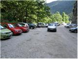
From the Ljubljana - Jesenice motorway, take the Lesce exit and follow the road towards Bled and further towards Bohinjska Bistrica. Continue driving towards Lake Bohinj (Ribčev laz), where we reach a junction and continue right towards Stara Fužina. In Stara Fužina, at the junction by the chapel, turn sharply left onto the ascending road towards Planina Blato, Planina Vogar and Voje Valley. The road then takes us to the toll and parking fee collection point, from which we follow it further to the next junction, continuing left (right Voje). We then follow the road to the next junction (driving for quite some time), where we turn sharply right towards Planina Blato (straight Planina Vogar). Follow this road to the parking lot above Planina Blato.
Route description:
From the parking lot, continue along the gravel road, which takes us past the barrier in a few steps to a right-hand bend. On the right side of this bend, we will notice the start of a hunting trail, which with the aid of a fixed cable leads us across a short very steep slope. The path soon enters the forest and turns slightly to the right, where we step onto a wide eroded cart track (up to here also possible by road, or higher on the cart track). Follow the cart track to the right (straight ahead the hunting trail continues towards Planina Krstenica), which continues steeply uphill for some time. Follow the cart track, from which a few dead-end branches branch off, to a somewhat larger and partially marked junction, where on one of the trees we notice the inscription Grintovica.
Here we leave the wide cart track and continue along the narrower right-hand cart track, which continues gently uphill for some time. The path then descends slightly a few times, after which we notice the signs for Grintovica, directing us right into the dense forest (here we leave the increasingly poor cart track). In the forest, the trail completely disappears, but we continue in the same direction, reaching a larger number of fallen trees. Here we cross a marked path leading from Voje Valley towards Planina Krstenica (due to fallen trees, the crossing is almost unnoticeable, but we must still be careful not to continue along the marked path). On the other side of the marked path, we cross a small clearing, and the path returns to the forest behind it and gradually begins to descend more steeply. After a short steep descent, the path levels out, leading us to steep slopes across which we mostly descend transversely. During the crossing, we pass a few short slightly exposed slopes, after which the slope levels out, and the path continues with a few short ascents and descents. A bit further, we exit the forest onto the southern part of Planina Zgornja Grintovica, where we notice the first wooden huts. The path then crosses a strip of forest and takes us to a water trough, next to which stands the Kefova koča hut. We continue further, again through a strip of forest, and follow the path to the upper part of the pasture, where we notice a few more old shepherds' dwellings.
At the very top part of the pasture, on the right side near a collapsing hut, we will notice a wide trail that enters the forest and begins to descend transversely towards Planina Spodnja Grintovica. After about ten minutes of descent, we reach this pasture, where we join the marked path from Voje Valley, which we follow left (right downhill Voje) and on the upper part of the pasture re-enter the forest; the path ahead is narrower and no longer resembles a mule track. This is followed by a steeper ascent through the forested slopes of Tisovec, a side ridge of the Stogov ridge; higher up, as the path crosses to the northern slopes of this hill, it levels out and enters the indistinct depression Jurjevčeva vrtača.
Here, at the beginning of the depression, a fairly unnoticeable trail branches off to the right downhill towards the former Planina Vrtača.
Continue along the marked path, which leads us through increasingly sparse forest; higher up, the path turns right and after a few more minutes of walking takes us to a poorly marked junction in the area called Razorje, from which we continue right towards Vodnikov dom on Velem polju (slightly left Planina pod Mišelj vrhom).
This is followed by another steeper ascent along the indistinct ridge of the lesser-known peak Na Zagonu (1819 m), after which the path levels out and takes us to a marked junction where we join the path from Pokljuka or Uskovnica.
Continue left towards Vodnikov dom (sharply left Velo polje, right Pokljuka) and after about 20 minutes crossing the slopes of Tosca arrive at Vodnikov dom on Velem polju.
At Vodnikov dom, head right towards Bohinjska vratca and Krma (straight Triglav), first ascending past the botanical garden, then beginning a steep ascent up the steep, mostly grassy slopes between Vernar on the left and Tosca on the right. Higher up, we reach an indistinct depression, through which we ascend in a few minutes to Bohinjska vratca, from where we get a nice view towards Krma.
From Bohinjska vratca, continue left onto an unmarked trail leading uphill across the grassy slope. The grassy slope becomes steeper and steeper and is particularly dangerous for slipping when wet. Follow the steep trail, which runs slightly left of the ridge, all the way to the grassy subpeak at 2183 m.
From the subpeak, continue along the ridge, first descending steeply for a few meters across the rocky slope. Continue along the ridge, which becomes quite narrow and exposed. We mostly walk on the left side of the ridge, with direction shown by a few cairns. A few very short scrambling sections (I-II grade) follow, and we are already at the summit of Vernar.
Starting point - junction Na vrhu 1:00, junction Na vrhu - Planina Zgornja Grintovica 0:30, Planina Zgornja Grintovica - Planina Spodnja Grintovica 0:10, Planina Spodnja Grintovica - Razorje 1:25, Razorje - Na Zagonu 0:25, Na Zagonu - Vodnikov dom 0:20, Vodnikov dom - Bohinjska vratca 0:25, Bohinjska vratca - Vernar 0:50.

Photos:
 1
1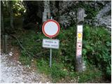 2
2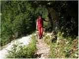 3
3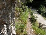 4
4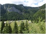 5
5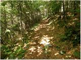 6
6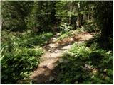 7
7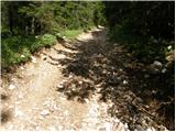 8
8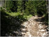 9
9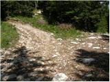 10
10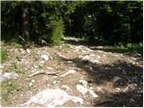 11
11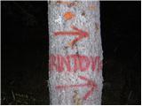 12
12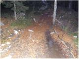 13
13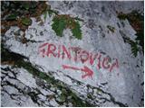 14
14 15
15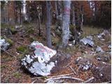 16
16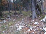 17
17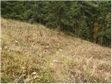 18
18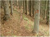 19
19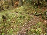 20
20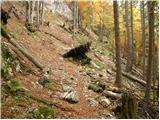 21
21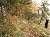 22
22 23
23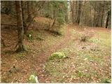 24
24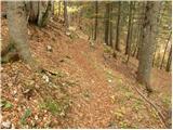 25
25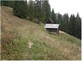 26
26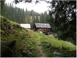 27
27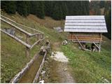 28
28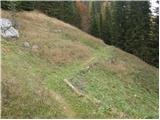 29
29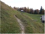 30
30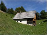 31
31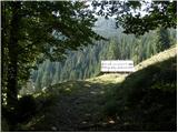 32
32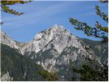 33
33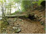 34
34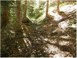 35
35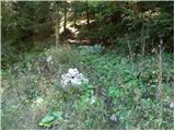 36
36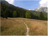 37
37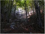 38
38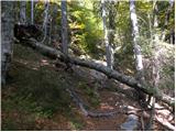 39
39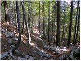 40
40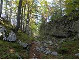 41
41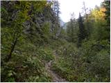 42
42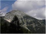 43
43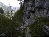 44
44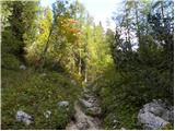 45
45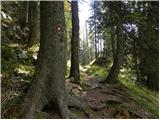 46
46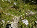 47
47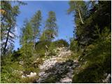 48
48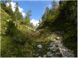 49
49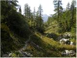 50
50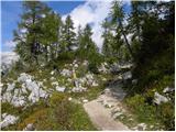 51
51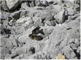 52
52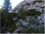 53
53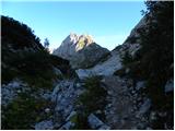 54
54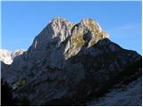 55
55 56
56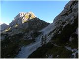 57
57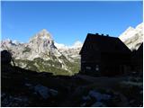 58
58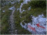 59
59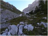 60
60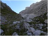 61
61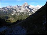 62
62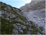 63
63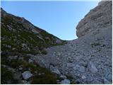 64
64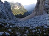 65
65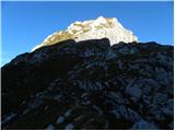 66
66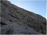 67
67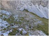 68
68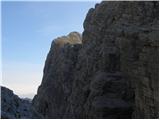 69
69 70
70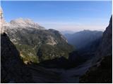 71
71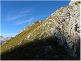 72
72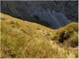 73
73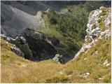 74
74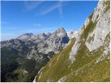 75
75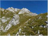 76
76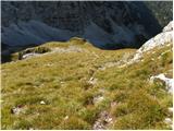 77
77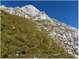 78
78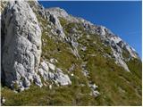 79
79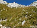 80
80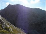 81
81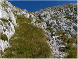 82
82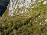 83
83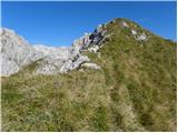 84
84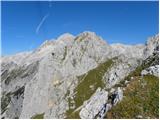 85
85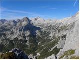 86
86 87
87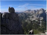 88
88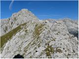 89
89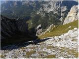 90
90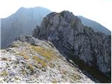 91
91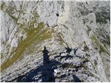 92
92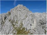 93
93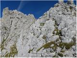 94
94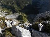 95
95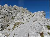 96
96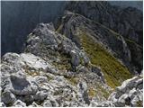 97
97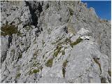 98
98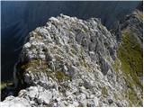 99
99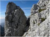 100
100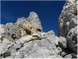 101
101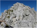 102
102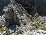 103
103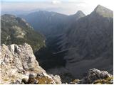 104
104 105
105
Discussion about the trip Planina Blato - Vernar (via Grintovica)
To post a comment you must log in:
If you do not yet have a username, you must first
register.