Planina Blato - Vrh nad Vodeno Rupo
Starting point: Planina Blato (1147 m)
| Latitude/Longitude: | 46,31120°N 13,85010°E |
| |
Walking time: 3 h
Difficulty: easy pathless terrain
Elevation gain: 848 m
Elevation difference along the route: 875 m
Map: Triglav 1:25.000
Recommended equipment (summer):
Recommended equipment (winter): ice axe, crampons
Views: 3.891
 | 1 person like this post |
Access to starting point:
From the Ljubljana - Jesenice motorway, take the Lesce exit and follow the road towards Bled and further towards Bohinjska Bistrica. Continue driving towards Lake Bohinj (Ribčev laz), where we reach a junction and continue right towards Stara Fužina. In Stara Fužina, at the junction by the chapel, turn sharply left onto the ascending road towards Planina Blato, Planina Vogar and Voje valley. The road then takes us to the toll and parking collection point, from where we follow it further to the next junction, continuing left (right to Voje). Then follow the road to the next junction (driving for quite some time), where we turn sharply right towards Planina Blato (straight to Planina Vogar). Follow this road to the parking lot above Planina Blato.
Route description:
From the marked parking lot at Planina Blato, we walk back a few dozen steps, then head onto a wide and initially quite steep cart track towards Planina pri Jezeru. After ten minutes of fairly steep ascent, we reach a marked junction, where we continue on the steep left cart track (straight to Planina v Lazu), to which a marked path from Planina Vogar joins a little higher up. We continue on the wide, partly stony cart track, which levels out higher up, then steeply ascends through a small cutting. Further on, the path levels out again and then crosses steep slopes (danger of slipping in snow and ice). A little further, the path turns sharply left and takes us to a cold hollow called Pungrat, where we cross an abandoned pasture fence. The path then begins to ascend more steeply again, then turns right and levels out completely. A few meters further, a path from Planina Vodični vrh joins from the left, we continue straight and after five more minutes of walking arrive at Planina pri Jezeru, in the middle of which stands a mountain hut.
From the mountain hut, we continue slightly left and initially downhill to a marked junction, from which we take the right path towards Dedno polje (left to Planina Viševnik and Pršivec). The still wide path first ascends gently, then moderately to steeply through sparse spruce forest. Higher up, a path branches left over Krištofojca towards Planina Viševnik, we continue on the wide path, which levels out somewhat higher up and then turns slightly right, where we see Planina Dedno polje ahead. Here the path turns left and after a few more steps takes us to Planina Dedno polje, at the edge of which there is a marked junction.
Here we leave the wide path leading to the Koča pri Triglavskih jezerih hut. We continue right (direction Vratca pass, Hribarice and Prehodavci) initially slightly downhill past shepherd huts on the mentioned alpine pasture. On the other side of the pasture, the path begins to ascend again and takes us to a less noticeable junction, where the path to Planina v Lazu branches right. We continue straight uphill on the path, which gradually begins to ascend more steeply. The path, which takes us past a dry watering place for animals, ascends mostly through coniferous forest (larches and spruces). After about half an hour of walking from Planina Dedno polje, the terrain flattens and we get a nice view of the peaks surrounding the beginning of the Za Kopico valley. The path then ascends transversely along the slopes of Slatna and later Prvi Vogal. The crossing of moderately steep slopes soon ends, and the path takes us into the initially indistinct Za Kopico valley. Here, along the marked path, we will notice a small cairn and next to it the start of a poorly trodden path leading left towards Voden Rupi. We head onto the mentioned path, which takes us through a series of short hollows into a more plateau-like terrain, where we notice some karst sinkholes. After a good ten minutes, we leave the barely visible path and continue the ascent slightly left, where after a few minutes of ascent on easier pathless terrain we climb to Vrh nad Vodeno Rupo.
In fog, it will be hard to find the right summit.
Starting point - Planina pri Jezeru 1:00, Planina pri Jezeru - Planina Dedno polje 0:30, Planina Dedno polje - Stog 0:30, Stog - Vrh nad Vodeno Rupo 1:00.

Photos:
 1
1 2
2 3
3 4
4 5
5 6
6 7
7 8
8 9
9 10
10 11
11 12
12 13
13 14
14 15
15 16
16 17
17 18
18 19
19 20
20 21
21 22
22 23
23 24
24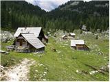 25
25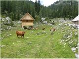 26
26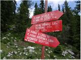 27
27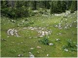 28
28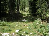 29
29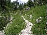 30
30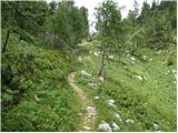 31
31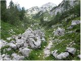 32
32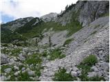 33
33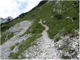 34
34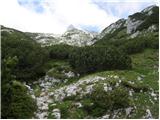 35
35 36
36 37
37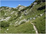 38
38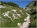 39
39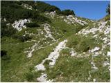 40
40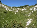 41
41 42
42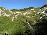 43
43 44
44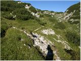 45
45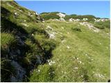 46
46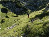 47
47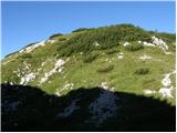 48
48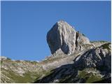 49
49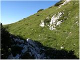 50
50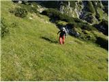 51
51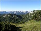 52
52 53
53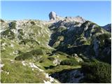 54
54
Discussion about the trip Planina Blato - Vrh nad Vodeno Rupo
To post a comment you must log in:
If you do not yet have a username, you must first
register.