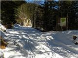
Planina Blato - Zadnji Vogel (snowy approach)
Starting point: Planina Blato (1147 m)
| Latitude/Longitude: | 46,31120°N 13,85010°E |
| |
Route name: snowy approach
Walking time: 4 h 15 min
Difficulty: easy pathless terrain
Elevation gain: 1180 m
Elevation difference along the route: 1205 m
Map: Triglav 1:25.000
Recommended equipment (summer):
Recommended equipment (winter): ice axe, crampons
Views: 17.862
 | 2 people like this post |
Access to starting point:
From the Ljubljana-Jesenice motorway, take the Lesce exit and follow the road towards Bled and further towards Bohinjska Bistrica. Continue driving towards Lake Bohinj (Ribčev laz), where we reach a junction and continue right towards Stara Fužina. In Stara Fužina, at the junction by the chapel, turn sharply left onto the ascending road towards Planina Blato, Planina Vogar and Voje Valley. The road then brings us to the toll and parking fee collection point, but we follow it further to the next junction, continuing left (right to Voje). Then follow the road to the next junction (after quite some driving), where we turn sharply right towards Planina Blato (straight to Planina Vogar). Follow this road to the parking lot above Planina Blato.
Route description:
From the parking lot at Planina Blato, head slightly back along the road to the signposts at the cart track. Here, take the cart track that first ascends steeply, then moderately, and brings us in ten minutes of walking to a junction, where we turn left (straight to Planina v Lazu). Follow the cart track through the forest all the way to Koča na Planini pri Jezeru. Here, a view opens to the surrounding hills.
Bypass the mountain hut on the left and the path leads us in a slight descent to a junction, where we continue straight on the cart track (left to Planina Viševnik). The mostly rocky cart track, running through an indistinct valley, ascends steeper several times and after half an hour of walking from Planina pri Jezeru brings us to Planina Dedno polje, where we reach the next junction.
Here, leave the wide path leading to Koča pri Triglavskih jezerih and continue right (direction Vratca pass, Hribarice and Prehodavci), initially slightly downhill past the shepherd huts on the mentioned alpine pasture. On the other side of the pasture, the path starts ascending again and brings us to a less noticeable junction, where the path to Planina v Lazu branches right. Continue straight uphill on the path, which gradually steepens. The path, passing a dry animal watering place, ascends mostly through coniferous forest (larches and spruces). After about half an hour from Planina Dedno polje, the terrain levels out and a nice view opens to the peaks surrounding the start of the Za Kopico valley. The path ahead ascends along the southern slopes of Slatna and Prvi Vogel, then gradually enters the central part of the Za Kopico valley.
Here, pay attention, as an indistinct valley branches right from the marked path, running between Srednji and Zadnji Vogel (the passage is located level with Kopica (2190 m), recognizable by the overhanging wall). Head into this valley, which ascends steeply and higher up through a series of smaller valleys leads to more plateau-like terrain (between Zadnji and Srednji Vogel). Continue slightly left and ascend at moderate gradient to Zadnji Vogel.
In fog, orientation is very difficult.
Starting point - Planina pri Jezeru 1:00, Planina pri Jezeru - Planina Dedno polje 0:30, Planina Dedno polje - Stog 0:30, Stog - Zadnji Vogel 2:15.

Photos:
 1
1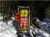 2
2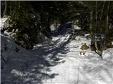 3
3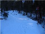 4
4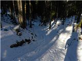 5
5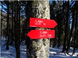 6
6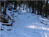 7
7 8
8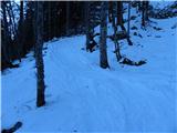 9
9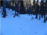 10
10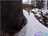 11
11 12
12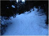 13
13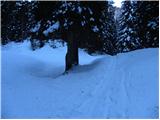 14
14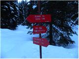 15
15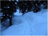 16
16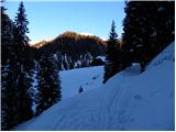 17
17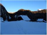 18
18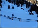 19
19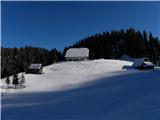 20
20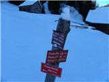 21
21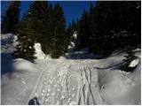 22
22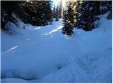 23
23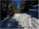 24
24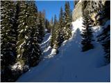 25
25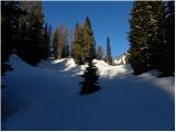 26
26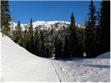 27
27 28
28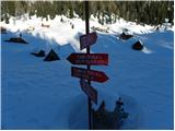 29
29 30
30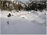 31
31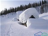 32
32 33
33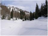 34
34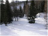 35
35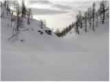 36
36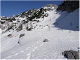 37
37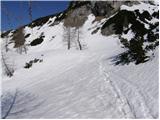 38
38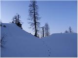 39
39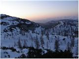 40
40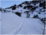 41
41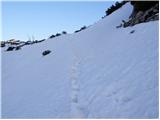 42
42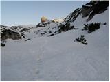 43
43 44
44 45
45 46
46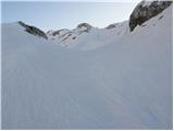 47
47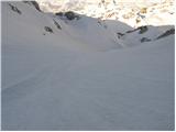 48
48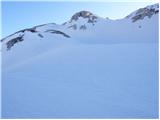 49
49 50
50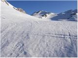 51
51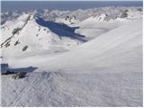 52
52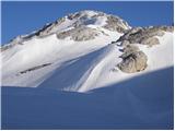 53
53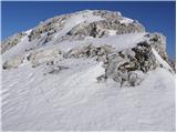 54
54
Discussion about the trip Planina Blato - Zadnji Vogel (snowy approach)
|
| felix28. 07. 2009 |
Is access to Zadnji Vogel possible from the Vrata saddle, which we reach via the valley behind Kopica? What is the ridge path over all three Vogle and to Kredo and Slatno like?
Thanks and best regards.
|
|
|
|
| mili28. 07. 2009 |
In mid-July we walked the ridge path over the Vogle in the opposite direction. The path we found from Zadnji Vogel joined the one from Vratc right opposite Kopica. The path could be followed quite well, you have to be careful on the descent from Prvi Vogel to the saddle, because it's quite steep. The views are fantastic, very nice tour. Best regards
|
|
|
|
| funnyboy5. 03. 2014 |
From the first picture it seems the road despite snow is drivable to pl. Blato (or maybe it wasn't mentioned). Is that really true, has it been plowed this year and drivable?
|
|
|
|
| Daaam5. 03. 2014 |
As far as I know (don't dare claim) they do NOT plow the road to Planina Blato.. so you have to add the access time from the valley..
|
|
|
|
| funnyboy5. 03. 2014 |
Thanks  . It seemed to me too that it's probably not plowed, but I wasn't sure. . It seemed to me too that it's probably not plowed, but I wasn't sure.
|
|
|
|
| damijanp20. 10. 2014 |
On Saturday we made a circular tour: Planina Blato - Prvi Vogel - Srednji Vogel - Zadnji Vogel - Vratca - Zelnarica - Kopica - passage to the valley Za Kopico - Planina Blato. Although we started in fog from which it was quite snowy, above the fog there were nice views of the surrounding peaks. The path is traceable in such conditions, only on the descent from Zadnji Vogel some caution is needed. Friendly hikers helped us with path advice, thanks to them.
Photos at:
Prvi, Srednji and Zadnji Vogel, Zelnarica, Kopica
|
|
|
|
| bo_zl13. 09. 2023 18:19:40 |
Today through the Za Kopico valley to Vratca, then to Zadnji, Srednji and first Vogel. There aren't many tracks, the path is traceable, then not again, so I descended from the first Vogel back to the marked path a bit on my own. But this is a path for lovers of peace, all three Vogels were only mine
|
|
|
To post a comment you must log in:
If you do not yet have a username, you must first
register.