Planina Dol - Rzenik (east path)
Starting point: Planina Dol (1308 m)
| Latitude/Longitude: | 46,31780°N 14,63790°E |
| |
Route name: east path
Walking time: 1 h 40 min
Difficulty: easy unmarked way
Elevation gain: 525 m
Elevation difference along the route: 525 m
Map: Kamniške in Savinjske Alpe 1:50.000
Recommended equipment (summer):
Recommended equipment (winter): ice axe, crampons
Views: 12.318
 | 1 person like this post |
Access to starting point:
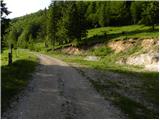
First, we drive to Kamnik, and then we continue driving in the direction of the mountain pass Črnivec. Just a few 100 m before the mentioned mountain pass we notice signs for Kranjski Rak, which point us sharply left onto a narrow and at first also quite steep road. The road flattens higher up and then brings us to the mountain pass Volovjek, where immediately behind the inn Kranjski Rak we turn left onto a road in the direction of Velika planina. Further, we drive on a macadam road, which higher brings us to the next slightly larger crossroad. We continue right (straight Planina Kisovec) and follow the moderately ascending road past the parking lot Ušivec. From the mentioned parking lot we continue on a somewhat rougher macadam road, which we follow at the crossroads in the direction of Planina Dol. After some time the road starts to descend steeply, and we follow it to a marked parking lot near Planina Dol.
From the Savinjska valley we first drive to Luče, and then we continue driving towards Kamnik. When we arrive at the mountain pass Volovjek (Kranjski Rak) we continue right in the direction of Velika planina. Further, we follow the above description.
Route description:
From the parking lot, we continue on a macadam road which barely noticeably descends towards the western part of the mountain pasture. After a few minutes of easy walking we will notice a shepherd hut on the left side, and we continue on the macadam road a few 10 m further, to the spot where on a tree we notice signs for Konj, which point us right across a meadow (left Velika planina, straight valley Kamniška Bistrica - lower station of the cable car to Velika planina). The path ahead moderately ascends across the meadow, then passes into the forest, where it turns right and gradually starts to ascend more and more steeply. Next follows approximately 20 minutes of steep ascent through the forest, then the path brings us to a smaller viewpoint. Here the path turns left and also flattens somewhat. We continue on a moderately steep path, where from the increasingly sparse forest we soon pass into a belt of dwarf pines. A short ascent follows on a well-trodden path through the dwarf pines and the path brings us to Planina Rzenik, on the edge of which we notice a shepherd hut.
From the hut we continue on the marked path towards Konj (slightly left Rzenik via the western path), which quickly brings us among the dwarf pines. We continue the ascent on a moderately steep path, and we walk on it only approximately 10 minutes more, then we will notice on the left side a quite overgrown path which leads to Rzenik (the start of the unmarked path is hard to find).
From the spot where we leave the marked path, we first ascend through dwarf pines (overgrown), then continue through a belt of raspberry bushes, higher again through dwarf pines (somewhat less overgrown). After approximately 15 minutes of forcing our way along the overgrown path, we step onto the ridge of Rzenik, which we follow to the left. The path ahead runs along the edge of the occasionally exposed ridge, but unlike the initial part it is much easier to pass, only in wet conditions greater caution is needed so that we do not slip on the steep grasses. Higher the path leads us past a mighty fissure, then in a few minutes of further walking brings us to the summit of Rzenik.

Photos:
 1
1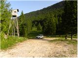 2
2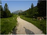 3
3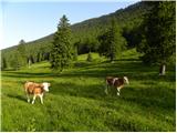 4
4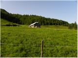 5
5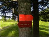 6
6 7
7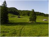 8
8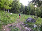 9
9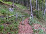 10
10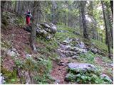 11
11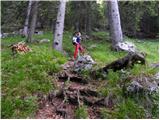 12
12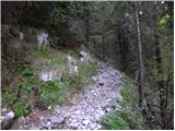 13
13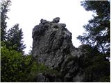 14
14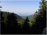 15
15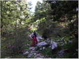 16
16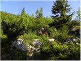 17
17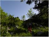 18
18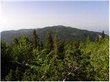 19
19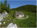 20
20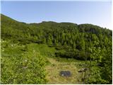 21
21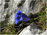 22
22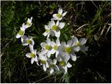 23
23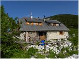 24
24 25
25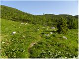 26
26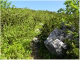 27
27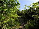 28
28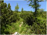 29
29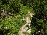 30
30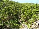 31
31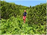 32
32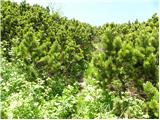 33
33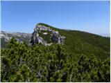 34
34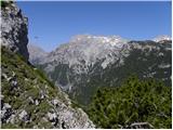 35
35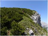 36
36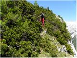 37
37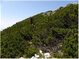 38
38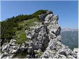 39
39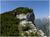 40
40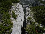 41
41 42
42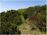 43
43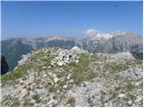 44
44
Discussion about the trip Planina Dol - Rzenik (east path)
|
| pohodnik386. 05. 2012 |
Interesting path, too bad it's not marked, and some photos from a week ago when I was up there.
PHOTOS
|
|
|
|
| rober6. 05. 2012 |
Thanks to the markers that it's not. Where are we headed if everything is marked.:
|
|
|
|
| pohodnik386. 05. 2012 |
For my sake it's fine like that, I'll get where I want anyway, others just complain later about getting lost or off track and how hard it was to get up there.
|
|
|
|
| Volk8. 05. 2012 |
Pohodnik38, it's hard to get via Sfingo too but nobody complains. About there being more than enough marked paths in our mountains has already been discussed.
Regards.
|
|
|
|
| Darxta18. 05. 2013 |
Today up the eastern, down the western.
The path to Rzenik is really hard to find. I completely missed it on the way to Konj, on the way down I had to use GPS 
I would add that anyone who wants to reach Rzenik should by no means wear shorts or a short-sleeved shirt, unless they are not afraid of a large number of scratches  I would also advise against hiking poles, there's no space to use them. Instead, better some gloves for gripping the brush on the exposed ridge. I would also advise against hiking poles, there's no space to use them. Instead, better some gloves for gripping the brush on the exposed ridge.
View from the top? Phenomenal
|
|
|
|
| jax8. 06. 2014 |
I was up there today. The description misses an important detail - the junction to Rzenik is marked! On the larch on the right side of the path (in ascent direction - if coming from Konj, of course on the left) there is a signpost. It is quite high and might be a bit hidden among the branches, but if you know it exists, you'll surely see it.
As for the path itself - no orientation problems at all. There is a signpost at the junction, then the path is always visible. It is indeed quite overgrown with brushwood, so it is strenuous and one must show quite a bit of heart to get through. No technical difficulties either, but there is a short exposed section along the top of the wall. But if you ask me, it is worth it. The view is even a bit nicer than from Konj, the wall edge also adds its own charm. And when you see the crowd on Konj, while you are up here alone, it is fulfilling.
|
|
|
|
| anak6. 10. 2018 |
Along the nicely cut trail there was still recently
a wooden sign with the inscription Rzenik. Today it was no longer there...
|
|
|
|
| anica.zu@gmail.com23. 10. 2019 |
Today I was on Konj and Rzenik. Trail nicely marked and beautifully cleared (CONGRATS) so summit access without issues real pleasure. View from both peaks fantastic.
|
|
|
|
| natasacraine23. 08. 2024 20:30:57 |
How's parking at Planina Dol? Is it still possible? Or do you have to park earlier? Thaaaanks...
|
|
|
To post a comment you must log in:
If you do not yet have a username, you must first
register.