Planina Dol - Rzenik (west path)
Starting point: Planina Dol (1308 m)
| Latitude/Longitude: | 46,31780°N 14,63790°E |
| |
Route name: west path
Walking time: 1 h 40 min
Difficulty: easy unmarked way
Elevation gain: 525 m
Elevation difference along the route: 525 m
Map: Kamniške in Savinjske Alpe 1:50.000
Recommended equipment (summer):
Recommended equipment (winter): ice axe, crampons
Views: 27.897
 | 1 person like this post |
Access to starting point:
First, we drive to Kamnik, and then we continue driving in the direction of the mountain pass Črnivec. Only a few hundred meters before the mentioned mountain pass we notice signs for Kranjski Rak, which point us sharply left onto a narrow and at first also quite steep road. The road higher up flattens and then brings us to the mountain pass Volovjek, where immediately behind the inn Kranjski Rak we turn left onto a road in the direction of Velika planina. Further, we drive on a macadam road, which higher up brings us to the next slightly larger crossroad. We continue right (straight to mountain pasture Kisovec) and follow the moderately ascending road past the parking lot Ušivec. From the mentioned parking lot we continue on a somewhat rougher macadam road, which we follow at the crossroads in the direction of the mountain pasture Planina Dol. After some time the road starts to descend steeply, and we follow it to a marked parking lot near the mountain pasture Planina Dol.
From the Savinjska Valley we first drive to Luče, and then we continue driving towards Kamnik. When we come to the mountain pass Volovjek (Kranjski Rak) we continue right in the direction of Velika planina. Further, we follow the description above.
Route description:
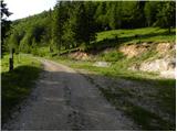
From the parking lot, we continue on a macadam road which barely noticeably descends towards the western part of the mountain pasture. After a few minutes of easy walking we will notice a shepherd hut on the left side, and we continue on the macadam road for a few tens of meters ahead, to the spot where on a tree we notice signs for Konj, which point us right across a meadow (left Velika planina, straight valley Kamniška Bistrica - bottom cableway station to Velika planina). The path ahead moderately ascends across the meadow, and then transitions into the forest, where it turns right and gradually starts to ascend steeper and steeper. Next follows approximately 20 minutes of steep ascent through the forest, and then the path brings us to a smaller viewpoint. Here the path turns left and also flattens somewhat. We continue on a moderately steep path, where from increasingly sparse forest we soon pass into a belt of dwarf pines. A short ascent follows on a well-trodden path through the dwarf pines and the path brings us to mountain pasture Rzenik, at the edge of which we notice a shepherd hut.
At the hut we leave the marked path which leads to Konj and head somewhat left and walk to the western part of the partly overgrown mountain pasture. Here we will among the dwarf pines notice a less well-trodden path, which leads us into a dense belt of dwarf pines, through which runs an otherwise cleared but high-grass-overgrown path. The moderately steep path gradually turns more and more towards the left, then, when it reaches the ridge, turns right and brings us after a few minutes of further walking to the grassy summit.

Photos:
 1
1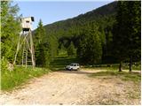 2
2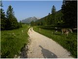 3
3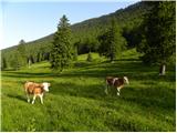 4
4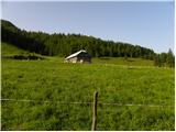 5
5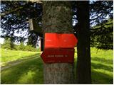 6
6 7
7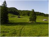 8
8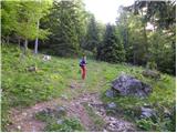 9
9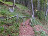 10
10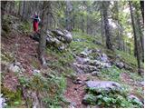 11
11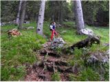 12
12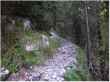 13
13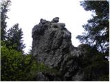 14
14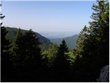 15
15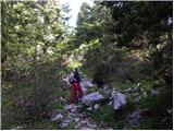 16
16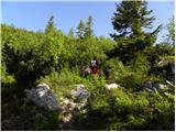 17
17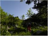 18
18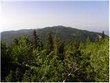 19
19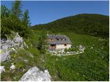 20
20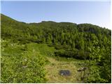 21
21 22
22 23
23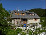 24
24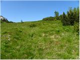 25
25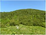 26
26 27
27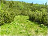 28
28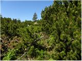 29
29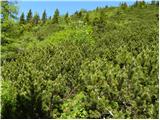 30
30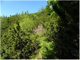 31
31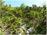 32
32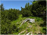 33
33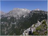 34
34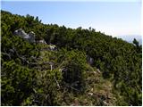 35
35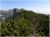 36
36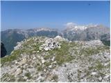 37
37
Discussion about the trip Planina Dol - Rzenik (west path)
|
| 03183338520. 12. 2010 |
How about skiing? - Has anyone tried it, is it worth carrying skis up such a mountain? Please for prompt answers while the weather holds...
|
|
|
|
| viharnik20. 12. 2010 |
I haven't skied there yet, but I was there with snowshoes in winter a few years ago. For the upper part of Rzenik you need a lot of snow to cover the brushwood. Further down from Pl. Rzenik to Pl. Dol the path is narrow, strewn with roots, here and there with some rocks, the terrain around is densely covered with thick spruces and it's quite steep. I think that in abundant snow conditions you can ski down, but for any special popular ski terrain I think there isn't any there.
|
|
|
|
| Darxta18. 05. 2013 |
Today up the eastern, down the western.
The western path is very overgrown, in places you have to push the brush aside quite a bit to get through.
I would add that anyone who wants to reach Rzenik should by no means wear shorts or a short-sleeved shirt, unless they are not afraid of a large number of scratches  I would also advise against hiking poles, there's no space to use them. Instead, better some gloves for gripping the brush on the exposed ridge. I would also advise against hiking poles, there's no space to use them. Instead, better some gloves for gripping the brush on the exposed ridge.
View from the top? Phenomenal 
|
|
|
|
| mancar29. 05. 2014 |
Hello,
does anyone know when the mass is in June at Mlakarjeva hut on Planina Rzenik?
Thanks!
|
|
|
|
| mancar29. 05. 2014 |
Thanks Miri! Do you know the time too? At twelve? Thanks
|
|
|
|
| ranyhyn4. 06. 2018 |
The western trail is, except for the entrance which might be a bit harder to find, currently quite well cleared. It seems that some scrub was cut last year, so the path is nicely visible to the summit and can be walked without problems.
|
|
|
|
| klm25. 04. 2020 |
Today from the lower gondola station through Dolski graben and via Planina Dol at conversational pace (although I didn't talk to anyone because I was alone. Well: above Planina Dol I met a nice girl, on Planina Rzenik then some familiar old farts ) straight to Rzenik. That took me 1h25min. I took advantage of the proximity of Konj and climbed to its summit too, where there was a three-member family and two nice girls from the Savinja region. We exchanged a few dozen words, then I said goodbye and descended quite quickly to the starting point. Total about two hours. Nice Saturday tour. ) straight to Rzenik. That took me 1h25min. I took advantage of the proximity of Konj and climbed to its summit too, where there was a three-member family and two nice girls from the Savinja region. We exchanged a few dozen words, then I said goodbye and descended quite quickly to the starting point. Total about two hours. Nice Saturday tour.
|
|
|
|
| J.P.19. 09. 2020 |
Well visible trodden path, slightly overgrown in places, Rzenik is even marked with a small sign. Definitely go to Konj too if you're in these beautiful parts. Safe steps, best regards
|
|
|
|
| zokipoki19. 09. 2020 |
J.P. what's the condition of the road to pl. Dol?
|
|
|
|
| garmont19. 09. 2020 |
On Sunday it was completely fine, even for lower vehicles.
|
|
|
|
| zokipoki19. 09. 2020 |
Thanks a lot for the reply.
|
|
|
|
| iUnknown19. 09. 2020 |
There is also a more western path to Rzenik, but it's not on the maps. Along this path you can find quite a few interesting things
|
|
|
To post a comment you must log in:
If you do not yet have a username, you must first
register.