Planina Jezerca - Veliki Zvoh (via Dom na Krvavcu)
Starting point: Planina Jezerca (1410 m)
| Latitude/Longitude: | 46,28550°N 14,53140°E |
| |
Route name: via Dom na Krvavcu
Walking time: 1 h 40 min
Difficulty: easy marked way
Elevation gain: 561 m
Elevation difference along the route: 575 m
Map: Kamniške in Savinjske Alpe 1:50.000
Recommended equipment (summer):
Recommended equipment (winter): ice axe, crampons
Views: 33.538
 | 1 person like this post |
Access to starting point:
A) From the Ljubljana - Jesenice highway, take the Vodice exit, then continue driving to the first traffic-light intersection in Vodice, where we continue left in the direction of Cerklje na Gorenjskem and Brnik. When we arrive at the main roundabout in Spodnji Brnik, we continue driving in the direction of Cerklje and Krvavec ski resort. At the end of the settlement Cerklje na Gorenjskem, we leave the main road which continues towards Velesovo and Visoko, and continue driving slightly right onto the road in the direction of the Krvavec ski resort. Further on, we arrive at the village Grad, where signs for the settlement Ambrož pod Krvavcem direct us right onto a steep asphalt road (straight ahead: bottom station of the circular cable car to Krvavec and Štefanja Gora). When the steepness of the steep road decreases a little, we arrive at an intersection, where we continue left in the direction of the settlement Ambrož pod Krvavcem (straight [to the] settlements Ravne, Apno and Šenturška Gora). A little further, the road temporarily descends a little, then ascends through occasionally quite panoramic slopes. Higher up, we arrive at Ambrož pod Krvavcem, where we bypass the church of St. Ambrož and tourist farm Pr Ambružarju on the left side. From the tourist farm onward, the road passes into the forest and ascends through it all the way to the alpine pasture Jezerca, where there is a large arranged parking lot.
B) From the Jesenice - Ljubljana highway, take the Kranj-East exit, then continue driving towards Brnik, Komenda and Mengeš. When we arrive at the main roundabout in Spodnji Brnik, we continue driving in the direction of Cerklje and Krvavec ski resort. At the end of the settlement Cerklje na Gorenjskem, we leave the main road which continues towards Velesovo and Visoko, and continue driving slightly right onto the road in the direction of the Krvavec ski resort. Further on, we arrive at the village Grad, where signs for the settlement Ambrož pod Krvavcem direct us right onto a steep asphalt road (straight ahead: bottom station of the circular cable car to Krvavec and Štefanja Gora). When the steepness of the steep road decreases a little, we arrive at an intersection, where we continue left in the direction of the settlement Ambrož pod Krvavcem (straight [to the] settlements Ravne, Apno and Šenturška Gora). A little further, the road temporarily descends a little, then ascends through occasionally quite panoramic slopes. Higher up, we arrive at Ambrož pod Krvavcem, where we bypass the church of St. Ambrož and tourist farm Pr Ambružarju on the left side. From the tourist farm onward, the road passes into the forest and ascends through it all the way to the alpine pasture Jezerca, where there is a large arranged parking lot.
Route description:
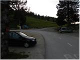
At the end of the parking lot, where the road turns to the left, and to the right branches the road towards the nearby alpine pasture Jezerca, we will notice red hiking signposts, which direct us straight on a marked footpath in the direction of Kriška planina, Vrh Korena, Košutna, Kompotela and Mokrica, which ascends through pastures of the already mentioned alpine pasture. After a short ascent, we reach a cart track, which we follow to the left, where we cross slopes of Kržišče (1658 m). The cart track on which we walk quickly splits into two parts, and we continue straight on the lower one. Temporarily, a nice view opens towards Kranj, Škofjeloško hribovje and Storžič, then the path starts to descend lightly. A few minutes of walking follow, then we arrive at the parking lot by the lower part of Kriška planina.
Here a marked path continues slightly to the right towards Planina Koren, we continue straight to the other side of the valley, where we start to ascend a grassy slope towards the nearby hamlet. After a short ascent, we arrive at mountain hut Pr Florjan, which we bypass on the right side. Above the mountain hut, we gradually step onto a nicely beaten but poorly marked path, which starts to ascend more steeply on a grassy slope. Higher, we reach a poorer, partly grassy cart track, and ascend on it to the place where it turns right. From the mentioned turn, we continue straight on a somewhat less distinct path, on which we ascend to Dom na Krvavcu in a few minutes.
At Dom na Krvavcu we step on a macadam road, and start ascending it in the direction of Krvavec summit and Zvoh. Further on, we ascend with nice views on the Storžič group as well as Kočna and Grintovec, the path past the transmitter tower gradually leads us to somewhat steeper slopes of Krvavec summit. Here the road levels out and crosses the western slopes of the mentioned summit, then soon we arrive at saddle Razor.
On the saddle an unmarked path from Planina Koren joins almost unnoticeably from the right (the path branches off from the marked path Kriška planina - Planina Koren shortly before Planina Koren), and we continue straight to the nearby red signposts, which are located shortly before the junction where a marked path to Planina Dolgi njivi branches slightly to the left. Here too we continue straight and start steeply ascending a transport-rescue road, which is paved on the steepest part. Higher, the steepness gradually eases and the path leads us to an accumulation lake intended for snowmaking on the ski resort. We bypass the lake on the left side, then continue slightly right and ascend to the panoramic summit Zvoh in a few minutes.
Stamp and logbook are located somewhat below the summit, namely along the marked path which continues towards Vrh Korena.
During the operation of the ski resort, walking on the part of the path where it runs across the ski run is prohibited.

Photos:
 1
1 2
2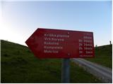 3
3 4
4 5
5 6
6 7
7 8
8 9
9 10
10 11
11 12
12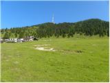 13
13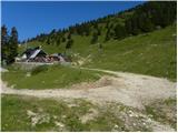 14
14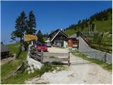 15
15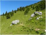 16
16 17
17 18
18 19
19 20
20 21
21 22
22 23
23 24
24 25
25 26
26 27
27 28
28 29
29 30
30 31
31 32
32 33
33 34
34 35
35 36
36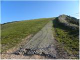 37
37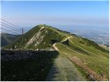 38
38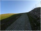 39
39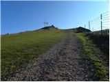 40
40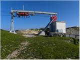 41
41 42
42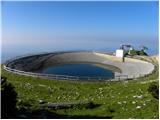 43
43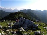 44
44 45
45
Discussion about the trip Planina Jezerca - Veliki Zvoh (via Dom na Krvavcu)
To post a comment you must log in:
If you do not yet have a username, you must first
register.