Starting point: Planina Krnica (1240 m)
| Latitude/Longitude: | 46,35274°N 13,50801°E |
| |
Walking time: 4 h
Difficulty: very difficult pathless terrain
Elevation gain: 1166 m
Elevation difference along the route: 1180 m
Map: Julijske Alpe - zahodni del 1:50.000
Recommended equipment (summer): helmet
Recommended equipment (winter): helmet, ice axe, crampons
Views: 5.170
 | 4 people like this post |
Access to starting point:
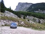
We drive to the center of Bovec, where from the intersection at the main square we continue on the ascending road that past the post office begins to ascend toward the nearby church. We bypass the mentioned church on the left side, then arrive at Kaninska vas. Bovec then ends, and the road leads us westward for some time. At a smaller intersection, we leave the main asphalt road that leads to the village Plužna and continue driving on the slightly right road (after the intersection, signs for the Gozdec road). Behind the nearby homestead, the road splits once again; this time we choose the slightly left road (slightly right to Zavrzelno and the starting point of the path to Rombon). We continue ascending on a macadam road, which higher brings us to the B station of the Kanin cableway. At the B station, the road turns sharply left, then in a traversing ascent after approximately 1 km of further driving brings us to the next intersection. At the mentioned intersection, we continue sharply right toward the mountain pasture Krnica (left to Gozdec). Later, the road toward the C and D stations branches off to the left. We continue straight all the way to the mountain pasture Krnica, where there is a smaller parking lot. In the last part toward the mountain pasture Krnica, the road is in quite bad condition.
Route description:
From the parking lot on the mountain pasture Krnica we head left onto the marked footpath, which starts to ascend and quickly brings us into a belt of sparse forest. The forest soon ends, and the path continues on mostly grassy terrain along which dwarf pines initially still grow. The path, running through the Krnica valley, slowly turns slightly left and then proceeds northwest. The path is only occasionally somewhat steeper, and higher it transitions from grassy slopes to scree below the slopes of Lopa. The path later ascends somewhat more steeply and soon brings us to the ski slope on Prevala, where there is also a junction.
On the Prevala saddle we continue right and begin ascending the ski slope toward the upper station of the Italian gondola cableway. Here, from the path, a nice view first opens toward the west, then toward the north, where Montaž and Viš are clearly visible. When the path on the ski slope turns right, path 536 from Nevejsko sedlo joins from the left. Only a short ascent to the upper cableway station follows.
At the upper station of the gondola cableway we turn left onto an unmarked track that traverses scree on the northern slopes eastward. The path initially in a gentle ascent traverses slopes below the northern walls of the ridge Vršiči pod Lopo (Monte Golovec). When we reach the northwest side of the mentioned ridge, a view opens to the right toward the notch Forca sopra Medon. We continue along the track traversing the slopes eastward. We follow the track, which occasionally ascends slightly further on, all the way to the notch on the east side of Lopa peak.
About 10 meters before the notch (first somewhat easier passage from the notch on the north side) we turn right upward toward the ridge. After an initial very short ascent, the terrain flattens slightly, and ahead we will see a short gully. On this section, there is also some scree on the slope. We head straight toward the mentioned gully. After just a few meters of ascent in the gully, we continue left onto the ledge.
Once on the mentioned ledge, we have two options. We can, after just a few meters of traversing the ledge, turn right, followed by a few meters of climbing to the ridge. If we turn right at the correct spot, the climbing difficulty does not exceed grade I. The second option is to continue traversing the mentioned ledge further to reach the south side of the ridge. On the south side, where the slope is somewhat covered with grass, we traverse the steep slope below the ridge for a short time. When the slope above us becomes somewhat less steep, we turn right onto the ridge.
We then walk along the ridge, and the ascent becomes less demanding for a while. While walking the panoramic ridge, cairns also assist us. Somewhat higher, we reach steeper slopes again. In the initial part of the steep slope, we keep to the left side, then about halfway across we traverse the steep, partly grass-covered slope to the right. A few cairns also help with orientation. A short steep ascent follows, then we continue left and soon reach the ridge again.
We then walk along the ridge the entire time to the panoramic summit. In the last part of the ridge, there are a few very short steep ascents that present no major difficulties.
We descend via the ascent path.
For less experienced hikers, rope belaying is recommended on the more difficult sections.

Along the route: Prevala (2067m), Sella Golovec (2133m)
Photos:
 1
1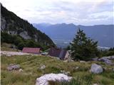 2
2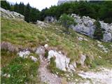 3
3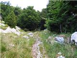 4
4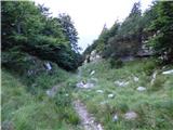 5
5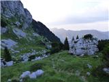 6
6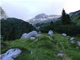 7
7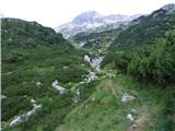 8
8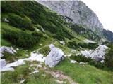 9
9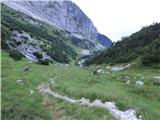 10
10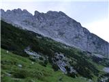 11
11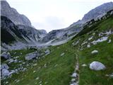 12
12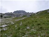 13
13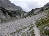 14
14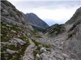 15
15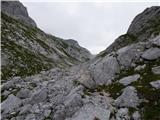 16
16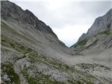 17
17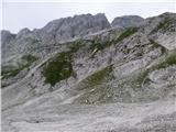 18
18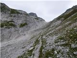 19
19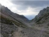 20
20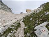 21
21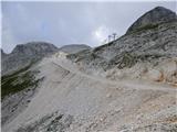 22
22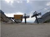 23
23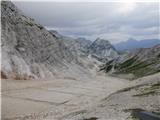 24
24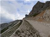 25
25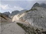 26
26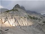 27
27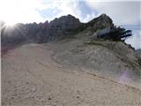 28
28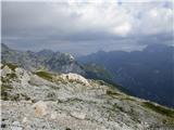 29
29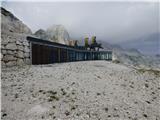 30
30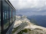 31
31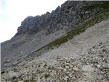 32
32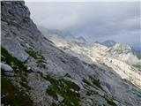 33
33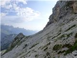 34
34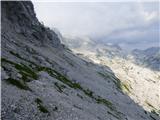 35
35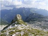 36
36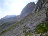 37
37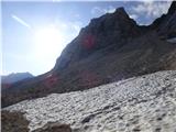 38
38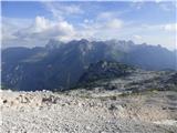 39
39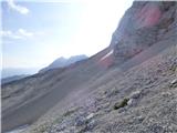 40
40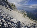 41
41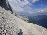 42
42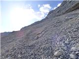 43
43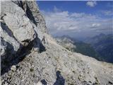 44
44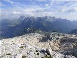 45
45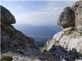 46
46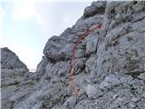 47
47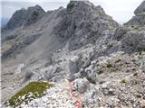 48
48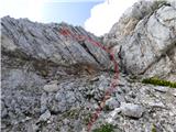 49
49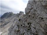 50
50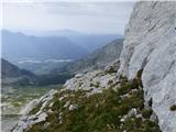 51
51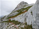 52
52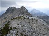 53
53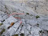 54
54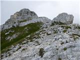 55
55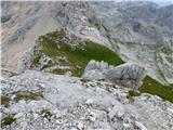 56
56 57
57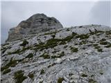 58
58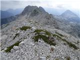 59
59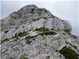 60
60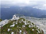 61
61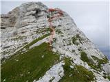 62
62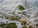 63
63 64
64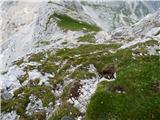 65
65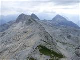 66
66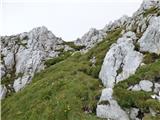 67
67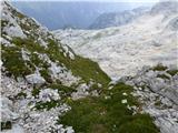 68
68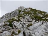 69
69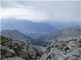 70
70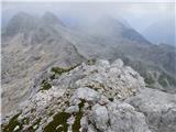 71
71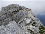 72
72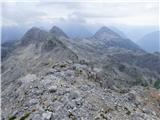 73
73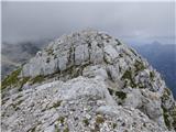 74
74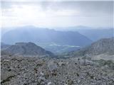 75
75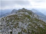 76
76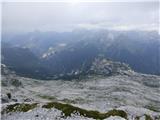 77
77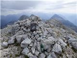 78
78
Discussion about the trip Planina Krnica - Lopa
|
| ljubitelj gora25. 07. 2017 |
Just a note that the car should be left at B station and proceed on foot, as driving to Krnica on such a road is suitable only for off-road vehicles.
|
|
|
|
| mirank25. 07. 2017 |
Not quite; you can drive to the bench and parking lot located 400m further from the junction of the service road to C station with any vehicle. From there it's 15 min to Krnica! Tested last time when the lady at the cable car wouldn't sell us tickets to B station because they weren't on the price list  . Well, to not lie, we could have bought the full package:rolleyes or a bike ticket . Well, to not lie, we could have bought the full package:rolleyes or a bike ticket  : :
|
|
|
|
| ljubitelj gora25. 07. 2017 |
Sure you can drive there, but what does the car's undercarriage say after such a drive. 
|
|
|
|
| gams126. 07. 2017 |
The description is good, but unfortunately , the author exaggerated with the "view back" photos, because you lose the sense and feeling of how demanding the ascent is.
|
|
|
|
| dprapr4. 09. 2018 |
If you’ve already gone all the way to Preval, it would be much nicer at photo 30 to approach the ridge via the grass and follow it to Lopa, rather than those scree slopes from behind.
|
|
|
|
| darinka42. 09. 2020 |
Now there is a sign at B station or road forbidding all vehicles further. Where do you park at B station now?
|
|
|
|
| darinka42. 09. 2020 |
Further on, those who descend by zip line drive with jeeps. And during the descent some were very loud.
|
|
|
|
| darinka417. 09. 2020 |
Yesterday we went from Selle Neveje. Along path 636. To the turn-off for Preval. Continuation over scree under the foot of Lopa. To the summit, where there are cairns and red dots on the rocks to help. There it was necessary to be careful and cautious. Helmet use is almost mandatory. No fixed protection. Free climbing. For me the summit was a great vantage point. For the others too. We descended the same way. And met no one. From the summit we admired a fairly large flock, I think hawks, gliding in the air. I remember that smaller birds were very agitated. If you're looking for solitude, it's certainly at home here.
|
|
|
To post a comment you must log in:
If you do not yet have a username, you must first
register.