Planina Kuhinja - Planina Slapnik
Starting point: Planina Kuhinja (991 m)
| Latitude/Longitude: | 46,24130°N 13,66300°E |
| |
Walking time: 45 min
Difficulty: easy marked way
Elevation gain: 259 m
Elevation difference along the route: 265 m
Map: Julijske Alpe - zahodni del 1:50.000
Recommended equipment (summer):
Recommended equipment (winter): ice axe, crampons
Views: 123
 | 1 person like this post |
Access to starting point:
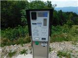
a) We drive to Kobarid, then follow the signs for Drežnica. After crossing the Soča river via the Napoleonov most, turn right towards Tolmin and Vrsno (Drežnica is slightly to the left) and gradually start ascending. We continue driving past the settlements of Ladra, Smast and Libušnje to the settlement of Vrsno, where the birth house of Simon Gregorčič is located. Here the road from the settlement of Kamno joins from the right, while we continue following the signs towards the village of Krn and the mountain pasture Kuhinja. There is still quite a long drive along a relatively narrow road; at junctions we always follow the direction for the mountain pasture Kuhinja. Just a short distance before the mountain pasture, turn left where the barrier for paying the parking fee is located. Beyond the barrier, a few parking spaces are already available along the road, with many more on a small flat area. It is also possible to park a little further ahead, in front of the Koča na planini Kuhinja.
b) We drive to Tolmin, then follow the signs for Kobarid. On the flat section of the road, turn right towards the settlement of Kamno, which we reach via a narrow bridge over the Soča river, then follow the signs for the village of Vrsno. In Vrsno we join the road coming from Kobarid and continue following the signs towards the village of Krn and the mountain pasture Kuhinja. There is still quite a long drive along a relatively narrow road; at junctions we always follow the direction for the mountain pasture Kuhinja. Just a short distance before the mountain pasture, turn left where the barrier for paying the parking fee is located. Beyond the barrier, a few parking spaces are already available along the road, with many more on a small flat area. It is also possible to park a little further ahead, in front of the Koča na planini Kuhinja.
Route description:
From the parking lot in front of the mountain pasture Kuhinja, we turn onto the lower left road that leads towards Koča na planini Kuhinja (slightly to the right lies mountain pasture Leskovica, Jezero v Lužnici...) and along which there are signs for Gomiščkovo zavetišče and Krn. A short distance before Koča na planini Kuhinja the path forks; we can choose the right branch, which is slightly shorter than the one that passes the hut, or continue straight ahead on the slightly longer variant that passes the hut.
At the memorial to fallen mountaineers in the Krn mountain range, both paths rejoin, and we continue following the marked trail towards Krn. This is followed by a few minutes of moderate ascent during which we cross several grazing fences; when we reach the access road to the nearby mountain pastures we only cross it (to the left is the Italian chapel on Planica and the nearby mountain pastures) and then begin to ascend steeply. The ascent continues up an increasingly panoramic grassy slope; higher up we reach mountain pasture Slapnik, where several identical buildings stand.
Starting point – Koča na planini Kuhinja 0:05, Koča na planini Kuhinja – Planina Slapnik 0:40.
Description and photographs refer to conditions in July 2025.

Photos:
 1
1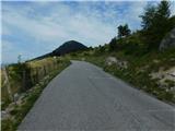 2
2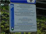 3
3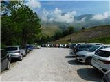 4
4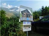 5
5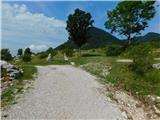 6
6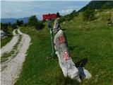 7
7 8
8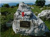 9
9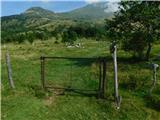 10
10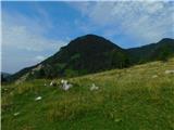 11
11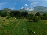 12
12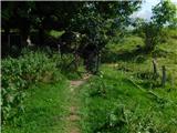 13
13 14
14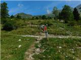 15
15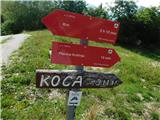 16
16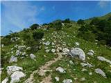 17
17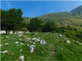 18
18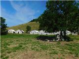 19
19
Discussion about the trip Planina Kuhinja - Planina Slapnik
To post a comment you must log in:
If you do not yet have a username, you must first
register.