Planina Kuhinja - Vrh nad Peski
Starting point: Planina Kuhinja (991 m)
| Latitude/Longitude: | 46,24130°N 13,66300°E |
| |
Walking time: 4 h
Difficulty: easy unmarked way
Elevation gain: 1185 m
Elevation difference along the route: 1185 m
Map: Julijske Alpe - zahodni del 1:50.000
Recommended equipment (summer): helmet
Recommended equipment (winter): helmet, ice axe, crampons
Views: 24.503
 | 2 people like this post |
Access to starting point:
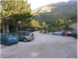
From Tolmin we drive towards Kobarid or vice versa, but only to a spot where signs for Kamno point us to the right (from the direction of Kobarid to the left) over a bridge. We then follow a relatively narrow and ascending road in the direction of the village Vrsno and higher Krn. From the village Krn we continue in the direction of the mountain hut Koča na planini Kuhinja. When we get to a large parking lot, where the road continues slightly to the left towards the mountain hut Koča na planini Kuhinja, we park at the large parking lot.
Route description:
From the parking lot at the smaller quarry we continue on the right upper road in the direction of the mountain pasture Kašina (left mountain pasture Planina Kuhinja 3 minutes). The road, which further moderately ascends, already after a few steps of further walking brings us to the next crossing, where we continue right again (left mountain pasture Zaslap). The relatively gentle road, which gradually changes into a cart track, soon brings us onto ample grassy slopes, where we step onto the pastures of the mountain pasture Kašina.
Here the road or cart track turns even more to the right, then makes a sharp left turn, and then continues by crossing the slopes to the right. After approximately 45 minutes (from the starting point) of moderate ascent, the relatively panoramic path brings us to the mountain pasture Leskovca covered with nettles.
From the mentioned mountain pasture we continue slightly left on the marked and initially quite gentle mountain path. The path, which passes onto the western and increasingly steep grassy slopes, higher up joins from the right a somewhat less trodden path from the mountain pasture Sleme. We continue left on the already very steep path, which ascends along the foot of the steep walls of Maselnik (1906 m). A little higher, the path, which due to its considerable steepness is exposed to falling stones, is joined by another path from the mountain pasture Sleme. We continue straight on the path, which a little higher levels out, then turns quite to the left, where it passes into a smaller valley. There follows a short somewhat steeper ascent and to the left a little below us we spot the lake Jezero v Lužnici (1801 m).
The marked path bypasses the mentioned lake on the right side and then ascends along the foot of the scree of the ridge Mali Peski. Higher, the path turns somewhat to the left and ascends over the grassy slopes of Srednji vrh (2032 m) to the saddle named Prag (2068 m).
On Prag, where there is a marked junction, we continue right in the direction of the mountain hut on Planina Razor (left Batognica and Krn, straight down Krnsko jezero) on the path which crosses the slopes of Vrh nad Peski. After approximately 10 minutes of crossing the scree below Vrh nad Peski, we will come to a smaller junction, where we continue left in the direction of "V. Peski". The path ahead ascends in a few minutes to a smaller grassy saddle, then continues on an increasingly panoramic and occasionally quite steep path. We then follow this panoramic and relatively steep path all the way to Vrh nad Peski, which we reach after a few minutes of further walking.

Photos:
 1
1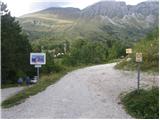 2
2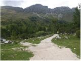 3
3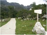 4
4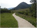 5
5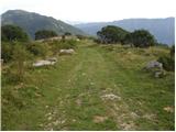 6
6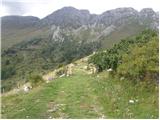 7
7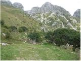 8
8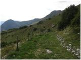 9
9 10
10 11
11 12
12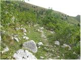 13
13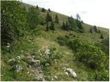 14
14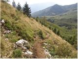 15
15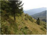 16
16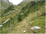 17
17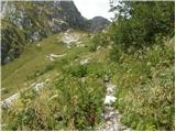 18
18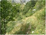 19
19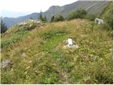 20
20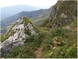 21
21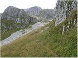 22
22 23
23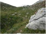 24
24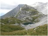 25
25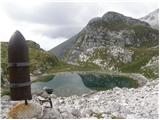 26
26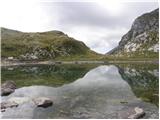 27
27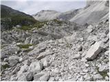 28
28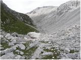 29
29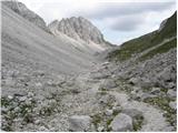 30
30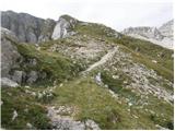 31
31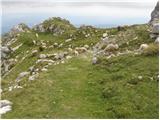 32
32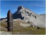 33
33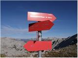 34
34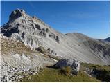 35
35 36
36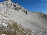 37
37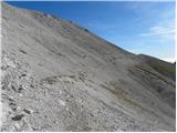 38
38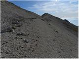 39
39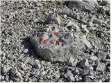 40
40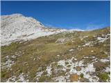 41
41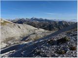 42
42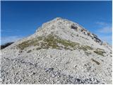 43
43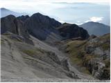 44
44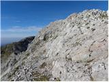 45
45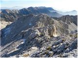 46
46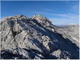 47
47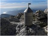 48
48 49
49
Discussion about the trip Planina Kuhinja - Vrh nad Peski
|
| katty14. 07. 2012 |
Hey.
Can anyone tell me how long the ascent to Vrh nad Peski takes, specifically from that junction - picture 34? I'm thinking of going from Planina Kuhinja via Jezero v Lužnici and Batognjica to vrh Krna, in between try to also go to Vrh nad Peski and via Gomiščikov zavetišče back to the start. Is this Vrh nad Peski very off the path, and do you have to descend a lot and then ascend to reach the summit?
Thanks for all information.
|
|
|
|
| funnyboy14. 07. 2012 |
Hi
from that junction to vrh nad Peski is 20 min moderate walking.
The summit is fairly close to the path. Descent from the saddle is minimal. But it's quite steep towards the summit 
|
|
|
|
| katty14. 07. 2012 |
Oh super. This summit always seemed so tempting to me, so this year when I'm around here, I'll definitely go up. Already looking forward to it.
Thanks funnyboy.
|
|
|
|
| ben14. 07. 2012 |
katty, on picture 34 it says on the signs elevation of junction 2071m, which means over 100m to the summit. It takes you about half an hour one way, maybe less. Last year for exactly the same loop, with Vrh nad Peski including all stops, I needed good 6.5 hours, so definitely go there too
Best B
|
|
|
|
| michael665. 09. 2013 |
how long from vrh nad peski to vrh krna - I mean how much time walking. thanks
|
|
|
|
| miri5. 09. 2013 |
About half an hour or a bit more.
|
|
|
|
| Laščan5. 09. 2013 |
Picture 34 is taken at Sedlo Prag from where under Batognica to Krn summit one hour walk, from Sedlo Prag to Vrh nad Peski summit less than half hour walk!
|
|
|
|
| Ruzowski19. 10. 2013 |
Today a circular tour from Kuhinja to škrbina, Batognica, Vrh nad Peski, descent to the lake in Lužnica back to Kuhinja....Weather sunny, warm, beautiful clear views towards Triglav.(good 5 hours of walking) easy.. 
|
|
|
|
| darinka411. 03. 2022 13:40:00 |
Yesterday, March 10th, we went from Planina Kuhinja over Leskovec, past the lake in Lužnica, which is now under snow, to Vrh nad Peski. But we reached 2160 m. Then we turned back due to wind-packed snow on the last part to the summit. Back down the same way. And also in the morning we started from Planina Leskovec steeply along the new path of the old mule track. Above it joins the summer path. There's quite a lot of snow back there. The tour requires good fitness.
|
|
|
|
| BorStenar3. 12. 2022 13:37:48 |
hey
does anyone know the length of the entire tour Krn-Batognica-Vrh nad Peski-Rdeči Rob from Planina Kuhinja? can it be done in one day?
|
|
|
|
| mirank3. 12. 2022 17:27:45 |
Completely doable in about 6-7h, depending on terrain knowledge (unmarked passages-multiple variants) and fitness
|
|
|
|
| BorStenar3. 12. 2022 19:42:08 |
Is this length only the ascent (6-7h) or total with descent?
Also, is there a stamp at the top?
|
|
|
|
| rokeg3. 12. 2022 20:50:32 |
According to signs and path descriptions this adds up to about 8h for the whole loop. I recommend reverse, first to Rdeči rob, descent via Krn, because it drags quite a bit to the peak, and from Rdeči rob it's easier to hit the gully from below.
Stamps were last year on all listed, except on Rdeči rob, where there hasn't been one for years, though there was one 10 years ago.
|
|
|
|
| mirank3. 12. 2022 22:44:06 |
Yes, if you wander up and down according to the description and signs, it probably adds up to nearly 8h. That gully for access to R rob doesn't make much difference compared to the standard access, more important is which variant you choose from there
|
|
|
|
| BorStenar3. 12. 2022 22:44:58 |
Good, thanks for the information.
By the way, if there's no stamp at the top I'll take a stone from the top
|
|
|
|
| saram17. 09. 2023 21:44:03 |
Today on this path, which is without special features. Don't know if I was so slow, from Lužnica lake to the summit I walked one and a half hours. But the path is marked all the way to the very junction for the summit, which is well visible and trodden. Under Peski there's actually the alpine transverse path from Komna to Krn. And today on Vrh nad Peski only three visits. On Krn everything's alive.
|
|
|
|
| bo_zl8. 10. 2023 19:00:28 |
From this path, visiting Rdeči rob is possible en route, junction marked on the rock, from there to the top 35 to 40 minutes walk.
|
|
|
|
| tadej123423. 09. 2024 19:42:18 |
or does it just seem to me that soon it won't be possible anymore to go to the peak above Peski "easy", because 4 m before the summit it's collapsing right next to the path, the hut on top has the outer wall already over the edge and is hanging in the air
|
|
|
|
| darinka45. 11. 2024 07:53:32 |
Yesterday's hike from planina Kuhinja over Leskovec, past Rdeči rob to Škofič. Descent under the window in steep meadows to the upper path above the lake in Lužnica. To Male Peske and past the monument to Vrh nad Peski. Descent on the scree path where caution is needed to the saddle behind Batognica. Visit to two caves on Batognica. Then over the summit and the škrbina saddle between Krn and Batognica to planina Kuhinja. Hike from morning to evening. But in calm weather and beautiful views in November, wonderful.
|
|
|
To post a comment you must log in:
If you do not yet have a username, you must first
register.