Starting point: Planina (520 m)
| Latitude/Longitude: | 45,82640°N 14,23580°E |
| |
Walking time: 1 h 30 min
Difficulty: easy unmarked way
Elevation gain: 417 m
Elevation difference along the route: 450 m
Map: Snežnik 1:50.000
Recommended equipment (summer):
Recommended equipment (winter):
Views: 10.615
 | 1 person like this post |
Access to starting point:
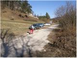
From Ljubljana, we drive on the highway towards Koper and take the Unec exit. At the intersection, we continue right in the direction of Planina, where at the intersection we turn sharply left towards Postojna (also possible on the old road up to here). Further, we drive through Planina and at the spot where we notice signs for Strmca and Studeno we turn right. The road soon brings us to the next intersection, where it says left Postojna, straight Strmca and Studeno, right nothing. Here we turn right (towards the quarry) and we drive only 30m to the spot where a worse road branches off to the left alongside which we park.
From Postojna on the old road we drive towards Ljubljana. Soon behind the village Mačkovec in a sharp right bend a road branches off to the left towards the village Strmca. This road then soon brings us to the next intersection, where we continue straight towards the quarry. We do not follow this road to the quarry because already after 30m we leave it, turning left onto a worse road alongside which we park.
Route description:
From the parking lot, we continue on the worse road ahead, but only to a smaller water supply structure. Here a cart track branches off to the right, which steeply ascends already after a few meters. The cart track, which runs through the forest, is really very steep at the beginning but the steepness eases after a few minutes. A moderate ascent follows on the cart track, which after some time joins another wider one. Here we continue left on the cart track, which slightly ascends and after a few minutes joins the next cart track, which is already almost a worse road. Here we can notice a few old military trenches along the path. This path then quickly brings us to the church of Holy Mary.
West of the church, near the forest road we notice a cart track which crosses the slopes towards the west. We head to the mentioned cart track, which higher brings us out of the forest onto grassy slopes, where it disappears. We continue the ascent on one of numerous, mostly poorly visible footpaths, which lead us towards the west. The path soon brings us to a panoramic forepeak of Petričev hrib (we can also bypass the peak on the left side), from which we descend to a smaller indistinct saddle between the two peaks. From the saddle only a short ascent follows on a panoramic grassy slope.
In nice weather despite numerous footpaths orientation is not particularly demanding, in fog it is almost impossible.

Photos:
 1
1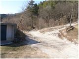 2
2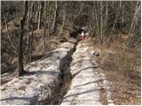 3
3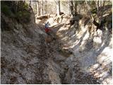 4
4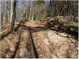 5
5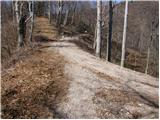 6
6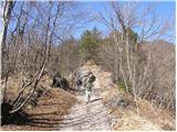 7
7 8
8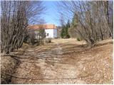 9
9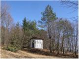 10
10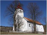 11
11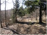 12
12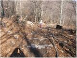 13
13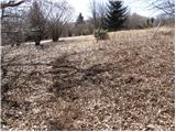 14
14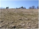 15
15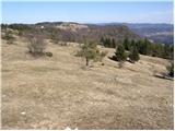 16
16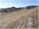 17
17 18
18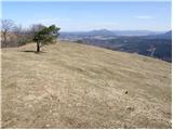 19
19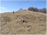 20
20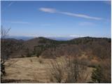 21
21 22
22
Discussion about the trip Planina - Petričev hrib
|
| nusa25. 02. 2012 |
Today we walked the described path. Great trip and beautiful views. The Slovenian Way of St. James passes by the church of St. Mary.
|
|
|
To post a comment you must log in:
If you do not yet have a username, you must first
register.