Planina pod Golico (Betel) - Krvavka
Starting point: Planina pod Golico (Betel) (980 m)
| Latitude/Longitude: | 46,47060°N 14,05990°E |
| |
Walking time: 2 h 15 min
Difficulty: easy pathless terrain
Elevation gain: 804 m
Elevation difference along the route: 825 m
Map: Karavanke - osrednji del 1:50.000
Recommended equipment (summer):
Recommended equipment (winter): ice axe, crampons
Views: 9.245
 | 1 person like this post |
Access to starting point:
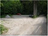
Leave the Gorenjska motorway (Ljubljana–Jesenice) at the Lipce exit (or Hrušica) and follow the road towards Jesenice. In the town, directional signs for Planina pod Golico direct us right (if coming from the direction of Hrušica, left) onto the ascending road (the junction is marked and is located at the Jesenice Health Centre). The relatively steep road soon takes us to the mentioned village, where in May we can admire the blooming narcissi on the surrounding meadows. From Planina pod Golico we continue driving to the next intersection with numerous mountain signposts. Here we turn right in the direction of Golica, then after the end of the settlement we drive another good 50 metres to the parking lot under the Savske jame.
Route description:
From the parking lot we walk back a few dozen steps and head towards Kmečki turizem Betel (if we continue up the road, we can reach Golica via the path past Korlnov rov or via the Savske jame). A short ascent along the asphalt road follows and we soon arrive at Kmečki turizem Betel; behind it we turn right at the junction in the direction of Golica.
A few minutes higher we reach the hut Pri Fencu (Apartments Pri Fencu); here we watch for the marked path branching off to the right that starts behind the apartments.
We continue along the wide marked path that first climbs across a small meadow, then enters a narrow belt of forest and a little higher reaches dense forest. About 15 minutes of ascent through the forest follows, where the path leads near a stream; we then reach a gravel road which we follow to the right until the marked junction at the lower station of the freight cable car that leads to Koča na Golici.
Here we join the previously mentioned path that leads past Korlnov rov; we continue only a little further left onto the path towards Koča na Golici and Golica. The path immediately forks again.
We continue on the slightly right, normal path (slightly left is the winter route) which then climbs quite steeply through increasingly sparse forest higher up. When we approach the altitude of 1500 m higher up, we leave the forest and, with fine views, traverse obliquely to the marked junction where we continue slightly left towards Koča na Golici, which we can already see nicely ahead (sharply right are Struška, Markljev and Pusti Rovt and the Savske jame).
A short traverse to the left follows and the path forks once more. The signs for Koča na Golici direct us right onto the trail (the lower path leads past Mokotova bajta and also reaches the hut), along which we climb in a few minutes to the hut, from where a fine view of the highest peaks of the Julian Alps opens up.
From the hut we follow the marked path towards the summit of Golica. The path initially leads north along a fairly gentle slope that soon becomes increasingly steep. Continuing, we move from the broad ridge onto grassy slopes, across which we first traverse left, then ascend straight up in a few switchbacks.
Higher up the gradient eases and shortly before the main ridge of the Karavanke we reach a marked junction where we go right (left to Golica, 15 minutes). We walk for a short time along the marked path towards Sedlo Suha, then turn slightly left onto the trail that continues along the border ridge. Along it we reach the scenic, grassy summit of Krvavka in a few minutes; its slopes appear white during the narcissus bloom due to the abundance of flowers.
Starting point – lower station of the freight cable car 0:35, lower station of the freight cable car – Koča na Golici 1:00, Koča na Golici – junction on the Golica ridge 0:30, junction on the Golica ridge – Krvavka 0:10.

Along the route: Koča na Golici (1000m), Apartments pri Fencu (1050m), Sp. postaja tovorne žičnice (1205m), Razpotje V od Koče na Golici (1496m),
Koča na Golici (1582m), Razpotje na grebenu Golice (1757m), Odcep z markirane poti (1736m)
Photos:
 1
1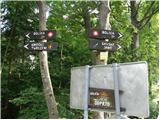 2
2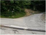 3
3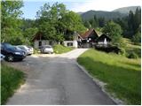 4
4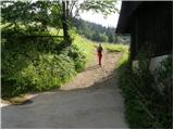 5
5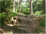 6
6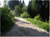 7
7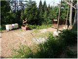 8
8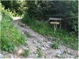 9
9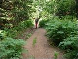 10
10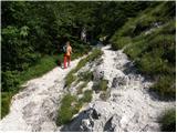 11
11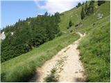 12
12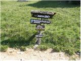 13
13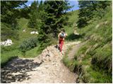 14
14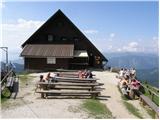 15
15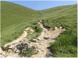 16
16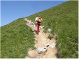 17
17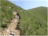 18
18 19
19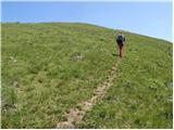 20
20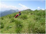 21
21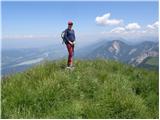 22
22
Discussion about the trip Planina pod Golico (Betel) - Krvavka
|
| planinec alex2. 10. 2009 |
There is also the Jesenice-Javorniški
rovt path. You drive to the Pristava hut in Javorniški rovt and then on the gravel road
to Suhega sedlo where we park, when we reach
the monument from WWII we spot the border stone between Republic of Slovenia and Austria. There is a nice view of Austrian
Carinthia. From there it's 7 min. walk to Krvavka
and 48 min. walk to Golica.
|
|
|
|
| heinz3. 10. 2009 |
hiker alex, this is unfortunately a somewhat unfortunate description..
Suha sedlo usually doesn't serve as a starting point, as it has no parking lot or space for more cars, so the start in the mentioned direction should at least be from Pustega rovta, if not from Križovec.
From the saddle- 1439, to Krvavka- 1785, 7 min. walk is by no means enough, the altitude difference alone indicates that.. Not even Mala Golica- 1646 is that close, which you probably confused with Krvavka.
If anything, half an hour to Krvavka, one hour to Golica, that's closer to reality, although even this estimate is too modest for many hikers.
|
|
|
|
| Enka3. 10. 2009 |
We went to Golica in spring, via the trail described by mountaineer alex. At Sedlo Suha there was parking for at least 10 cars. For those with less fitness who don't like crowds on the classic trail during narcissus blooming time, this is an excellent starting point.
Walking time is of course relative, but nevertheless - we don't burst with fitness and it took us more than an hour to Golica  . .
|
|
|
|
| Enka4. 10. 2009 |
I forgot to write that we went from Pristava to Sedlo Suha on foot and that the cars were possibly getting on our nerves, but nevertheless...
|
|
|
|
| heinz4. 10. 2009 |
Already soon on the road from Križovec there is a barrier, a little later before Pusti Rovt another one, which indicates that the road is not intended for tourism, but for the needs of the alpine pasture and forestry. Therefore, I wouldn't talk about a starting point at this place.., as it might happen that the barrier is closed on the way back. And we don't all have keys, as we know.
For those with less fitness, I recommend only the "ascent" from Planina pod Golico to Fenc, or to Pristava from Javornik..
|
|
|
To post a comment you must log in:
If you do not yet have a username, you must first
register.