Planina pod Golico - Rosenbachsattel/Rožca
Starting point: Planina pod Golico (980 m)
| Latitude/Longitude: | 46,46240°N 14,04880°E |
| |
Walking time: 2 h
Difficulty: easy marked way
Elevation gain: 607 m
Elevation difference along the route: 650 m
Map: Karavanke - osrednji del 1:50.000
Recommended equipment (summer):
Recommended equipment (winter): ice axe, crampons
Views: 14.975
 | 2 people like this post |
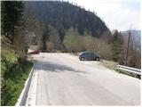
Access to starting point:
From the Ljubljana - Jesenice highway we take the Lipce exit (also possible Hrušica) and follow the road ahead in the direction of Jesenice, where signs for Planina pod Golico direct us onto an ascending road (the turn-off is marked and located at the health center in Jesenice). The relatively steep road soon brings us to the mentioned village, where in May on the surrounding meadows we can admire the blooming of daffodils. We park on one of the parking lots at the foot of the ski center Španov vrh.
Route description:
From the parking lot we continue on the asphalt road, which after a few minutes of walking brings us to a marked junction, where we continue left downhill in the direction of Rožca (straight Golica, right Španov vrh). We continue on the road which past the church of the Holy Cross brings us to an unmarked junction (by the cross), where we continue right. The path ahead leads us past a few houses, then soon we notice signposts which direct us left onto a footpath.
The path ahead ascends along a quite muddy cart track, then passes into dense forest, where it continues on and beside the cart track. Locally poorly visible path, which all the time runs through the forest, brings us higher to a forest road, which we only cross. We continue the ascent on a wide cart track, which first ascends beside the clearing, then returns into the forest.
The cart track, which is becoming worse and worse, then quickly brings us to a smaller, usually swampy clearing, where it ends.
Here a little to the right we will notice already quite faded blaze, which directs us onto a for a short time poorly visible and somewhat steeper footpath. Soon the path brings us to a wide ridge, where it widens. We continue the ascent along the mentioned ridge, which is surrounded by a grazing fence. Along the grazing fence we ascend only a few dozen steps, then blazes direct us left downhill.
Follows a gentle transverse descent along the path, which runs through initially dense spruce forest. The path then levels out, crosses two successive streams and then brings us to a poor forest road (road from Plavški Rovt). We follow the mentioned road, which partly runs through forest, partly across grassy hayfields (the road has some marked shortcuts), all the way to Jeseniška planina, from which a beautiful view opens up.
From the mountain pasture we continue on a moderately steep grassy slope, across which several smaller paths lead. Higher the paths merge and along the path we notice some faded blazes. After approximately 20 minutes of ascent from Jeseniška planina, the path turns left, where it passes into a short stretch of forest. Follows a few minutes of traversing the slopes of Klek, then the path exits the forest, where it crosses a somewhat awkward but in dry not difficult passage across the gully. From the gully to the hunting hut on Rožca follows only a short walk along a very panoramic grassy slope.

Photos:
 1
1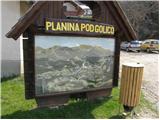 2
2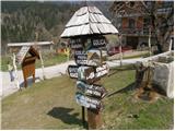 3
3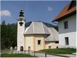 4
4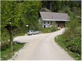 5
5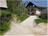 6
6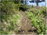 7
7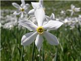 8
8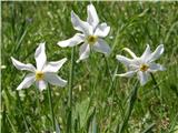 9
9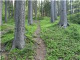 10
10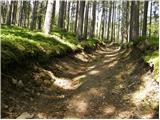 11
11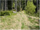 12
12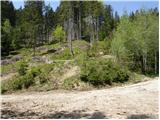 13
13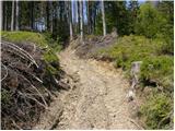 14
14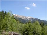 15
15 16
16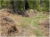 17
17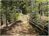 18
18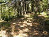 19
19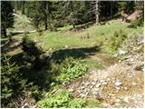 20
20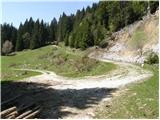 21
21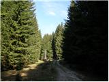 22
22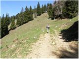 23
23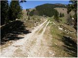 24
24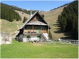 25
25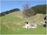 26
26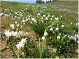 27
27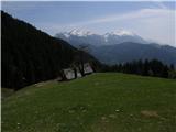 28
28 29
29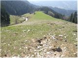 30
30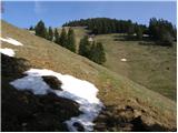 31
31 32
32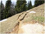 33
33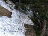 34
34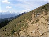 35
35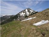 36
36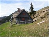 37
37
Discussion about the trip Planina pod Golico - Rosenbachsattel/Rožca
|
| klavdipo22. 05. 2009 |
How long does it take to hike from Rožca to Golica?
LP
|
|
|
|
| Tadej22. 05. 2009 |
Over Klek 2 hours, on the marked path about half an hour less.
|
|
|
|
| klavdipo23. 05. 2009 |
Thanks Tadej! Tomorrow I'm going on this tour: Pl.pod Golico-Rožca-Hruški vrh-Rožca-Klek-Golica-Pl.pod Golico! I hope the weather holds! Tomorrow I'm going on this tour: Pl.pod Golico-Rožca-Hruški vrh-Rožca-Klek-Golica-Pl.pod Golico! I hope the weather holds!
LP
|
|
|
|
| Martin Dercar20. 05. 2026 21:55:06 |
Tadej, which marked path? Less than half an hour, there is no path here that would be a little less than 2 hours
|
|
|
To post a comment you must log in:
If you do not yet have a username, you must first
register.