Planina pod Golico - Rosenkogel/Hruški vrh
Starting point: Planina pod Golico (980 m)
| Latitude/Longitude: | 46,46240°N 14,04880°E |
| |
Walking time: 2 h 30 min
Difficulty: easy marked way
Elevation gain: 796 m
Elevation difference along the route: 860 m
Map: Karavanke - osrednji del 1:50.000
Recommended equipment (summer):
Recommended equipment (winter): ice axe, crampons
Views: 19.670
 | 1 person like this post |
Access to starting point:
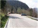
From the Ljubljana-Jesenice highway, take the Lipce exit (also Hrušica) and follow the road ahead towards Jesenice, where signs for Planina pod Golico direct us onto an ascending road (the turn-off is marked and located at the health centre on Jesenice). The relatively steep road soon brings us to the mentioned village, where in May we can admire the blooming daffodils on the surrounding meadows. We park on one of the parking lots at the foot of the ski centre Španov vrh.
Route description:
From the parking lot, we continue on the asphalt road, which after a few minutes of walking brings us to a marked crossroads, where we continue left downhill in the direction of Rožca (straight Golica, right Španov vrh). We continue on the road, which past the church of the Holy Cross brings us to an unmarked crossroads (by the cross), where we continue right. The path ahead leads us past a few houses, and then we soon notice signposts, which direct us left onto a footpath.
The path ahead ascends a quite muddy cart track, then passes into a dense forest, where it continues on and beside the cart track. Locally poorly visible path, which all the time runs through the forest, brings us higher to a forest road, which we only cross. We continue the ascent on a wide cart track, which first ascends beside a clearing, then returns into the forest.
The cart track, which is becoming worse, then quickly brings us to a smaller, usually swampy clearing, where it ends.
Here, somewhat to the right, we will notice a quite faded blaze, which directs us onto a shortly poorly visible and somewhat steeper footpath. Soon the path brings us onto a wide ridge, where it widens. We continue the ascent on the mentioned ridge, which is surrounded by a grazing fence. Beside the grazing fence we ascend only some 10 steps, then the blazes direct us left downhill.
Follows a gentle diagonal descent on the path, which runs through initially dense spruce forest. The path then flattens, crosses two successive streams and then brings us to a poor forest road (road from Plavški Rovt). We follow the mentioned road, which partly runs through the forest, partly over grassy hay meadows (the road has some marked shortcuts), all the way to Jeseniška planina mountain pasture, from which a nice view opens up.
From the mountain pasture we continue on a moderately steep grassy slope, over which several smaller paths lead. Higher the paths join and beside the path we notice some faded blazes. After approximately 20 minutes of ascent from Jeseniška planina mountain pasture, the path turns left, where it passes into a short stretch of forest. Follows a few minutes of crossing the slopes of Klek, then the path exits the forest, where it crosses a somewhat awkward but in dry not difficult passage over the gully. From the gully to the hunting cottage on Rožca follows only a short walk on a very panoramic grassy slope.
From the hunting cottage we continue on one of the paths, which in a diagonal ascent climbs to the border ridge between Slovenia and Austria.
Once we step onto the ridge we continue on a well-beaten path, which continues towards the west (right Klek). Beside the path, which ahead runs along the border ridge, instead of Slovenian we will notice Austrian blazes (blazes in the colours of the Austrian flag). We follow this increasingly panoramic and undemanding path, which occasionally ascends quite steeply, all the way to Hruški vrh, on which stands a small chapel.
Planina pod Golico - Jeseniška planina 1:30, Jeseniška planina - Rožca 30 minutes, Rožca - Hruški vrh 30 minutes.

Photos:
 1
1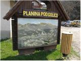 2
2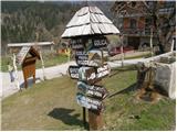 3
3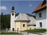 4
4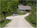 5
5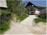 6
6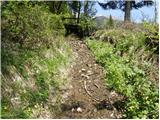 7
7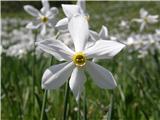 8
8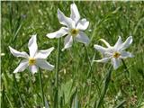 9
9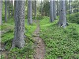 10
10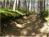 11
11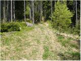 12
12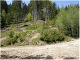 13
13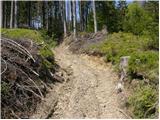 14
14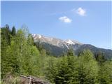 15
15 16
16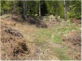 17
17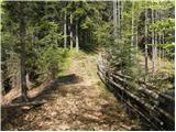 18
18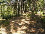 19
19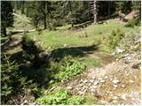 20
20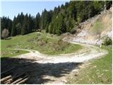 21
21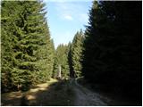 22
22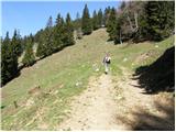 23
23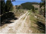 24
24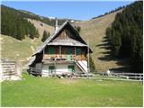 25
25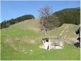 26
26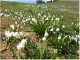 27
27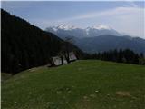 28
28 29
29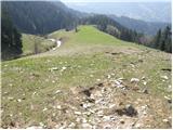 30
30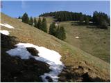 31
31 32
32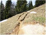 33
33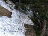 34
34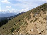 35
35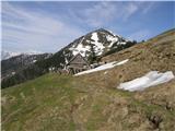 36
36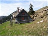 37
37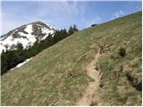 38
38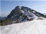 39
39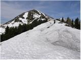 40
40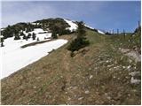 41
41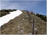 42
42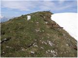 43
43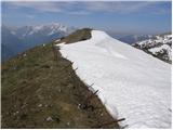 44
44 45
45
Discussion about the trip Planina pod Golico - Rosenkogel/Hruški vrh
|
| superpalčica13. 02. 2011 |
Hello, I'm interested in the snow conditions on this path. Thanks in advance
|
|
|
|
| Zalas14. 02. 2011 |
Was on Tuesday at Dovška baba and there was no problem, because the southern side was dry along the path. From Dolška baba we also descended to Hruški vrh along the ridge! It was warm and dry! Of course conditions changed yesterday!
|
|
|
|
| Trox20. 06. 2023 14:10:48 |
From here you can extend the path to Dovška Baba. The path extends by 40-60min. It is easy, but unmarked. Stick to the ridge and you won't get lost.
Best,
D.T.
|
|
|
To post a comment you must log in:
If you do not yet have a username, you must first
register.