Planina pod Golico - Španov vrh
Starting point: Planina pod Golico (980 m)
| Latitude/Longitude: | 46,46240°N 14,04880°E |
| |
Walking time: 1 h 15 min
Difficulty: easy unmarked way
Elevation gain: 354 m
Elevation difference along the route: 354 m
Map: Karavanke - osrednji del 1:50.000
Recommended equipment (summer):
Recommended equipment (winter): ice axe, crampons
Views: 23.000
 | 3 people like this post |
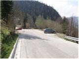
Access to starting point:
From the highway Ljubljana - Jesenice we take the exit Lipce (Hrušica also possible) and follow the road ahead in the direction of Jesenice, where signs for Planina pod Golico direct us to an ascending road (the turn-off is signalized and is located at the health center in Jesenice). The relatively steep road soon brings us to the mentioned village, where in May, on the surrounding meadows, we can admire the blooming of daffodils. We park on one of the parking lots at the foot of the lower station of the Španov vrh cable car.
Route description:
From the parking lot, we continue on the asphalt road, which after a few minutes of walking brings us to a marked intersection, where we continue right in the direction of Španov vrh and ski cottage Črni vrh (left Rožca, straight Golica). The road on which we continue the ascent crosses the stream and only a few steps further brings us to an unmarked intersection, where we continue on the left, increasingly steep road. The road, which ascends past individual holiday cottages and by which we notice rare and faded blazes, ascends even steeper higher up and then brings us to the spot where we cross a ski slope.
The steepness then soon eases and the increasingly panoramic path, which runs through numerous meadows, quickly brings us to the ski cottage Črni vrh.
From the ski cottage, we continue slightly left in the direction of Pristava. The still poorly marked path, after a short ascent, brings us to the midway station of the one-seater chairlift Španov vrh.
We continue right along the edge of the initially gentle ski slope, then the blazes direct us right onto an ascending cart track, along which we ascend mostly through thin forest.
Higher, we notice a signpost for Španov vrh, which directs us left onto a path that ascends past numerous holiday cottages. Further on, the path flattens for a short time and brings us out of the forest onto the panoramic upper slopes of Španov vrh. After a few more steps, we step onto the edge of the ski slope, along which, with a slightly steeper ascent in a few minutes, we ascend to Španov vrh.

Photos:
 1
1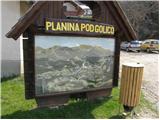 2
2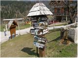 3
3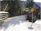 4
4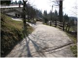 5
5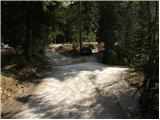 6
6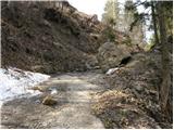 7
7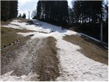 8
8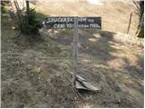 9
9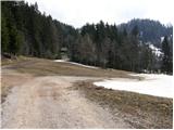 10
10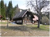 11
11 12
12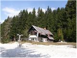 13
13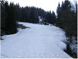 14
14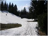 15
15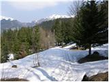 16
16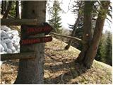 17
17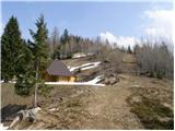 18
18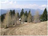 19
19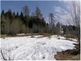 20
20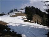 21
21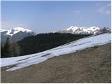 22
22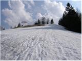 23
23 24
24
Discussion about the trip Planina pod Golico - Španov vrh
|
| Edina28. 04. 2014 |
Today I went on this nice walk, continued towards Zavetišče GRS and descended back to Planina pod Golico past Križovec and Savske jame. It might be important for some that the road from Planina pod Golico towards Križovec is still impassable, but from Javorniški rovt to Križovec it is already passable. I don't know about the direction from Prihodi. Some impressions from the path
http://stezeinsledi.blogspot.com/2014/04/spanov-vrh_28.html
|
|
|
|
| Jusk1. 06. 2020 |
I started the trail from the bottom of the valley, from Murova past Zgornje Pejce to Prihode, then part of the way to the parking lot under the cable car along the road, just before this parking lot there is an unmarked cart track up towards the ski area, which eventually gets lost because it becomes very overgrown. A few minutes of off-trail straight up and you reach the hut on Črni vrh, then it's just a short way to the top around Španov vrh there are still quite a few blooming narcissus around Španov vrh there are still quite a few blooming narcissus
|
|
|
|
| di1. 12. 2024 16:51:18 |
We also conquered Triglavček.
Mostly the approach is on a cart track, the last meters are pathless.
From the top, with the pre-New Year's fir tree, there is a nice view also to Golica.
The path to Španov vrh is an unmarked marked path (if you go along the road, otherwise it is pathless).
This time too we struggled finding the path or rather walked "around". We also used the PZS map at 1:25,000 scale, which is not worth it for detailed use (it obviously serves mainly those interested in where the mostly known peaks are, e.g. Stol, Golica), as despite the more accurate scale it has too many blank spots despite existing peaks (not to mention actual unmarked paths).
The official hiking signpost indicates 0.5h to Črni vrh (the highest peak in the Španov vrh area), actually you need about 1h more (if you don't miss the junction).
Current conditions: For more worry-free walking on the road (without slips and falls), especially when descending, we recommend crampons.
|
|
|
|
| Majdag29. 11. 2025 10:02:24 |
26.11.--Planina pod Golico - GRS - Španov vrh, circular path...
Hikers from DU Jav. Kor. Bela headed towards Španov vrh. Before the steep ascent to the summit, we took the path to the left. It is nice, gradually ascends and leads us to the GRS station. There is about 20 cm of snow and the atmosphere is really wintry. Then we descended the slope and soon we were at Španov vrh. Great wandering and nice company. Good luck.
https://jelenkamenmajdag.blogspot.com/2025/11/na-spanov-vrh-krozna-pot.html
|
|
|
To post a comment you must log in:
If you do not yet have a username, you must first
register.