Planina Podvežak - Deska (Veža)
Starting point: Planina Podvežak (1500 m)
| Latitude/Longitude: | 46,33190°N 14,67260°E |
| |
Walking time: 1 h 30 min
Difficulty: easy unmarked way
Elevation gain: 470 m
Elevation difference along the route: 470 m
Map: Kamniške in Savinjske Alpe 1:50.000
Recommended equipment (summer):
Recommended equipment (winter): ice axe, crampons
Views: 16.345
 | 1 person like this post |
Access to starting point:
First, we drive to Luče, and then we continue driving into the Podvolovjek valley (direction Kamnik and Kranjski Rak). At the road marker between 11 and 11.5 km, we will get to a smaller intersection, where a road towards the Planinšek farm and mountain pastures Podvežak, Ravne and Vodole branches off to the right (turn-off is marked). We go on this initially still asphalted road, which at the intersections we follow in the direction of the mountain pasture Podvežak. On a relatively long and in the upper part also worse macadam road we will get to the parking lot below the mountain pasture Podvežak (by the starting point are a gate and numerous mountaineering signposts).
From Kamnik we drive towards the mountain pass Črnivec, but only to an intersection, where the road towards Kranjski Rak branches off sharply to the left (turn-off is marked and is located only 500 meters before the mentioned mountain pass). At the intersection at Kranjski Rak we continue straight on the main road which starts descending into the Podvolovjek valley. In the mentioned valley we will only 100 meters behind bar Gams come to an intersection, where the road towards the Planinšek farm and mountain pastures Podvežak, Ravne and Vodole branches off to the left (turn-off is marked). Further, we follow the description above.
Route description:
From the parking lot, we go on a footpath (or road) in the direction of the mountain pasture Podvežak. Both the road and the footpath, which during the ascent crosses a forest road, bring us in 15 minutes of moderate ascent to the shepherd's hut on the mountain pasture Podvežak, from which a beautiful view opens up towards Rogatec and Lepenatka.
From the mountain pasture, we continue on a marked but initially poorly visible path, which soon goes into the forest. The path through the forest ascends a bit more steeply, then passes into a smaller unvegetated valley, above which it entirely flattens. Next follows a few minutes of crossing the slopes below the side ridge of Deska, then the path brings us to a less noticeable junction, where a somewhat narrower path branches off to the left, which leads towards Deska and Vodotočno Lake.
We continue on the mentioned path, which starts ascending diagonally towards the saddle between Deska and Tolsti vrh. From the point where we left the wider marked path, we first ascend through a belt of dwarf pines, then over increasingly panoramic grassy slopes. Next follows a somewhat steeper diagonal ascent over a smaller scree slope and the path brings us to the already previously mentioned saddle.
Here we continue left (straight Vodotočno Lake, right Tolsti vrh) and continue the path initially on a somewhat steeper grassy slope, which flattens already after a few dozen steps. Next follows approximately 5 minutes of easy walking on the gentle grassy slope of the mountain.

Photos:
 1
1 2
2 3
3 4
4 5
5 6
6 7
7 8
8 9
9 10
10 11
11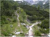 12
12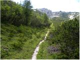 13
13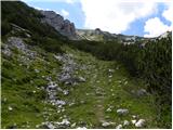 14
14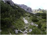 15
15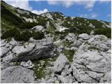 16
16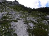 17
17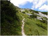 18
18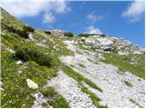 19
19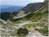 20
20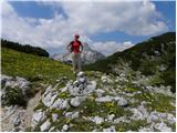 21
21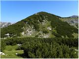 22
22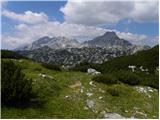 23
23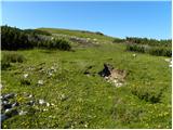 24
24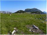 25
25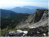 26
26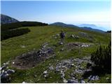 27
27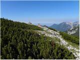 28
28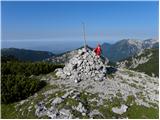 29
29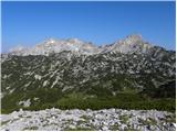 30
30
Discussion about the trip Planina Podvežak - Deska (Veža)
|
| garmont24. 10. 2012 |
This path is now marked as well.
The markers continue further to Vodotočnik, where they join the already marked path to Korošica.
|
|
|
|
| šošo20. 07. 2017 |
I'm wondering if there's a summit logbook and stamp at the top
|
|
|
|
| legenda20. 07. 2017 |
There is no logbook or stamp at Deska.
|
|
|
|
| šošo22. 07. 2017 |
Thanks for the reply. But I'm also interested how much further it is to the Vodoročni pond?
|
|
|
|
| jprim22. 07. 2017 |
Yes, to Vodotočnik, depending on how fast you go, , if you descend from Veža, quite quickly, approximately 10 minutes or even less. Another interesting path is if you continue to Lučki dedec and to Korošica. , if you descend from Veža, quite quickly, approximately 10 minutes or even less. Another interesting path is if you continue to Lučki dedec and to Korošica.
LP!
|
|
|
|
| Planinecizgg20. 02. 2020 |
Hello,
has anyone been to Deska recently, as I'm interested if crampons and ice axe are needed. Best regards.
|
|
|
To post a comment you must log in:
If you do not yet have a username, you must first
register.