Planina Podvežak - Planjava (via Škarje)
Starting point: Planina Podvežak (1500 m)
| Latitude/Longitude: | 46,33190°N 14,67260°E |
| |
Route name: via Škarje
Walking time: 4 h 45 min
Difficulty: difficult marked way
Elevation gain: 892 m
Elevation difference along the route: 1100 m
Map: Kamniške in Savinjske Alpe 1:50.000
Recommended equipment (summer): helmet
Recommended equipment (winter): helmet, ice axe, crampons
Views: 18.524
 | 2 people like this post |
Access to starting point:
First, we drive to Luče, and then continue driving into the Podvolovjek valley (direction Kamnik and Kranjski Rak). At the road marker between 11 and 11.5 km, we will arrive at a smaller intersection, where a road towards the farm Planinšek and mountain pastures Podvežak, Ravne and Vodole branches off to the right (turn-off is marked). We head onto this initially still asphalted road, which we follow at the intersections in the direction of the mountain pasture Podvežak. After a relatively long and in the upper part also poorer macadam road, we will arrive at the parking lot below the mountain pasture Podvežak (at the starting point there is a barrier and numerous mountaineering signposts).
From Kamnik we drive towards the mountain pass Črnivec, but only to an intersection, where the road towards Kranjski Rak branches off sharply to the left (turn-off is marked and is located only 500 m before the mentioned pass). At the intersection at Kranjski Rak we continue straight on the main road, which starts descending into the Podvolovjek valley. In the mentioned valley we will arrive only 100 m after bar Gams at an intersection, where the road towards the farm Planinšek and mountain pastures Podvežak, Ravne and Vodole branches off to the left (turn-off is marked). Further, follow the above description.
Route description:
From the parking lot, we head onto the footpath (or road) in the direction of the mountain pasture Podvežak. Both the road and the footpath, which during the ascent crosses a forest road, bring us in 15 minutes of moderate ascent to the shepherd's hut on the mountain pasture Podvežak, from which a beautiful view opens up towards Rogatec and Lepenatka.
From the mountain pasture, we continue on a marked but initially poorly visible path, which soon enters the forest. The path through the forest ascends somewhat more steeply, then passes into a smaller unvegetated valley, above which it flattens out completely. There follows a few minutes of crossing the slopes below the side ridge of Deska, then the path brings us to a less noticeable junction, where an unmarked path branches off to the left towards Deska and Vodotočno jezero. We continue straight on the marked path, which descends into a pleasant grassy plain, then turns somewhat to the right and ascends through a belt of dwarf pines. At the top of the ascent, the path from mountain pasture Vodole joins us from the right, and we continue left, cross the grazing fence and after a few more steps arrive at Inkretov studenec, which is located just a few meters from the path.
There follows only a slight ascent, then the path flattens again and brings us below the relatively steep and in snow avalanche-prone slopes of Tolsti vrh. A little further, the pleasant path brings us to a marked junction, where we continue slightly left in the direction of Korošica (slightly right chapel on Molička peč (mountain pasture)). The path ahead crosses the slopes below Tolsti vrh for some time longer, then passes onto the plateau-like terrain of Dleskovška planota, which is crisscrossed with numerous sinkholes and caves. The path, continuing with some shorter ascents and descents, then quickly brings us to a junction, where the path from Robanov kot and mountain pasture Ravne joins from the right side.
We continue in the direction of Korošica on the path which ascends across to the saddle between the less known Koroški vrh on the left and Mala Ojstrica on the right. We continue straight downhill (left Prag, right Ojstrica via Mala Ojstrica) on the marked path, which starts descending towards Korošica. After a few minutes of descent, we step onto the expansive grassy slopes of Korošica, across which we then walk in a few minutes to the mountain hut.
From Kocbekov dom we continue on the marked path in the direction of Ojstrica. The path already a few meters above the hut enters a belt of dwarf pines, where it gradually begins to ascend more and more steeply. After a good 20 minutes of ascent from Kocbekov dom, the path flattens, passing onto grassy slopes which are soon replaced by scree. The path ahead crosses two successive gullies, then begins to ascend more steeply on the increasingly panoramic slope. The path ahead brings us to a less noticeable junction, where we continue left in the direction towards Planjava and Škarje (right Ojstrica). Further, the path turns slightly to the left, crosses a relatively crumbly gully, then passes onto less steep slopes, across which we ascend to the saddle Škarje in a few minutes of further walking.
On the saddle Škarje, the inscription on the rock directs us left. The path ascends steeply and retreats from the ridge somewhat to the south side. We approach the ridge again and ascend a partly grassy slope. The path then bypasses the summit of Baba (Lučka Brana 2244 m), to which from the marked path we have only a few minutes of ascent. The path then becomes less steep and later descends somewhat while crossing the south slopes. At the end, the path turns left and becomes somewhat more demanding again for a short time. During the ascent we cross steep slopes below the summit of Planjava, then arrive at a junction where we join the other paths to Planjava. At the junction, we head right and only a short ascent follows on the summit slope of the mountain.

Photos:
 1
1 2
2 3
3 4
4 5
5 6
6 7
7 8
8 9
9 10
10 11
11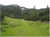 12
12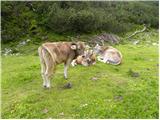 13
13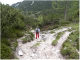 14
14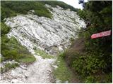 15
15 16
16 17
17 18
18 19
19 20
20 21
21 22
22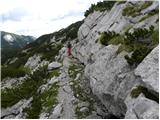 23
23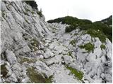 24
24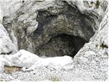 25
25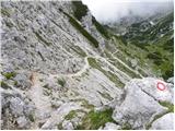 26
26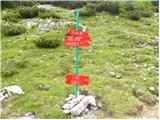 27
27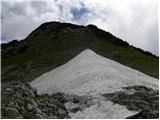 28
28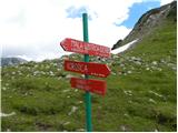 29
29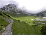 30
30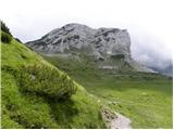 31
31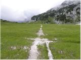 32
32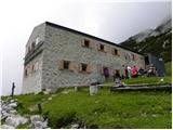 33
33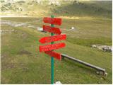 34
34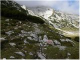 35
35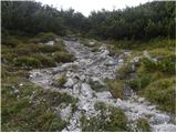 36
36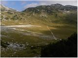 37
37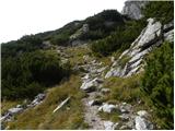 38
38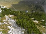 39
39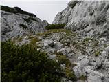 40
40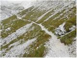 41
41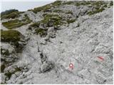 42
42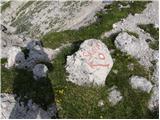 43
43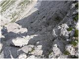 44
44 45
45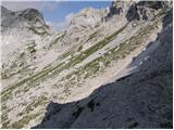 46
46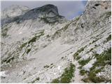 47
47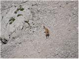 48
48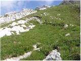 49
49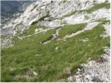 50
50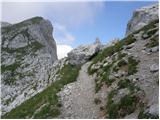 51
51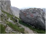 52
52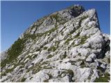 53
53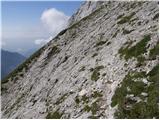 54
54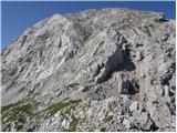 55
55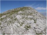 56
56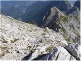 57
57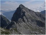 58
58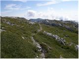 59
59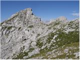 60
60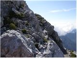 61
61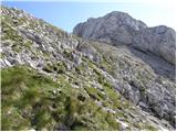 62
62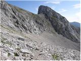 63
63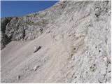 64
64 65
65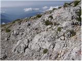 66
66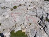 67
67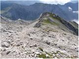 68
68 69
69
Discussion about the trip Planina Podvežak - Planjava (via Škarje)
|
| ločanka24. 07. 2016 |
Nice hike, you just have to be careful to find the right Lučka baba so you don't celebrate too early. There are several peaks with rocky pyramids on top. The path from Škarje onwards is sparsely marked, mainly the marks are very faded, probably last renewed decades ago.
|
|
|
|
| Gregor Celje27. 08. 2016 |
Between Škarje and the summit, the markers are really completely faded. Not recommended in fog or rain.
|
|
|
To post a comment you must log in:
If you do not yet have a username, you must first
register.