Planina Podvežak - Planjava (via Srebrno sedlo)
Starting point: Planina Podvežak (1500 m)
| Latitude/Longitude: | 46,33190°N 14,67260°E |
| |
Route name: via Srebrno sedlo
Walking time: 4 h 15 min
Difficulty: difficult marked way
Elevation gain: 892 m
Elevation difference along the route: 1100 m
Map: Kamniške in Savinjske Alpe 1:50.000
Recommended equipment (summer): helmet
Recommended equipment (winter): helmet, ice axe, crampons
Views: 60.208
 | 2 people like this post |
Access to starting point:
First, we drive to Luče, then continue driving into the Podvolovjek valley (direction Kamnik and Kranjski Rak). At the road marker between 11 and 11.5 km, we will reach a smaller intersection, where the road to the Planinšek farm and mountain pastures Podvežak, Ravne and Vodole branches off to the right (the turn-off is marked). We head onto this initially still asphalted road, following it at the intersections in the direction of the Podvežak mountain pasture. Along a relatively long and in the upper part also poorer macadam road, we will reach the parking lot below the Podvežak mountain pasture (at the starting point there is a barrier and numerous hiking signposts).
From Kamnik we drive towards the Črnivec pass, but only to the intersection where the road to Kranjski Rak branches off sharply to the left (the turn-off is marked and is located only 500 m before the mentioned pass). At the intersection at Kranjski Rak we continue straight on the main road, which starts descending into the Podvolovjek valley. In the mentioned valley, just 100 m past the Gams bar, we will come to an intersection where the road to the Planinšek farm and mountain pastures Podvežak, Ravne and Vodole branches off to the left (the turn-off is marked). Continue as per the above description.
Route description:
From the parking lot, we head onto the footpath (or road) in the direction of the Podvežak mountain pasture. Both the road and the footpath, which crosses a forest road during the ascent, bring us in 15 minutes of moderate ascent to the shepherd's hut on the Podvežak mountain pasture, from which a beautiful view opens towards Rogatec and Lepenatka.
From the mountain pasture we continue on the marked but initially poorly visible path, which soon enters the forest. The path through the forest ascends somewhat more steeply, then transitions into a smaller treeless valley, above which it completely flattens. There follows a few minutes of traversing the slopes below the side ridge of Deska, then the path brings us to a less noticeable junction, where an unmarked path branches off to the left towards Deska and Vodotočno Lake. We continue straight on the marked path, which descends into a pleasant grassy plain, then turns slightly to the right and ascends through a belt of dwarf pines. At the top of the ascent, the path from the Vodole mountain pasture joins from the right; we continue left, cross the grazing fence and after a few more steps reach Inkret's spring, which is located just a few meters off the path.
There follows only a gentle ascent, then the path flattens again and brings us below the relatively steep slopes of Tolsti vrh, which are avalanche-prone in snow. A bit further, the pleasant path brings us to a signposted junction, where we continue slightly left towards Korošica (slightly right is the chapel on Molička peč (mountain pasture)). The path ahead traverses the slopes below Tolsti vrh for a while longer, then transitions onto the plateau-like terrain of the Dleskovška planota, which is riddled with numerous sinkholes and pits. The path, continuing with some shorter ascents and descents, quickly brings us to a junction where the path from Robanov kot and the Ravne mountain pasture joins from the right.
We continue towards Korošica on the path that ascends across to the saddle between the lesser-known Koroški vrh on the left and Mala Ojstrica on the right. We continue straight downhill (left Prag, right Ojstrica via Mala Ojstrica) on the marked path, which begins descending towards Korošica. After a few minutes of descent we step onto the expansive grassy slopes of Korošica, along which we then walk in a few minutes to the mountain hut.
From Kocbekov dom we continue in the direction of Planjava and Kamniško sedlo. The path ahead first descends slightly, then through a series of smaller valleys in a gentle ascent brings us to the steeper section of the path. The path then ascends alongside the gully upwards and crosses it higher up. During the ascent ever new views open up, and a natural window catches our eye. The path then transitions from grassy to rocky slopes, where we quickly enter the secured section of the path. The well-secured and partly quite steep path then brings us to Srebrno sedlo, where a fine view opens onto the Kamnik side. There follows a traverse of the slopes to the west, which we cover in a moderate ascent. Further on we reach the next junction, where we continue right towards the summit of Planjava (left Kamniško sedlo). From the increasingly panoramic path the green meadows finally give way to gray rock. Just below the summit, paths from Klemenča jama and Kamniško sedlo also join. There remains only a short ascent along the summit slope of the mountain.
Podvežak - Korošica 2:15, Korošica - Planjava 2:00.

Photos:
 1
1 2
2 3
3 4
4 5
5 6
6 7
7 8
8 9
9 10
10 11
11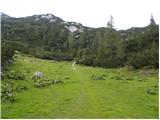 12
12 13
13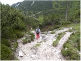 14
14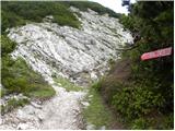 15
15 16
16 17
17 18
18 19
19 20
20 21
21 22
22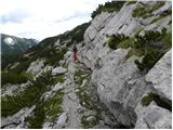 23
23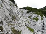 24
24 25
25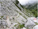 26
26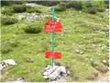 27
27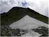 28
28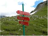 29
29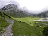 30
30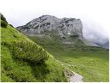 31
31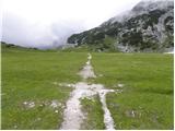 32
32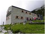 33
33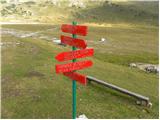 34
34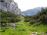 35
35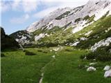 36
36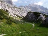 37
37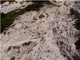 38
38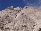 39
39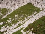 40
40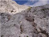 41
41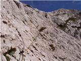 42
42 43
43 44
44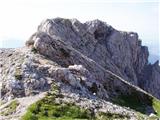 45
45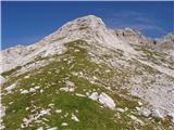 46
46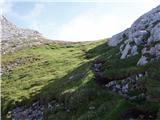 47
47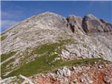 48
48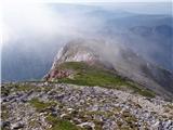 49
49 50
50
Discussion about the trip Planina Podvežak - Planjava (via Srebrno sedlo)
|
| lepenatka17. 06. 2011 |
Hello,
has anyone hiked the above mentioned path these days?
What are the conditions like?
BEST regards to all
|
|
|
|
| Betoner18. 07. 2012 |
Yesterday nice weather, at Korošica there are 2 small sheep, the ascent to Planjava is quite a steep climb.
|
|
|
|
| tiffernus25. 11. 2012 |
Today for the end of November it was really incredible weather - sunshine, almost completely windless, around 10 C. Below the summit there are some patches of snow, but they don't hinder walking. Nice trip.
|
|
|
|
| baxon12. 09. 2013 |
Hi,
I'm interested if there are any pegs on this path and if it's exposed?
Thanks for the reply
|
|
|
|
| otiv3. 09. 2013 |
@baxon1 look above at pictures 41 and 42 and you'll see the situation. On this section the path is steep, but not precipitous.
Good luck!
|
|
|
|
| Rokovnjacica3. 09. 2013 |
Where on the above mentioned path and on the upper pictures is Srebrno sedlo? And how to get to it from the Kamnik end via the valley of Bela? 
|
|
|
|
| Rokovnjacica3. 09. 2013 |
and also is the path suitable for those afraid of heights?
|
|
|
|
| otiv3. 09. 2013 |
Srebrno sedlo is on pictures 45 and 46, you reach it via the path from Korošica if you intend to go over Presedljaj. If you have vertigo, I advise against the route, especially if you're hiking alone.
Good luck!
|
|
|
|
| Rokovnjacica3. 09. 2013 |
Otiv, thanks! If it's steep it doesn't worry me, cliffs worry me.
|
|
|
|
| Rokovnjacica3. 09. 2013 |
Are there cliffs along the path or not? Please Otiv tell me this too... Please Otiv tell me this too...
|
|
|
|
| otiv3. 09. 2013 |
@Rokovnjacica you have ZS
|
|
|
|
| ločanka24. 07. 2016 |
Nice path, especially the lower part above Petkove njive is full of flowers at this time, a real botanical garden. To those who find walking on steep scree unpleasant and slippery, I would advise against descending. Srebrno sedlo is a wonderful place to sit and enjoy!
|
|
|
|
| Dariny27. 12. 2017 |
is this a difficult route, exposed? thanks...planning to go up in summer...thanks 
|
|
|
|
| geppo28. 12. 2017 |
The route is not difficult nor exposed. There are some pitons and cables when ascending from Korošica towards Srebrno sedlo but it's not hard.
regards
|
|
|
|
| darinka428. 12. 2017 |
I was there in summer. First time. Didn't seem difficult to me. A bit exposed from Planjava to Kamniško sedlo.
|
|
|
|
| mersudin18. 07. 2019 |
Yesterday on this path to Planjava, super weather and trip, sadly the hut at Korošica looks...
|
|
|
|
| skiro12316. 08. 2019 |
Markings on the trail from Korošica to Planjava are very faded. As long as the trail is clearly visible there are no problems, but in the last part (past Srebrno sedlo) concentration is needed to avoid straying. Accordingly, I do not recommend it in case of poor visibility.
|
|
|
|
| Planinecizgg14. 04. 2020 |
Hello,
which path is easier and less exposed to Planjava, the one from Kamniško sedlo or this one and Korošice?
Best regards!
|
|
|
|
| garmont14. 04. 2020 |
This one, described above.
|
|
|
|
| zokipoki16. 04. 2020 |
Planinecizgg in my opinion it is not only less exposed, but also more beautiful than from Kamniško sedlo, as the path from Korišica to the summit is practically strewn with flowers and beautiful grasses. To me the most beautiful marked one to Planjava. Good luck!
|
|
|
|
| Planinecizgg9. 05. 2020 |
Thanks for this answer.
When the snow melts I'll definitely go up this path this year.
|
|
|
|
| 12a3bc20. 10. 2024 12:36:11 |
Is the path dry? And over Ojstrica too?
|
|
|
|
| Tomco20. 10. 2024 16:05:54 |
|
|
|
To post a comment you must log in:
If you do not yet have a username, you must first
register.