Planina Polog - Vrh Škrli (via planina Dobrenjščica)
Starting point: Planina Polog (457 m)
| Latitude/Longitude: | 46,23800°N 13,72320°E |
| |
Route name: via planina Dobrenjščica
Walking time: 4 h 35 min
Difficulty: easy pathless terrain
Elevation gain: 1469 m
Elevation difference along the route: 1469 m
Map: Julijske Alpe - zahodni del 1:50.000
Recommended equipment (summer):
Recommended equipment (winter): ice axe, crampons
Views: 3.217
 | 2 people like this post |
Access to starting point:
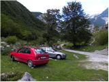
First, we drive to Tolmin, from there we follow the road in the direction of Zatolmin (we leave the main road at the traffic light). In Zatolmin, we notice the signposts for Javorca, which direct us onto an ascending road towards Javorca. The occasionally quite narrow and in places precipitous road brings us, after approximately 8 km of driving, to a smaller intersection, where the road towards Javorca branches off to the left uphill. We continue straight, we follow the road only for approximately another 100 m, then at a suitable spot next to the barrier we park.
Route description:
From the starting point, we continue on a macadam road (road is closed to public traffic), which after a few minutes of easy walking brings us to the central part of the mountain pasture, where there are a few cottages. Behind the mountain pasture, the road becomes even a little worse, and after a few minutes of further walking it brings us to a junction, where to the right branches off the path towards the mountain pasture Planina na Prodih (access to the mountain pasture is very interesting, as we have to cross the river Tolminka, which is enabled by a manual cableway). We continue straight, and the road eventually turns into a cart track and higher into a well-preserved mule track. The path then becomes somewhat steeper and past two benches and higher past a fresh rocky outcrop (earthquake in Posočje 1998) brings us to a grazing fence, over which we step onto the southern edge of the mountain pasture under Osojnica. Just a few meters further, the path splits into two parts. We continue on the right lower path, by which in a gentle descent we quickly arrive at the hunting cottage at the source of Tolminka.
From the source of Tolminka we continue with a gentle ascent across the mountain pasture under Osojnica, and from the left the upper path soon joins us, which is exposed to active rocky debris.
We continue in the direction "planina Prode in Prehodci" on the path that brings us to a mighty torrent bed where there is again a junction.
At the junction we continue right following the signs »Planina Prode« and beside the dam we cross the wide bed of the torrent. On the other side of the bed there is again a junction. This time we continue left, to the right leads the path towards Planina Prode. The path then briefly leads through the forest parallel to the torrent bed, then turns right and begins to ascend. Later the path brings us to a small clearing, then a somewhat steeper ascent through the forest begins. In the continuation, we ascend in switchbacks through the forest for quite some time. Higher, the forest becomes somewhat sparser on some sections and increasingly beautiful views begin to open up. The path then turns right and in the ascent crosses the slopes towards the southeast. From the forest we reach slopes somewhat overgrown with nettles and scrub, and the final ascent to the hunting cottage on Planina Dobrenjščica follows.
At the hunting cottage we continue left towards the northwest and the path soon brings us to a marked junction. To the right uphill leads the path towards Koča na planini Razor, we continue left and further cross the slope towards the northwest. Along the path we will soon notice a poorly visible pathlet that leads left downhill towards a spring (marked with the inscription »Voda 40m«). From here we continue another good 100 meters along the path, then we will notice to the right uphill a narrow strip that is not overgrown with dwarf pines. Here we leave the marked path and head straight uphill along the dwarf pines. In the continuation we then steeply ascend alongside the dwarf pines uphill until we reach a poorly trodden path. On the path we continue right and then begin to ascend in switchbacks uphill. The path here is marked with a few cairns and brings us from the dwarf pines onto rocky slopes. The path becomes even somewhat less visible and turns somewhat right towards the east. Just below the ridge we will spot a military bunker towards which we ascend. From here follows a short ascent to the saddle between the summits Kser and Vrh Škrli, where we reach the marked path that leads to Tolminski Kuk.
We continue left (right Tolminski Kuk) along a poorly visible and unmarked pathlet, by which in less than 5 minutes of further walking we ascend to the panoramic summit.

Photos:
 1
1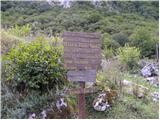 2
2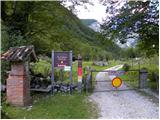 3
3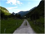 4
4 5
5 6
6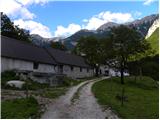 7
7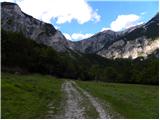 8
8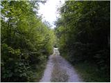 9
9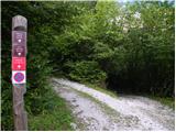 10
10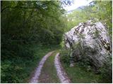 11
11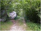 12
12 13
13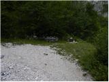 14
14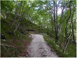 15
15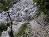 16
16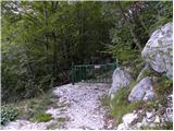 17
17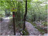 18
18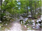 19
19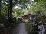 20
20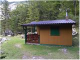 21
21 22
22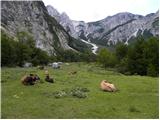 23
23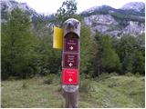 24
24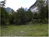 25
25 26
26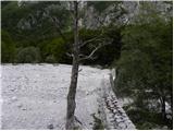 27
27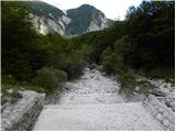 28
28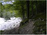 29
29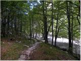 30
30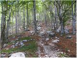 31
31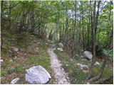 32
32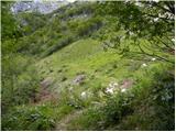 33
33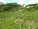 34
34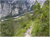 35
35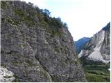 36
36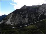 37
37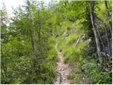 38
38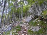 39
39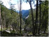 40
40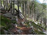 41
41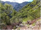 42
42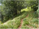 43
43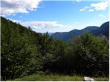 44
44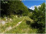 45
45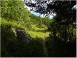 46
46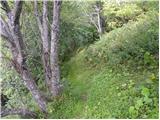 47
47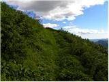 48
48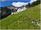 49
49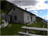 50
50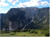 51
51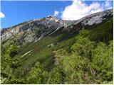 52
52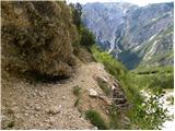 53
53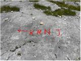 54
54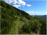 55
55 56
56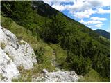 57
57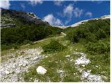 58
58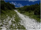 59
59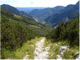 60
60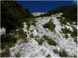 61
61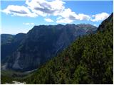 62
62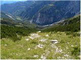 63
63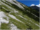 64
64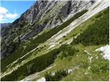 65
65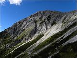 66
66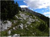 67
67 68
68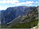 69
69 70
70 71
71 72
72 73
73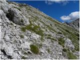 74
74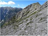 75
75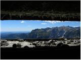 76
76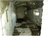 77
77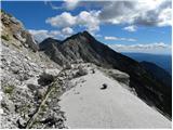 78
78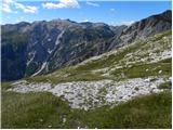 79
79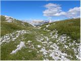 80
80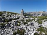 81
81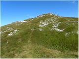 82
82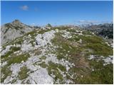 83
83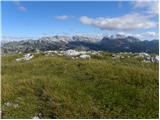 84
84
Discussion about the trip Planina Polog - Vrh Škrli (via planina Dobrenjščica)
|
| darinka44. 06. 2020 |
Yesterday we went to the saddle just below Vrh Škrli summit. We had been here last year. Visited the casemate right below the summit. Probably many don't know about it. We chose new paths, namely from Planina Kal we turned left towards Krn. Before the path turns down past the hunters' hut on Dobrenjščica, in the bend there is an inscribed old path, which looks quite overgrown. Continuing through scree, where you had to go carefully, with a fixed rope in places for help, we found a hunting path leading to the cavern below Vrh Škrli.
|
|
|
|
| padez4. 06. 2020 |
I think on the rock at the Vrh Škrli saddle there is "bivak" written and an arrow showing the direction down a poorly trodden path that takes us in a couple of minutes to the Italian border casemate dug into the hill that you mention, very useful for quick retreat from the ridge in case of sudden weather deterioration. Of course the marking is poorly visible, it should be renewed, even better to put up a signpost...
|
|
|
To post a comment you must log in:
If you do not yet have a username, you must first
register.