Planina Ravne - Križevnik
Starting point: Planina Ravne (1500 m)
| Latitude/Longitude: | 46,34930°N 14,69970°E |
| |
Walking time: 2 h
Difficulty: easy unmarked way
Elevation gain: 409 m
Elevation difference along the route: 475 m
Map: Kamniške in Savinjske Alpe 1:50.000
Recommended equipment (summer):
Recommended equipment (winter): ice axe, crampons
Views: 42.482
 | 2 people like this post |
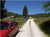
Access to starting point:
A) First, we drive to Kamnik, and then we continue driving towards Stahovica and mountain pass Črnivec. A few 100 meters before the mountain pass Črnivec we leave the main road which leads towards Gornji Grad and we continue driving sharply left in the direction of the mountain pass Volovljek (Kranjski Rak). From the mentioned mountain pass we continue straight (left road which leads to Velika planina, right Štajerski Rak) and start descending towards Luče. Lower down the road flattens a little and brings us into the valley Podvolovljek. Further on we first drive past the turn-off of the road which leads into the valley of Lučka Bela, after that also past the bar Pri Gamsu. After the bar, we need to pay attention, because only a few 100 meters further the road which leads towards the mountain pasture Podvežak and mountain pasture Ravne and farm Planinšek branches off to the left (at the spot where we leave the main road there is a road sign approximately 11 km). Further, we drive on a road that is at first still asphalt, which then ascends towards the plateau Dleskovška planota. Higher, the road towards Planinšek branches off to the right, and here we continue on the upper left road, which a few 100 meters further from the turn-off towards the farm Planinšek becomes macadam, and a little further it brings us to the next crossroad, where we continue straight in the direction of the mountain pasture Ravne (left mountain pasture Podvežak). Further on a somewhat rougher road, then we follow to the beginning of the mountain pasture Ravne, where we park on an appropriate place by the road.
From the main road to the mountain pasture Ravne is approximately 10 km, of this approximately 4 km macadam.
B) First, we drive to Luče, and then we continue driving towards Kamnik. When by the road we notice a road sign which shows 10.5 km, we need to pay attention to the right turn-off, because only a little further to the right the road towards the mountain pasture Podvežak and Ravne and farm Planinšek branches off. Further, we drive on a road that is at first still asphalt, which then ascends towards the plateau Dleskovška planota. Higher, the road towards Planinšek branches off to the right, and here we continue on the upper left road, which a few 100 meters further from the turn-off towards the farm Planinšek becomes macadam, and a little further it brings us to the next crossroad, where we continue straight in the direction of the mountain pasture Ravne (left mountain pasture Podvežak). Further on a somewhat rougher road, then we follow to the beginning of the mountain pasture Ravne, where we park on an appropriate place by the road.
From the main road to the mountain pasture Ravne is approximately 10 km, of this approximately 4 km macadam.
Route description:
From the starting point through the mountain pasture we walk to the shepherd hut, which we bypass on the right side, so that we continue in the direction of the mountain pasture Molička planina and mountain pasture Polšak (on the left side of the hut leads the path over Dolga trata). Behind the hut the path is at first a little hard to follow, but the blazes help us, and a little ahead we join the cart track which from the road on the mountain pasture Ravne branches off at the right turn.
When we step on the cart track we continue left, on it we at first walk without large changes in altitude, then we start gently to moderately ascending. After a few minutes we reach an indistinct saddle between Dleskovec on the left and Smrekovec on the right. Here from the right joins the path from the end of the road, and we continue straight over the grazing fence. Behind the grazing fence follows a short traverse, then we arrive at the next marked junction, where we continue straight in the direction of the mountain pasture Polšak (left Korošica, Molička planina, by the junction there are signs for mountain hut Lučka koča). Even though the turn-off is marked, the path further is no longer marked, exceptions are occasional unofficial signs with a red line.
After a short initial ascent the path flattens, then for some time it lightly descends, further it crosses slopes towards the right. When the traverse ends we reach an indistinct little valley, where to the right branches off the path to the nearby hunting cottage, and we continue left and ascend through the little valley, where the path leads past the water catchment. Through a pleasant little valley surrounded by sparse larch forest we gently to moderately ascend, then already after a few minutes we reach the mountain pasture Polšak, in the middle of which there is a newer shepherd hut (the old one burned down).
From the hut we continue somewhat to the right (direction north), then we return to the sparse larch forest, and the path after a few minutes brings us to a wooden trough with water, where usually the water flows very slowly, as it is a small spring. During the gentle ascent dwarf pines join the larches, and somewhat higher, on a small grassy clearing we arrive at a junction, where we continue on the slightly right path (slightly left Veliki vrh, Jamarski bivak...), so that we bypass the small sinkhole on the right side. Further the path starts to ascend transversely mostly towards the right, occasionally it ascends more steeply as well. Higher the path passes among the dwarf pines and gradually brings us with ever better views alongside the ridge of Križevnik, alongside which it continues all the way to the very scenic and precipitous summit.
Planina Ravne - mountain pasture Polšak 1:00, mountain pasture Polšak - Križevnik 1:00.
Description and pictures refer to the condition in the year 2016 (August).

Photos:
 1
1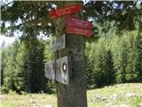 2
2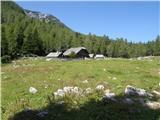 3
3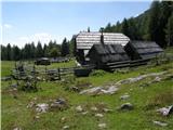 4
4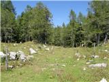 5
5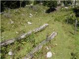 6
6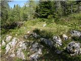 7
7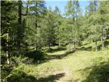 8
8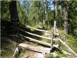 9
9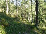 10
10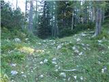 11
11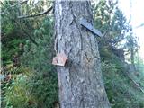 12
12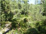 13
13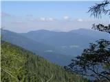 14
14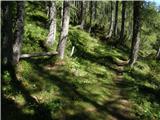 15
15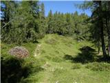 16
16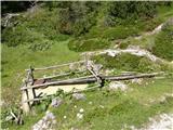 17
17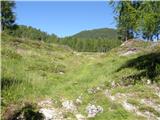 18
18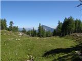 19
19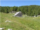 20
20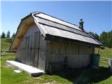 21
21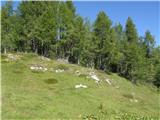 22
22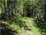 23
23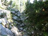 24
24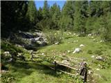 25
25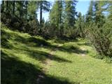 26
26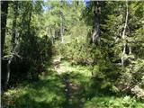 27
27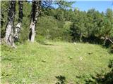 28
28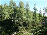 29
29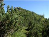 30
30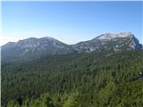 31
31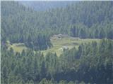 32
32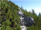 33
33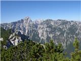 34
34 35
35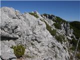 36
36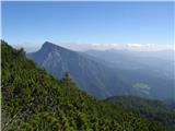 37
37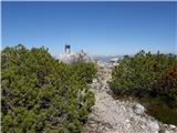 38
38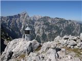 39
39
Discussion about the trip Planina Ravne - Križevnik
|
| fpetel115. 10. 2008 |
Summit with the best view of Ojstrica (sharp shape) and Krofička and Ute. At the summit, like at Veliki vrh, there is a miniature Aljaž tower. No summit logbook.
|
|
|
|
| fpetel115. 10. 2008 |
Well, the trail is incomparable. Below, no orientation issues due to red marks along the trail, but towards the summit you need to pay attention because there are several paths (no cairns) leading into the dwarf pines. When the path below the ridge branches towards the summit, I built a cairn (none in the vicinity, and it's the most important junction). Hope it stands for a while.
|
|
|
|
| geppo16. 10. 2008 |
We on 11.10.08 went right a bit earlier and then had quite a struggle with the dwarf pines. That way we almost directly reached the summit. But it was quite liked by some participants, as they faced dwarf pines in such a way for the first time. And it was interesting for them to search for passages in this overgrown world.
LP
|
|
|
|
| fpetel116. 10. 2008 |
I went straight to the ridge, where the overpowering dwarf pines stopped me, and descended about 20 meters to the junction, built a cairn on the right path and went to the summit. The path to Molička peč branches off a bit lower.
|
|
|
|
| geppo16. 10. 2008 |
fpetel1
have you already done that trail I described (Lastovec...Vodotočnik ..)? I recommend it to you - just without the ascent to Veliki vrh. It is extremely nice and you make a nice loop!
LP
|
|
|
|
| fpetel116. 10. 2008 |
No, but I was just thinking yesterday - from Podvežak up. Maybe I'll take my girlfriend along too, if she has time then down under the wall of Lastovec  Maybe a detour to Lučki dedec (that's likely if I go alone or with some colleague from the A course). But Križevnik really charmed me yesterday Maybe a detour to Lučki dedec (that's likely if I go alone or with some colleague from the A course). But Križevnik really charmed me yesterday 
|
|
|
|
| geppo16. 10. 2008 |
If you go from Podvežak, first under the wall of Lastovec (opposite to our path) - watch out not to miss the LEFT junction (wooden gate is visible. I would upload a photo for you if you don't know - but nothing works??
Best regards
|
|
|
|
| damijanp13. 10. 2014 |
The path is nice and fairly easy to follow. Even in the upper part, it's practically impossible to miss. Need to watch out at three spots: where the path to Polšak branches right from the path to Molička peč (probably picture 5, although there was no sign for Planina Polšak), at Planina Polšak itself, where you need to head straight towards Križevnik (the arrow is poorly visible, but there's a larger red dot nearby), and at the branch from picture 17, where you turn right. Further towards Molička peč there are no major difficulties, as the dwarf pines are fairly freshly cut.
We continued to Velika Zelenica and Veliki vrh, where the path gets lost on the scree, but no major issues.
Pictures at:
Križevnik - Molička peč - Velika Zelenica - Veliki vrh
|
|
|
|
| golica22. 07. 2017 |
I have a question... if you visit Križevnik, would you then like to visit Veliki vrh as well... or make a circular route back to the starting point at Planina Ravne, if anyone knows these paths, is it feasible? Thanks for advice/opinions
|
|
|
|
| ben22. 07. 2017 |
Of course it's possible. From Križevnik along the ridge to Polske device and further to Velika Zelenica and Veliki vrh. Descend via the marked path to the connecting path between pl. Ravne and Molička peč and return to the starting point. You can return via Dleskovec or below it to Dolge Trate or directly to pl. Ravne. A map will help.
|
|
|
|
| jprim22. 07. 2017 |
Many people don't know that this path is the easiest access to Veliki vrh.
Best regards!
It is really longer though.
|
|
|
|
| golica22. 07. 2017 |
Excellent description, clear. Thank you!
|
|
|
|
| golica26. 07. 2017 |
I agree, is this the path as described by ben ?? nothing serious, even if it's longer,
|
|
|
|
| jprim26. 07. 2017 |
Yes, the whole thing can be done, the path to Planina Polšak like in a fairy tale. When you reach the mountain pasture, you have to be careful not to miss it. We went right of the hut a few years ago, got lost, looked for passages up and down .... well, in the end we reached the marked path to Velika Zelenica. In short, it's like this: on the pasture go right, there's a cairn at the start of the path. The path is followable for some time, keep to the right. After a small ascent you reach a slightly flat path where the paths split. Left leads to VZ, right to Križevnik. You have a choice. If you go to Križevnik, try to find the ridge path all the way to Zelenica. Maybe the dwarf pines have overgrown it all, otherwise descend back to the junction. One more thing to watch: the last ascent to Velika Zelenica, when you reach under the summit-to the saddle, turn a bit left then right, don't crawl along the ridge itself, which we did, is a bit exposed.
I hope your tour succeeds, I plan to repeat it during the time of yellow larches.
Best regards! Jelica
|
|
|
|
| jprim26. 07. 2017 |
Correcting the comment: on the pasture you have to go right, not left. My eternal problem L .
|
|
|
|
| Borut128. 08. 2017 |
The path to Planina Polšak is really nice, but you have to watch the junctions. The turn-off to Planina Polšak is now well marked. I suggest that one of the local hikers puts up a sign at least at the garden where the path turns sharply right. We missed that turn-off too. Another place that would be good to mark is where the path from Planina Polšak turns into the forest. Future hikers will thank you.
|
|
|
|
| jprim29. 08. 2017 |
This is personally my most beautiful fairy-tale wedding.
Cheers!
|
|
|
|
| Petr17. 10. 2017 |
Well, the little tower on the summit is no longer there. Did someone take it away (?!) or push it over the wall.
|
|
|
|
| ljubitelj gora19. 10. 2018 |
I saw today that the tower on the summit is no longer there. Otherwise, the larches are fully glowing, so up as soon as possible. Road OK.
|
|
|
|
| sv6628. 10. 2018 |
Due to the rainy period that started yesterday, we used Friday afternoon to see the larch paradise from Planina Ravne via Planina Polšak to Križevnik. We were probably the last this year to still enjoy the beautiful colors that larches display in autumn.
|
|
|
|
| sv6628. 10. 2018 |
Pictures are under current conditions (couldn't upload them here).
|
|
|
|
| ločanka28. 10. 2018 |
they do fit there too
|
|
|
|
| sv6629. 10. 2018 |
It's true ločanka...that's because of my superficial reading of the instructions...next time I'll be more careful...lp
|
|
|
|
| felix13. 10. 2025 15:56:37 |
I'm curious if the larches from Planina Ravne to Križevnik are already yellow. Thanks.
|
|
|
|
| nina413. 10. 2025 16:05:39 |
Yesterday from Planina Podvežak towards Deska they were just starting to turn yellow, so in the next week or two they will be the most beautiful.
|
|
|
|
| cojma3. 11. 2025 23:01:01 |
Has anyone been to Križevnik these days? What are the conditions like?
|
|
|
To post a comment you must log in:
If you do not yet have a username, you must first
register.