Planina Ravne - Lučki Dedec
Starting point: Planina Ravne (1580 m)
| Latitude/Longitude: | 46,35742°N 14,70033°E |
| |
Walking time: 4 h
Difficulty: partly demanding unmarked way
Elevation gain: 443 m
Elevation difference along the route: 750 m
Map: Kamniške in savinjske Alpe 1:50.000
Recommended equipment (summer):
Recommended equipment (winter): ice axe, crampons
Views: 3.914
 | 2 people like this post |
Access to starting point:
A) First, we drive to Luče, then continue driving into the Podvolovljek valley (direction Kamnik and Kranjski Rak). At the road marker between 11 and 11.5 km, we will arrive at a smaller intersection, where the road towards the Planinšek farm and mountain pastures Podvežak, Ravne and Vodole branches off to the right (turn-off is marked). We turn onto this initially still asphalted road, which we follow at the intersections in the direction of the mountain pasture Ravne. After a relatively long and in the upper part also worse macadam road, we will arrive at the mountain pasture Ravne (possible starting point). We drive a little further on occasionally quite bad macadam road, which we then follow to the parking lot at the end of the road (to here is 11 km of driving from the valley, of which 10 km macadam).
B) From Kamnik we drive towards the Črnivec pass, but only to the intersection where the road branches off sharply to the left towards Kranjski Rak (turn-off is marked and is located only 500 m before the mentioned pass). At the intersection at Kranjski Rak we continue straight on the main road, which starts descending into the Podvolovljek valley. In the mentioned valley only 100 m behind the Gams bar we will arrive at an intersection, where the road towards the Planinšek farm and mountain pastures Podvežak, Ravne and Vodole branches off to the left (turn-off is marked). Further, we follow the above description.
Route description:
From the parking lot at the end of the road, we continue left on the cart track, which at first slightly ascends. Already after two minutes of walking the cart track turns into a footpath, which barely noticeably descends on an indistinct wide gentle ridge. After less than ten minutes of walking the path from the mountain pasture Ravne joins us (possible access also on this path) and turns right. We cross a grazing fence and follow the path, which on the left side bypasses the fenced abyss, only a few dozen steps further. Here we come to a junction, where we continue left in the direction of Lučka koča, Korošica and Molička planina (straight Planina Polšak). The path ahead slightly descends into a smaller valley in which cold air is retained. The path at the end of the valley turns slightly right and ascends to benches at the monument to the fallen fighters.
The path ahead mostly moderately ascends, only occasionally descends for a short time. On the path that we ascend, nice views occasionally open towards the peaks on the north of the Dleskovška planota. After a good hour of walking the path brings us to Sedelce (1840 m), where the path from the mountain pasture Dolga Trata joins us. We continue a few more meters ahead on the path, which slightly descends to the sign for Molička planina and Korošica.
We continue straight in the direction of Korošica and Molička planina on the path, which occasionally slightly descends and rises again. The path ahead circles the slopes of Veliki vrh and brings us to a junction, where the path to the mentioned peak branches off right upwards. Here we continue straight on the path, which a little further brings us to the saddle Prag, where the next junction is. We continue straight (sharply left Planina Podvežak) on the marked mountain path, which gradually starts to descend. After more than 10 minutes of descent the path levels out and brings us to a smaller marsh, behind which we come to the next junction. We continue slightly left in the direction of Korošica (straight Molička planina, right Robanov kot) on a pleasant mountain path, which starts moderately ascending. The path higher turns somewhat to the left, then the path from Planina Podvežak joins. We continue right in the direction of Korošica on the traverse path, by which in a few minutes of further walking we ascend to Sedelce (1900 m), where there is a marked junction.
We continue straight downhill (left Prag, right Ojstrica via Mala Ojstrica) on the marked path, which starts descending towards Korošica. After a few minutes of descent we step onto the expansive grassy slopes of Korošica, on which we then walk in a few minutes to the mountain hut.
From Kocbekov dom we continue left in the direction of Podvolovljek and Kamniška Bistrica on the path, which starts first gently then moderately ascending towards the saddle Prag. After approximately 15 minutes of walking we step onto the mentioned saddle (we can also reach here directly from Sedelce, so we do not need to descend to Kocbekov dom, this shortens the path by approximately 15 minutes), we follow the marked path a few more 10 m to the place where the signs for Lučki Dedec direct us right onto the unmarked path.
At the place where we notice the signs for Lučki Dedec we leave the marked path and continue the ascent on the initially well-visible track. The path ahead continues through a smaller valley, then turns right and steeply ascends. Further the track, along which there are numerous cairns, starts to fade, but in good weather this does not cause us orientation problems. Follows ascent over smaller rocky terrain, then the path transitions to grassy slopes surrounded by dwarf pines. Here we will already notice on the right one of the three peaks of Lučki Dedec, we continue straight on the path, which brings us to the main ridge. On the ridge we continue slightly left and the path past the second subpeak quickly brings us to a large meadow, on which we ascend in a few steps to the precipitous peak.
Planina Ravne - Kocbekov dom 3:00, Kocbekov dom - Lučki Dedec 1:00.

Photos:
 1
1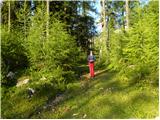 2
2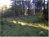 3
3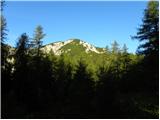 4
4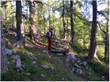 5
5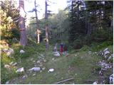 6
6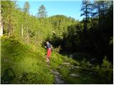 7
7 8
8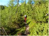 9
9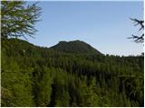 10
10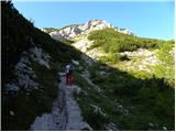 11
11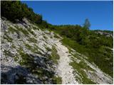 12
12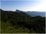 13
13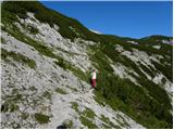 14
14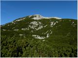 15
15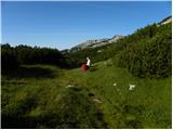 16
16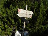 17
17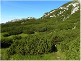 18
18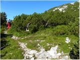 19
19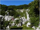 20
20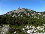 21
21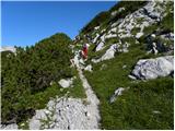 22
22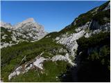 23
23 24
24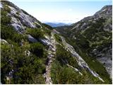 25
25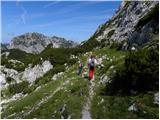 26
26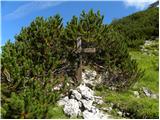 27
27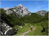 28
28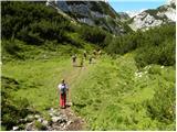 29
29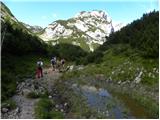 30
30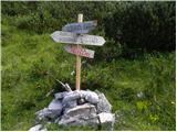 31
31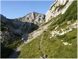 32
32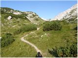 33
33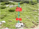 34
34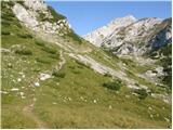 35
35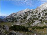 36
36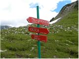 37
37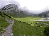 38
38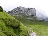 39
39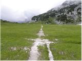 40
40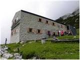 41
41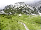 42
42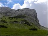 43
43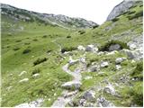 44
44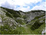 45
45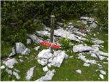 46
46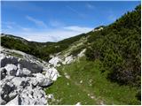 47
47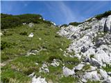 48
48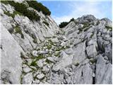 49
49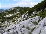 50
50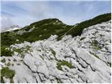 51
51 52
52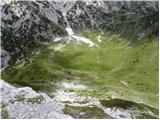 53
53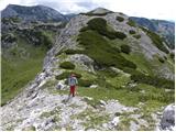 54
54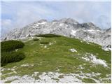 55
55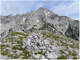 56
56
Discussion about the trip Planina Ravne - Lučki Dedec
To post a comment you must log in:
If you do not yet have a username, you must first
register.