Planina Ravne - Molička peč (via planina Polšak)
Starting point: Planina Ravne (1500 m)
| Latitude/Longitude: | 46,34930°N 14,69970°E |
| |
Route name: via planina Polšak
Walking time: 2 h 25 min
Difficulty: easy pathless terrain
Elevation gain: 529 m
Elevation difference along the route: 600 m
Map: Kamniške in Savinjske Alpe 1:50.000
Recommended equipment (summer):
Recommended equipment (winter): ice axe, crampons
Views: 19.097
 | 2 people like this post |
Access to starting point:
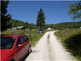
A) First, we drive to Kamnik, and then we continue driving towards Stahovica and mountain pass Črnivec. A few hundred meters before the mountain pass Črnivec we leave the main road which leads towards Gornji Grad and we continue driving sharply left in the direction of the mountain pass Volovljek (Kranjski Rak). From the mentioned mountain pass we continue straight (left road which leads to Velika planina, right Štajerski Rak) and start descending towards Luče. Lower down the road flattens a little and brings us into the valley Podvolovljek. Further we first drive past the turn-off of the road which leads into the valley of Lučka Bela, after that also past the bar Pri Gamsu. After the bar, we need to pay attention, because only a few hundred meters further a road which leads towards the mountain pasture Podvežak and mountain pasture Ravne and farm Planinšek branches off to the left (by the spot, where we leave the main road, there is a road sign approximately 11 km). Further, we drive on at first still asphalt road which is then ascending towards the plateau Dleskovška planota. Higher, the road towards Planinšek branches off to the right, and here we continue on the left upper road which a few hundred meters further from turn-off towards the farm Planinšek becomes a macadam, and a little further it brings us to the next crossroad, where we continue straight in the direction of the mountain pasture Ravne (left mountain pasture Podvežak). Further on a somewhat worse road, we then follow to the beginning of the mountain pasture Ravne, where we park on an appropriate place by the road.
From the main road to the mountain pasture Ravne is approximately 10 km, of which approximately 4 km macadam.
B) First, we drive to Luče, and then we continue driving towards Kamnik. When by the road we notice a road sign which shows 10.5 km, we need to pay attention to the right turn-off, because only a little further to the right a road towards the mountain pasture Podvežak and Ravne and farm Planinšek branches off. Further, we drive on at first still asphalt road which is then ascending towards the plateau Dleskovška planota. Higher, the road towards Planinšek branches off to the right, and here we continue on the left upper road which a few hundred meters further from turn-off towards the farm Planinšek becomes a macadam, and a little further it brings us to the next crossroad, where we continue straight in the direction of the mountain pasture Ravne (left mountain pasture Podvežak). Further on a somewhat worse road, we then follow to the beginning of the mountain pasture Ravne, where we park on an appropriate place by the road.
From the main road to the mountain pasture Ravne is approximately 10 km, of which approximately 4 km macadam.
Route description:
From the starting point through the mountain pasture we walk to the shepherd hut, which we bypass on the right side, so that we continue in the direction of Molička planina and mountain pasture Polšak (on the left side of the hut leads the path over Dolga trata). Behind the hut, the path is at first a little harder to follow, but the blazes help us, and a little ahead we join the cart track which from the road on the mountain pasture Ravne branches off at the right bend.
When we step on the cart track we continue left, on it we at first walk without major changes in altitude, and then we start gently to moderately ascending. After a few minutes, we reach an indistinct saddle between Dleskovec on the left and Smrekovec on the right. Here from the right joins the path from the end of the road, and we continue straight across the grazing fence. Behind the grazing fence follows a short crossing, and then we arrive at the next marked junction, where we continue straight in the direction of the mountain pasture Polšak (left Korošica, Molička planina, by the junction there are signs for Lučka koča). Although the turn-off is marked, the path further on is no longer marked, exceptions are occasional unofficial signs with a red line.
After a short initial ascent the path flattens, then for some time it gently descends, further it crosses slopes towards the right. When the crossing ends, we reach an indistinct little valley, where to the right branches off the path to the nearby hunting hut, and we continue left and ascend through the little valley, where the path leads past the water catchment. Through a pleasant little valley, surrounded by sparse larch forest we gently to moderately ascend, and then after a few minutes we reach mountain pasture Polšak, in the middle of which there is a newer shepherd hut (the old one burned down).
From the hut we continue somewhat to the right (direction north), then we return to the sparse larch forest, and the path after a few minutes brings us to a wooden trough with water, where usually the water flows very slowly, as it is a small spring. During the gentle ascent the dwarf pines join the larches, and somewhat higher, on a small grassy clearing we arrive at a junction, where we continue on the left path (right path leads to Križevnik, which is approximately 30 minutes from the junction).
From here onwards the path turns even somewhat more to the left, the larches by the path are increasingly replaced by dwarf pines, but the path is all the time nicely traceable and passable. After a shorter crossing we reach a grassy section, where there are several piles of cut dwarf pines and an ingenious small bench. From the mentioned section a nice view opens towards Dleskovec, Veliki vrh and Velika Zelenica, the path then returns to the belt of dwarf pines, through which the crossing continues. After some time the crossing ends, and the path starts to ascend more steeply and occasionally also to disappear, but with some care it can be followed. Higher the path becomes on a few shorter sections more rocky and gradually again less steep. When the path completely flattens, to the right opens a relatively nice passage towards the summit of Molička peč, to which there is a good 10 minutes of ascent.
From the place where we leave the trodden path we ascend a partly grassy slope which is surrounded by dwarf pines, so we carefully follow the cairns and look for passages, which are, if we left the path at the most suitable place, relatively easy. When we reach the summit we are rewarded with an exceptional view of the mountains above Robanov kot.
Description and pictures refer to the condition in the year 2016 (August).

Photos:
 1
1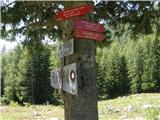 2
2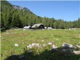 3
3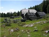 4
4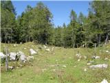 5
5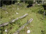 6
6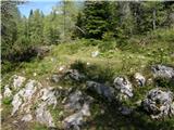 7
7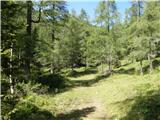 8
8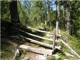 9
9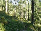 10
10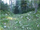 11
11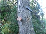 12
12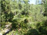 13
13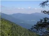 14
14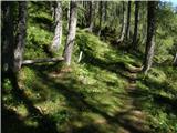 15
15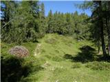 16
16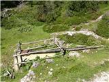 17
17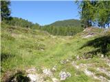 18
18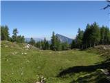 19
19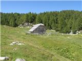 20
20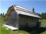 21
21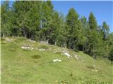 22
22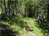 23
23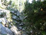 24
24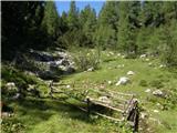 25
25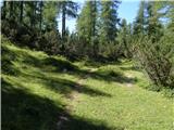 26
26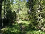 27
27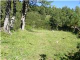 28
28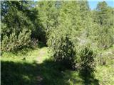 29
29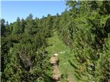 30
30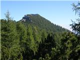 31
31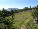 32
32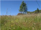 33
33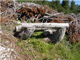 34
34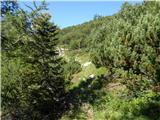 35
35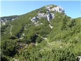 36
36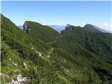 37
37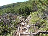 38
38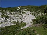 39
39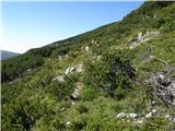 40
40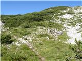 41
41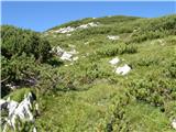 42
42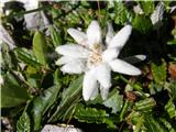 43
43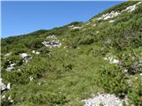 44
44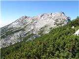 45
45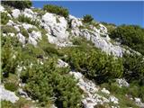 46
46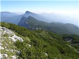 47
47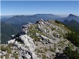 48
48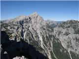 49
49
Discussion about the trip Planina Ravne - Molička peč (via planina Polšak)
|
| Matija G2. 08. 2020 |
Good path description, I followed it without major issues. Only at the final ascent to the summit I didn't find it well, I climbed the scree gully from the southeast side, which led me to the ridge somewhat east of the summit from where crossing to the summit along the exposed ridge is quite nasty due to scrub. Easier to find passages through the scrub, which is actually not as dense as it looks from the path below.
And one more thing - on the path from Ravne to Polšak I noticed several unusually large fresh footprints. On the meadow with piles of sawn scrub you describe, I stumbled upon several sheep skeletons, probably from last year. So I recommend loud walking.
|
|
|
|
| veja52. 08. 2020 |
Interesting,
But at the end of February a bit above Planina Ravne I almost stepped on a bigfoot's foot. My and his tracks crossed. In the snow there were fresh tracks. Size of shoe 42, just 2x wider.
Regards. Venčeslav.
|
|
|
|
| zago2. 08. 2020 |
Slaughter of sheep above Podvolovljek
Štefka Sem, 23.6.2020 10:24:00
End of last week a wolf or pack of wolves, possibly also pack of wolf and stray dogs in the area of Polšak and below Križevnik above Podvolovljek killed 20 sheep and lambs
Bear is also occasionally observed in this area.
Therefore caution is not superfluous and stick to the path and especially keep dogs on leashes.
Safe steps to all.
|
|
|
|
| Enka2. 08. 2020 |
One question. If you go along this path from Molička peč towards Planina Ravne, and your car is parked under Pl. Podvežak, which option to the car is the best (shortest, nicest, least strenuous  ). ).
|
|
|
|
| garmont2. 08. 2020 |
You definitely have to go past Planina Polšak to the junction with the marked path Ravne-Veliki vrh. Here you turn right (left to Planina Ravne...). You follow this path for quite some time to the saddle below Veliki vrh, where the new signposts direct you left towards Podvežak.
|
|
|
|
| Enka2. 08. 2020 |
Aha, so that's the most optimal one? That's where it's another 20 minutes to Ravne, right? Well, that's how we went too
|
|
|
|
| garmont2. 08. 2020 |
That's right.
There is also, about halfway from Planina Polšak, an unmarked branch to the right that takes you much higher up on the marked path Ravne-Veliki vrh...
|
|
|
|
| iUnknown2. 08. 2020 |
@Zago, this area is known for a pack of wolf-dog hybrids lingering there.
https://sasa-novice.si/v-zgornje-savinjski-dolini-se-vedno-tezave-zaradi-zveri/
According to some information I couldn't verify from multiple sources, they even attacked a woman in the parking lot. From the same source I heard that around December 26, 2019, three hybrids were shot on Planina Dol. I'm still trying to verify this too, but I have the bad luck that whenever I walk there, I don't meet any hunters, even though I know which cabins they're in.
|
|
|
|
| iUnknown2. 08. 2020 |
It happened to me in winter too, that some animals followed me in the dark when I was returning via Planina Dol from Rzenik. Definitely not roe deer, because roe deer don't follow you, especially not at a distance of a few meters. Despite the strong light, I only managed to see the reflection of their eyes, so I really don't know what it was.
|
|
|
|
| zago2. 08. 2020 |
Yes, Unknown, yes, some statements are true. I summarized this message from the Savinjske novice article. Hybrids were indeed shot last year. I can assure you from reliable sources. But the she-wolf was not shot. It is known that last year this pack spent most of its time in the Lučka Bela area. There is a possibility that she has created a new one. Therefore caution is not superfluous.
|
|
|
|
| iUnknown7. 08. 2020 |
Those from Lučka Bela most likely also go under Rzenik and to planina Dol.
Today I went along the ridge above planina Dol and below Rzenik. There is some unmarked path there, where very few people go and therefore it is not overly trodden. At some places you also have to study exactly where it goes.
But I did not go on that path but above it, where there are quite a few animal tracks and paths. And among them I noticed completely fresh "dog" tracks. But since there are very likely no stray dogs there, one could conclude that they were either jackals or wolves.
|
|
|
To post a comment you must log in:
If you do not yet have a username, you must first
register.