Planina Ravne - Molička peč (via Zelene trate)
Starting point: Planina Ravne (1500 m)
| Latitude/Longitude: | 46,34930°N 14,69970°E |
| |
Route name: via Zelene trate
Walking time: 2 h 25 min
Difficulty: easy pathless terrain
Elevation gain: 529 m
Elevation difference along the route: 550 m
Map: Kamniške in Savinjske Alpe 1:50.000
Recommended equipment (summer):
Recommended equipment (winter): ice axe, crampons
Views: 42.200
 | 3 people like this post |
Access to starting point:
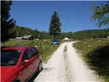
A) First, we drive to Kamnik, and then we continue driving towards Stahovica and the Črnivec pass. A few hundred meters before the Črnivec pass we leave the main road which leads towards Gornji Grad and we continue driving sharply left in the direction of the Volovljek pass (Kranjski Rak). From the mentioned pass we continue straight (left road which leads to Velika planina, right Štajerski Rak) and start descending towards Luče. Lower down, the road flattens a little and brings us into the Podvolovljek valley. Further on, at first we drive past the turn-off of the road which leads into the Lučka Bela valley, after that also past the bar Pri Gamsu. After the bar, we need to pay attention, because only a few hundred meters further a road which leads towards the mountain pasture Podvežak and mountain pasture Ravne and farm Planinšek branches off to the left (by the spot where we leave the main road, there is a road sign approximately 11 km). Further, we drive on the initially still asphalt road which then ascends towards the Dleskovška planota plateau. Higher, the road towards Planinšek branches off to the right, and here we continue on the left upper road which a few hundred meters further from the turn-off towards the farm Planinšek becomes macadam, and a little further it brings us to the next crossroad, where we continue straight in the direction of the mountain pasture Ravne (left mountain pasture Podvežak). Further on a somewhat rougher road, we then follow to the beginning of the mountain pasture Ravne, where we park on an appropriate place by the road.
From the main road to the mountain pasture Ravne is approximately 10 km, of which approximately 4 km macadam.
B) First, we drive to Luče, and then we continue driving towards Kamnik. When by the road we notice a road sign which shows 10.5 km, we need to pay attention to the right turn-off, because only a little further to the right a road towards the mountain pasture Podvežak and Ravne and farm Planinšek branches off. Further, we drive on the initially still asphalt road which then ascends towards the Dleskovška planota plateau. Higher, the road towards Planinšek branches off to the right, and here we continue on the left upper road which a few hundred meters further from the turn-off towards the farm Planinšek becomes macadam, and a little further it brings us to the next crossroad, where we continue straight in the direction of the mountain pasture Ravne (left mountain pasture Podvežak). Further on a somewhat rougher road, we then follow to the beginning of the mountain pasture Ravne, where we park on an appropriate place by the road.
From the main road to the mountain pasture Ravne is approximately 10 km, of which approximately 4 km macadam.
Route description:
From the starting point we walk across the mountain pasture to the shepherd's hut, which we bypass on the right side, so that we continue in the direction of Molička planina and Polšak mountain pasture (on the left side of the hut leads the path over Dolga trata). Behind the hut, the path is at first somewhat harder to follow, but the blazes help us, and a little ahead we join the cart track which branches off from the road on Planina Ravne at the right bend.
When we step on the cart track we continue left, on it at first we walk without major changes in elevation, then we start gently to moderately ascending. After a few minutes we reach an indistinct saddle between Dleskovec on the left and Smrekovec on the right. Here from the right another path from the end of the road joins us, and we continue straight across the grazing fence. Behind the grazing fence follows a short crossing, then we arrive at the next marked junction, where we continue left in the direction of Lučka koča, straight to Planina Polšak.
The path ahead continues through a series of several smaller valleys, then it brings us to the NOB monument, by which there are benches with a table. From here onward the path ascends somewhat more steeply, and somewhat higher the first nice views already open towards Križevnik, Raduha and the surrounding mountains. Higher we moderately ascend for some time through belts of brushwood, then the path flattens and brings us to Sedelce, where from the left the path over Dolga trata joins.
Here we continue straight and for a short time still continue on the marked path towards Korošica and Molička planina, then we continue right in the direction of the marked path to Veliki vrh. The path ahead leads through an indistinct valley eastward, then northeast of Veliki vrh. When the marked path to Veliki vrh turns left towards the slope, we continue straight on the subsequently worse path or partly pathless terrain. Here on the right we notice Jamarski bivak, to which there is a good 10 minutes of descent, and we continue with crossing the slopes of Velika Zelenica. After a few minutes we reach a somewhat wider path, on it we continue to the notch between Velika Zelenica on the left and Molička peč on the right. From the notch, from which a nice view opens, the path first moderately ascends, then crosses the slopes of Molička peč. In the second part of the crossing, before the path starts descending, a nice passage opens to the left towards the summit of Molička peč, to which about 10 minutes of ascent on a moderately steep slope surrounded by brushwood separates us.
Description and pictures refer to the condition in 2016 (August).

Along the route: Sedelce (1840m)
Photos:
 1
1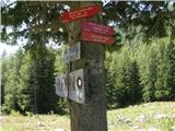 2
2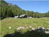 3
3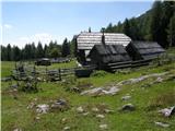 4
4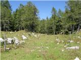 5
5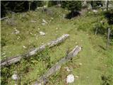 6
6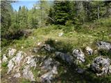 7
7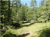 8
8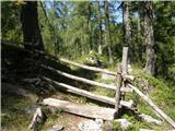 9
9 10
10 11
11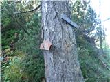 12
12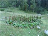 13
13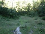 14
14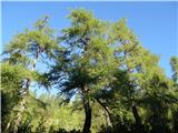 15
15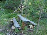 16
16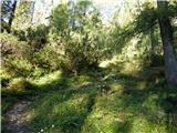 17
17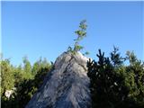 18
18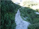 19
19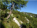 20
20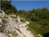 21
21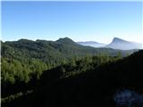 22
22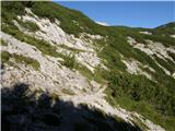 23
23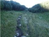 24
24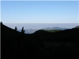 25
25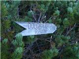 26
26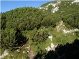 27
27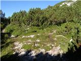 28
28 29
29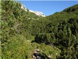 30
30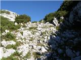 31
31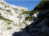 32
32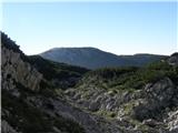 33
33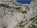 34
34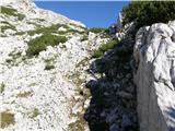 35
35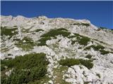 36
36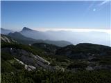 37
37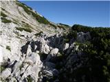 38
38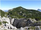 39
39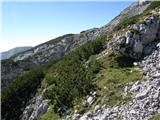 40
40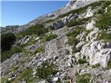 41
41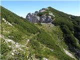 42
42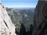 43
43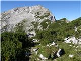 44
44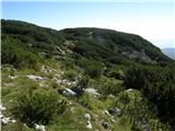 45
45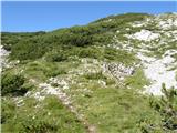 46
46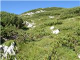 47
47 48
48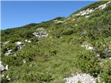 49
49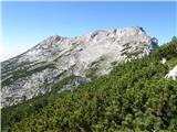 50
50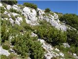 51
51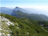 52
52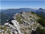 53
53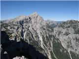 54
54
Discussion about the trip Planina Ravne - Molička peč (via Zelene trate)
|
| Stingray28. 08. 2010 |
The GPS coordinates of this summit are 300 meters further west than indicated and are:
46.364449°N / 14.672131°E
I am also attaching a picture of the GPS export of the above-mentioned path in Google Earth:
PICTURE
|
|
|
|
| Irina31. 12. 2012 |
And again an accident happened. The hikers didn't go from Sedlec, but still. Think again where you will go if you plan to visit the high mountains these days. Be careful and return safely to the valley.
Article transcript
Planica was carried away by an avalanche yesterday afternoon around 17:30 on the path from Robanov kot to Molička peč. They were rescued by members of the Celje mountain rescue service and handed over to the Celje emergency medical rescuers, who took them to Celje hospital, the RS Administration for Protection and Rescue reported.
|
|
|
|
| tropine10. 11. 2015 |
HELLO MOUNTAIN LOVERS
I'm interested if the road Podvolovjek- Planina -podvežak and ravne towards Molička is open because I would start from there to moličko peč -chapel and Ojstrica. Was it closed due to road collapse? L.P.
|
|
|
|
| slainter10. 11. 2015 |
Greeting,
The road to planina Podvežak or planina Ravni is drivable and asphalted to the Planinšek farm since June this year. Just courageously on the path and good luck!
|
|
|
|
| otiv10. 11. 2015 |
The road Kranjski Rak (Volovljek) - Podvolovljek is closed.
|
|
|
|
| potka10. 11. 2015 |
At the road closure we turned around and went via Gornji grad, Luče.. a bit more driving, but it was worth it
|
|
|
|
| Otzi21. 05. 2017 |
Is there perhaps a GPS track for this path or at least marked on the map? Today I went from Krizevnik to Molička peč then at the notch instead of higher under Velika Zelenica I turned too far down. Then I didn't want to go back and descended to the cavers' bivouac, down through the stone bridge and towards Zelene trate.
But I'd still like to know about the path described here, as it's probably easier to traverse.
|
|
|
|
| garmont22. 05. 2017 |
You've figured it out well yourself. From the col you continue on a worse trail upwards towards the summit of Velika Zelenica. Higher up the path splits, one part goes along the ridge slightly exposed to the summit, the other part crosses almost horizontally to the junction with the marked path to Veliki vrh.
|
|
|
|
| 30625. 06. 2017 |
Hello. I'm providing information that the road to the starting point is closed due to seasonal grazing. I recommend the Podvežak starting point.
Best regards
|
|
|
|
| lepenatka25. 06. 2017 |
Up to where is driving still allowed?
Regards
|
|
|
|
| kati190925. 06. 2017 |
Lepenatka; I don't know what the problem is. You can drive by car to Planina Ravne; checked on Thursday (22nd)!
|
|
|
|
| lepenatka25. 06. 2017 |
So there's no problem Thanks. It seemed strange to me because it would be something new. I responded to the above entry 306.
Wishing you lots of enjoyment in the mountains.
Regina
|
|
|
|
| garmont25. 06. 2017 |
Well, if you want to park at Ravne you have to open (and close) the gate on the road.
In my opinion it's there for a reason...
|
|
|
|
| geppo26. 06. 2017 |
Parking at the planina ended a bit sadly for a friend. The paint on the car was quite damaged from rubbing by animals that were interested in the parked "wonder"!!!
|
|
|
|
| lepenatka26. 06. 2017 |
Yes, that can happen.
On our pastures there are quite a few "opportunities" for such events.
Good luck on the trails, by car or on foot.
Regina
|
|
|
|
| mirank26. 06. 2017 |
Not only on our pastures; I watched a bull with a nose ring licking dew on fine terrain on Viška planina. It rang nicely on the tin
|
|
|
|
| dr_63526. 06. 2017 |
Whoever is afraid for the car should park in front of the gate. But not in the middle of the road, but firmly behind the edge.
From the gate to the parking lot is 500-600 m.
|
|
|
|
| 3061. 07. 2017 |
Nice greeting. The closure comment was just info. Yes, probably can open and drive further but I didn't think it wise to push the car ahead among the heifers ... Whoever it suits, fine. The animal can have its peace too.
|
|
|
To post a comment you must log in:
If you do not yet have a username, you must first
register.