Planina Storeča raven - Planinska koča Merjasec
Starting point: Planina Storeča raven (1100 m)
| Latitude/Longitude: | 46,26510°N 13,86140°E |
| |
Walking time: 1 h 15 min
Difficulty: easy marked way
Elevation gain: 435 m
Elevation difference along the route: 435 m
Map: TNP 1:50.000
Recommended equipment (summer):
Recommended equipment (winter): ice axe, crampons
Views: 10.959
 | 2 people like this post |
Access to starting point:
From the Ljubljana–Jesenice motorway we take the Lesce exit and follow the road towards Bled and onwards towards Bohinjska Bistrica and Bohinjsko jezero. After the settlement Laški Rovt we reach a smaller junction where a road branches off to the left leading to the starting points of paths to Rodica, planina Suha, Šija, Vogel and to the Laški Rovt scout camp.
The gravel road immediately enters the forest and first ascends past the mentioned scout camp, then continues to climb relatively steeply for several kilometres. After less than 6.5 km of driving on gravel we reach a somewhat larger junction where we continue right (straight ahead, only about 50 metres further, is the starting point of the path to planina Suha, Rodica and Šija).
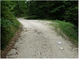
We continue on a somewhat poorer and narrower road that crosses several torrent beds. The road eventually brings us to the lower edge of planina Storeča raven, crosses it and returns to the forest on the other side. Only a few 100 metres further it brings us to a right-hand bend in the middle of which a track branches off to the left, where we notice signs for Vogel (a marked footpath to Vogel follows the track). Here the described path begins.
From the main road in the valley to the starting point is approximately 9 km of gravel, which is steep and rough in places, so careful driving is recommended (more suitable for vehicles with higher ground clearance).
Parking warning: The path runs within the area of Triglavski narodni park (TNP), where a strict regime applies and parking is permitted only in officially marked parking spaces. Since there is no officially marked parking space with traffic signage (blue sign with the letter P) at the starting point itself or along the road to the planina, parking along the entire route – including the roadside, passing places or grassy areas – is prohibited and is regularly fined. Visitors are therefore advised to leave vehicles in organised car parks (Javorje, Bohinjska Bistrica or Ribčev Laz) and continue on foot, which lengthens the route.
Route description:
From the road we turn onto the track towards Vogel, which at the beginning resembles a somewhat smaller torrent. After an initial gentle ascent the path brings us to a clearing after which the track turns into a footpath that begins to climb steeply. The path continues through dense forest and is in places somewhat harder to follow due to fallen trees. A little higher the gradient suddenly eases and a minute of level walking follows. The path next brings us to an area where a larger snow avalanche occurred and felled many trees. Once we cross this section the path turns right beneath the steep slopes of Storeči vrh and climbs steeply again. Further on the gradient eases and the path brings us to the edge of a ski slope. We cross a strip of stones and reach a triangular junction where we continue right towards the cable car. A little further we reach a wide track where we continue left for only a few metres. Soon the markings direct us right onto a footpath that quickly brings us in a gentle ascent to the upper station of the cable car.
We continue past the hotel and only a few metres further we see signs for koča Merjasec. We turn slightly left and in a few steps reach the hut.

Photos:
 1
1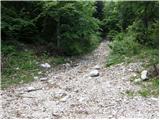 2
2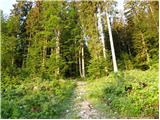 3
3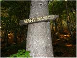 4
4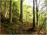 5
5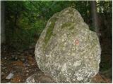 6
6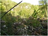 7
7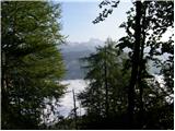 8
8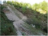 9
9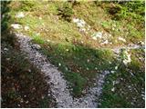 10
10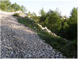 11
11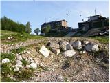 12
12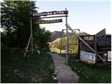 13
13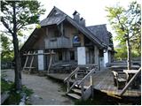 14
14
Discussion about the trip Planina Storeča raven - Planinska koča Merjasec
To post a comment you must log in:
If you do not yet have a username, you must first
register.