Planina Vetrh - Stegovnik
Starting point: Planina Vetrh (1185 m)
| Latitude/Longitude: | 46,39670°N 14,38580°E |
| |
Walking time: 3 h 15 min
Difficulty: easy unmarked way, partly demanding marked way
Elevation gain: 507 m
Elevation difference along the route: 600 m
Map: Karavanke - osrednji del 1:50.000
Recommended equipment (summer): helmet
Recommended equipment (winter): helmet, ice axe, crampons
Views: 2.101
 | 2 people like this post |
Access to starting point:
a) First, drive to Tržič, then continue towards Dovžan Gorge. Towards the end of Tržič, leave the road to Dovžan Gorge and continue right towards Lom pod Storžičem. Above Lom pod Storžičem, at the right hairpin, leave the main road leading higher to Grahovše and Dom pod Storžičem, and continue left towards the settlement of Potarje. Drive along the asphalt road to the intersection below the tourist farm pri Tič, where continue left towards Planina Konjščica. Then drive on the gravel road, from which a road soon branches left to the Pinč farm. Here go right on the upper road, which becomes noticeably worse; drive on it for quite some time to the next intersection. From the intersection continue straight on the lower road (right uphill Planina Konjščica), which shortly ahead crosses the Vetrnik stream. At the next intersection go left, then after 50 metres park at the marked parking lot on the edge of Planina Vetrh. From the intersection at the Lepenka factory in Tržič to the starting point is approximately 11 km, of which 6 km gravel.
b) First, drive to Tržič, then continue towards Dovžan Gorge. Continue through Dovžanovo soteska, Dolina to Jelendol, where at the triangular intersection continue on the right road towards Medvodje. A few kilometres further a road branches left towards Planina Zali potok, we drive along Tržiška Bistrica for some more time, specifically to the first access road right that crosses Tržiška Bistrica over a bridge. After the bridge, start ascending on the poorer gravel road, which is often in quite poor condition on individual sections. At intersections continue straight, then, when the road levels out, quickly arrive at the marked parking lot on the edge of Planina Vetrh, where park. From the intersection at the Lepenka factory in Tržič to the starting point is approximately 12.5 km, of which 3.7 km very poor gravel road, and there is even more gravel.
Route description:
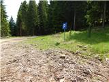
On the eastern side of the parking lot we notice a cart track that ascends through the forest to the nearby forest road, which we follow to the left. Along the road we quickly reach a right hairpin turn, from which a nice view opens towards Košuta, Plešivec and the surrounding mountains. Continuing, we first still get some views between the trees, then the path enters a fairly dense forest through which it ascends along the western slopes of Pečica (1421 m) and later Maljevec (1502 m). We do not walk along the slopes of Maljevec for long, as the road brings us to the valley of the Vetrnik stream. Over the bridge the road quickly passes to the left bank of the stream, then we ascend for a few minutes directly along the stream. When higher up the road crosses the stream again (this time without a bridge), a cart track branches off to the right, along which we can reach the hut pri Zdravc; we however continue along the road. A little further the road forks again, we choose the slightly left road, beside which there are signs for Planina Javornik (right hut pri Zdravc, Bela peč...). Continuing, the forest thins out, and the road soon brings us to a marked junction where a marked path from Dom pod Storžičem joins from the right.
Here we leave the road and continue in the direction of Stegovnik on a path that crosses the meadow. On the other side of the meadow the path enters the forest and continues along a cart track that mostly gently descends. After a while the cart track turns into a footpath that partly ascends, partly descends. The path, from which we have only rare views (mainly to the ridge of Košuta), brings us after some time to a pleasant bench. Further the path continues through the forest, which is occasionally interrupted by some clearing overgrown with tall grass. Somewhat further we reach a small junction where the path from Jezersko (and the eastern path from Dom pod Storžičem) joins from the right. Just a little after the junction the slope becomes quite steep, and the path brings us to the first fixed cable, with the aid of which we enter the window in Stegovnik. In the middle of the window a passage opens to the left towards the second window, to which we descend via a short ladder, from there we continue right through a smaller window, behind which we step onto the other side of the ridge.
On the other side of the window we descend to the slope with the aid of a short fixed cable, along which we then ascend relatively steeply. Continuing, the steep path leads us under cliffs (danger of falling rocks), then gradually we arrive at the main ridge of Stegovnik. Here the path turns left and ascends to the southwest subpeak amid ever better views, from which a short indistinct descent follows along a locally narrow ridge. We continue along the very panoramic and in places precipitous ridge, along which with a few minutes of gentle ascent we reach the 1692 m high summit.
Starting point - Strženica 0:50, Strženica - junction before window 1:15, junction before window - Stegovnik ridge 0:45, Stegovnik ridge - Stegovnik 0:25.

Along the route: Strženica (1464m), Razpotje pod Oknom v Stegovniku (1473m),
Okno v Stegovniku (1476m), Greben Stegovnika (1684m)
Photos:
 1
1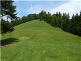 2
2 3
3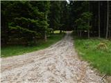 4
4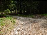 5
5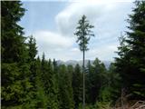 6
6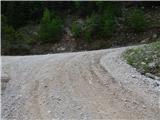 7
7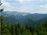 8
8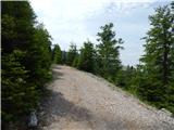 9
9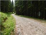 10
10 11
11 12
12 13
13 14
14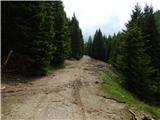 15
15 16
16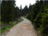 17
17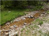 18
18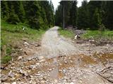 19
19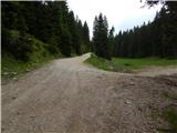 20
20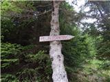 21
21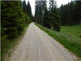 22
22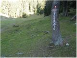 23
23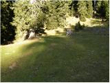 24
24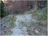 25
25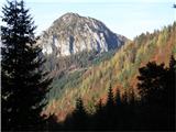 26
26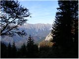 27
27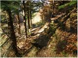 28
28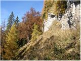 29
29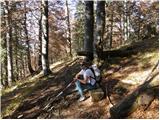 30
30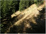 31
31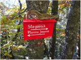 32
32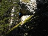 33
33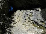 34
34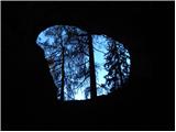 35
35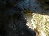 36
36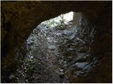 37
37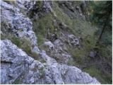 38
38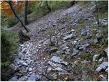 39
39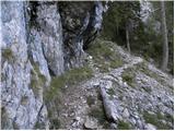 40
40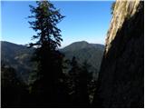 41
41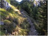 42
42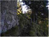 43
43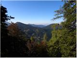 44
44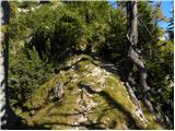 45
45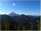 46
46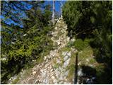 47
47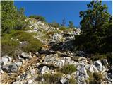 48
48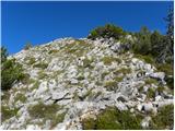 49
49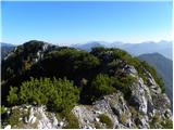 50
50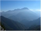 51
51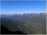 52
52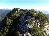 53
53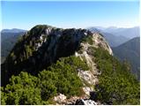 54
54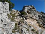 55
55 56
56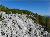 57
57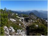 58
58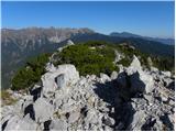 59
59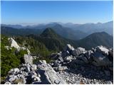 60
60
Discussion about the trip Planina Vetrh - Stegovnik
|
| rokeg5. 05. 2020 |
From the pictures I see that there's an inserted description Dom pod Storžičem - Planina Javornik, which I think is a mistake because that's a completely different valley.
|
|
|
|
| Tadej5. 05. 2020 |
Thanks for the heads-up, I've removed the wrong pictures.
|
|
|
To post a comment you must log in:
If you do not yet have a username, you must first
register.